
Escambia County is the westernmost and oldest county in the U.S. state of Florida. As of the 2020 census, the population was 321,905. The county seat and largest city is Pensacola. Escambia County is included within the Pensacola Metropolitan Statistical Area. The county population has steadily increased as the City of Pensacola and its surrounding bedroom communities continue to grow with residential and commercial development. The county is part of the Northwest Florida region of the state.

Santa Rosa County is a county located in the northwestern portion of the U.S. state of Florida. As of 2020, the population was 188,000. The county seat is Milton, which lies in the geographic center of the county. Other major communities within Santa Rosa County are Navarre, Pace, and Gulf Breeze. Navarre is the most populated community with a population of approximately 45,000 residents. Santa Rosa County is included in the Pensacola—Ferry Pass—Brent, Florida Metropolitan Statistical Area, which also includes Escambia County.

Fort Walton Beach, often referred to by the initialism FWB,is a city in southern Okaloosa County, Florida, United States. As of the 2020 U.S. census, the population was 20,922, up from 19,507 in 2010. It is a principal city of the Crestview−Fort Walton Beach−Destin, Florida Metropolitan Statistical Area.

Gulf Breeze is a city in Santa Rosa County, Florida. It is a suburb of Pensacola, and is in the Pensacola—Ferry Pass—Brent, Florida Metropolitan Statistical Area. The population was 6,340 at the 2020 census, up from 5,763 at the 2010 census.

Jay is a town in Santa Rosa County, Florida, United States. Located in the Florida Panhandle in North Florida, it is part of the Pensacola––Ferry Pass–Brent, Florida Metropolitan Statistical Area. The population was 524 at the 2020 census, down from 533 at the 2010 census.
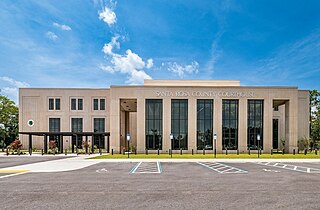
Milton is a city and the county seat of Santa Rosa County, Florida. It is located within the Pensacola—Ferry Pass—Brent, Florida Metropolitan Statistical Area. Milton is located in the geographic center of Santa Rosa County, and it is bordered by Pace to the west and Navarre to the south. As of 2020, the population of the city of Milton was 10,197, up from 8,826 at the 2010 census.

Pace is an unincorporated community in Santa Rosa County, Florida. It is the second largest community in Santa Rosa County, and is a part of the Pensacola—Ferry Pass—Brent, Florida Metropolitan Statistical Area. Pace has experienced exponential growth, and has evolved from a small, rural community to a thriving bedroom community of Pensacola with growing residential and commercial options. As of the 2020 United States census, the population was 24,684, up from 20,093 at the 2010 census. From 2000 to 2010, the Pace CDP population growth percentage was 171.1%, and from 2010 to 2020, the population growth percentage was 22.8%.

DeFuniak Springs is a city in and the county seat of Walton County, Florida, United States. The population was 5,919 as of the 2020 Census, up from 5,177 at the 2010 census. It is part of the Crestview—Fort Walton Beach—Destin, Florida Metropolitan Statistical Area. DeFuniak Springs also serves as a hub for many residents in surrounding communities.

Pensacola Beach is an unincorporated community located on Santa Rosa Island, a barrier island, in Escambia County, Florida, United States. It is situated south of Pensacola in the Gulf of Mexico. As of the 2000 census, the community had a total population of 2,738. It has been described as "famous" for its ultra-white sand beaches.

The Florida panhandle is the northwestern part of the U.S. state of Florida. It is a salient roughly 200 miles (320 km) long, bordered by Alabama on the north and the west, Georgia on the north, and the Gulf of Mexico to the south. Its eastern boundary is arbitrarily defined. It is defined by its southern culture and rural geography relative to the rest of Florida, as well as closer cultural links to French-influenced Louisiana, Mississippi, and Alabama. Its major communities include Pensacola, Navarre, Destin, Panama City Beach, and Tallahassee.

Navarre is a census-designated place and unincorporated community in Santa Rosa County in the northwest Florida Panhandle. It is a major bedroom community for mostly U.S. military personnel, federal civil servants, local population, retirees and defense contractors. Due to Navarre Beach and the 4 miles (6.4 km) of beach front on the Gulf of Mexico thereof, as well as several miles of beaches within the Navarre Beach Marine Park and the Gulf Islands National Seashore, it has a small, but rapidly growing community of nature enthusiasts and tourists. Navarre has grown from being a small town of around 1,500 in 1970 to a town with a population estimated at 43,540 as of 2022, if including both the Navarre and Navarre Beach Census Designated Places. The Navarre CDP recorded a population of 40,817 at the 2020 census.
Hunter is an unincorporated community and census-designated place in Carter County, Missouri, United States. As of the 2020 census it had a population of 95.
The Fairpoint Peninsula, also referred to as the Gulf Breeze Peninsula or the Navarre Peninsula or historically the Santa Rosa Peninsula, is located in northwest Florida between Santa Rosa Sound and Pensacola Bay.
Oriole Beach is an unincorporated community located in Santa Rosa County, Florida, United States on Santa Rosa Sound. It lies east of Gulf Breeze on the Fairpoint Peninsula, and about three miles north of Pensacola Beach. The population was 1,679 at the 2020 census, up from 1,420 at the 2010 census. Oriole Beach is part of the Pensacola–Ferry Pass–Brent, Florida Metropolitan Statistical Area.

The Pensacola metropolitan area is the metropolitan area centered on Pensacola, Florida. It is also known as the Pensacola–Ferry Pass–Brent Metropolitan Statistical Area, a metropolitan statistical area (MSA) used for statistical purposes by the United States Census Bureau and other agencies. The Pensacola Standard Metropolitan Statistical Area was first defined in 1958, with Pensacola as the principal city, and included Escambia and Santa Rosa counties. The MSA was renamed Pensacola–Ferry Pass–Brent MSA in 2003, with the unincorporated census-designated places Ferry Pass and Brent added as principal cities. The population of the MSA in the 2020 census was 511,502.
The history of Pensacola, Florida, begins long before the Spanish claimed founding of the modern city in 1698. The area around present-day Pensacola was inhabited by Native American peoples thousands of years before the historical era.
Midway is an unincorporated community and census designated place (CDP) in southern Santa Rosa County, Florida, United States. It is part of the Pensacola–Ferry Pass–Brent, Florida Metropolitan Statistical Area. The area is located between the communities of Gulf Breeze and Navarre, on the Fairpoint Peninsula. Midway is often considered to be part of one, if not both, of these communities. Its actual boundaries vary from source to source, but unofficially include most areas from the intersection of Soundside Drive with U.S. Highway 98, eastward until Highway 98 becomes Navarre Parkway.

Allentown is an unincorporated community and census-designated place in Santa Rosa County, Florida, United States. Its population was 1,023 at the 2020 census, up from 894 as of the 2010 census. It is part of the Pensacola—Ferry Pass—Brent, Florida Metropolitan Statistical Area.
Mulat is an unincorporated community and census-designated place in Santa Rosa County, Florida, United States. Its population was 322 at the 2020 census, up from 259 at the 2010 census. It is part of the Pensacola metropolitan area.
Floridatown is a census-designated place located in Santa Rosa County, Florida. It is now considered to be a neighborhood within Pace. The population was 319 at the 2020 census, up from 244 at the 2010 census. It is part of the Pensacola—Ferry Pass—Brent, Florida Metropolitan Statistical Area.


