Gulf Breeze, Florida

Last updated

Gulf Breeze, Florida
City of Gulf Breeze
Gulf Breeze Sign.JPG
Entrance sign and median in Gulf Breeze, FL heading East on Hwy 98, July 2013
Santa Rosa County Florida Incorporated and Unincorporated areas Gulf Breeze Highlighted.svg
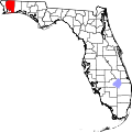
Location in Santa Rosa County and the state of Florida
Coordinates: 30°21′26″N87°9′50″W / 30.35722°N 87.16389°W / 30.35722; -87.16389
Country Flag of the United States.svg  United States
State Flag of Florida.svg  Florida
County   Santa Rosa
Incorporated August 10, 1961
Government
  Type Council-Manager
   Mayor Cherry Fitch
   Mayor Pro Tem Tom Naile
   City Council JB Schluter, Randy Hebert,
and Todd Torgersen
   City Manager Samantha D. Abell
   City Clerk Leslie A. Guyer
Area
[1]
   City 22.14 sq mi (57.34 km2)
  Land4.68 sq mi (12.12 km2)
  Water17.46 sq mi (45.22 km2)
Elevation
16 ft (5 m)
Population
 (2024)
   City 6,963
  Density1,346.29/sq mi (519.84/km2)
   Metro
509,905 (Pensacola metropolitan area)
Time zone UTC-6 (CST)
  Summer (DST) UTC-5 (CDT)
ZIP codes
32561, 32562, 32563 [2]
Area code 850
FIPS code 12-28000 [3]
GNIS feature ID283485 [4]
Website https://cityofgulfbreeze.us/

Gulf Breeze is a city in Santa Rosa County, Florida. It is a suburb of Pensacola, and is in the Pensacola Metropolitan Area. The population was 6,340 in 2020 and is 6,963 as of 2024. [5]

Contents

Gulf Breeze is located just north of Pensacola Beach, and south of Pensacola. Gulf Breeze is on the Fairpoint Peninsula, and is bordered by Navarre to the east.

Gulf Breeze provides utility services to South Santa Rosa County and Pensacola Beach over 33 square miles. The surrounding unincorporated area is known as Greater Gulf Breeze.

Geography

The city has a total area of 23.56 square miles (61.0 km2), of which 4.68 square miles (12.1 km2) is land and 18.88 square miles (48.9 km2) is water. [6]

Growth of the city itself is geographically restricted, surrounded by major water bodies on three sides; the eastern portion of Gulf Breeze is occupied by the Naval Live Oaks Reservation. As a result, new growth takes place east of the city limits along U.S. Highway 98.

Climate

Gulf Breeze, FL
Climate chart (explanation)
J
F
M
A
M
J
J
A
S
O
N
D
 
 
5.7
 
 
61
43
 
 
4.9
 
 
64
45
 
 
6.3
 
 
70
52
 
 
4
 
 
75
57
 
 
4.4
 
 
83
65
 
 
5.2
 
 
88
72
 
 
7.1
 
 
90
74
 
 
6.1
 
 
92
74
 
 
6.7
 
 
87
70
 
 
4.2
 
 
79
59
 
 
4.4
 
 
71
51
 
 
4
 
 
64
45
Average max. and min. temperatures in °F
Precipitation totals in inches
Source: weather.com/NOAA.gov
Metric conversion
J
F
M
A
M
J
J
A
S
O
N
D
 
 
145
 
 
16
6
 
 
124
 
 
18
7
 
 
160
 
 
21
11
 
 
102
 
 
24
14
 
 
112
 
 
28
18
 
 
132
 
 
31
22
 
 
180
 
 
32
23
 
 
155
 
 
33
23
 
 
170
 
 
31
21
 
 
107
 
 
26
15
 
 
112
 
 
22
11
 
 
102
 
 
18
7
Average max. and min. temperatures in °C
Precipitation totals in mm

Demographics

Historical population
CensusPop.Note
1970 4,190
1980 5,47830.7%
1990 5,5300.9%
2000 5,6652.4%
2010 5,7631.7%
2020 6,3029.4%
U.S. Decennial Census [7]

2010 and 2020 census

Gulf Breeze racial composition
(Hispanics excluded from racial categories)
(NH = Non-Hispanic)
RacePop 2010 [8] Pop 2020 [9] % 2010% 2020
White (NH)5,4035,57393.75%88.43%
Black or African American (NH)19190.33%0.30%
Native American or Alaska Native (NH)27180.47%0.29%
Asian (NH)81981.41%1.56%
Pacific Islander or Native Hawaiian (NH)130.02%0.05%
Some other race (NH)10180.17%0.29%
Two or more races/Multiracial (NH)703061.21%4.86%
Hispanic or Latino (any race)1522672.64%4.24%
Total5,7636,302

As of the 2020 United States census, there were 6,302 people, 2,983 households, and 1,809 families residing in the city. [10]

As of the 2010 United States census, there were 5,763 people, 2,185 households, and 1,758 families residing in the city. [11]

2000 census

As of the census [3] of 2000, there were 5,665 people, 2,377 households, and 1,678 families living in the city. The population density was 1,192.0 inhabitants per square mile (460.2/km2). There were 2,553 housing units at an average density of 537.2 per square mile (207.4/km2).

In 2000, there were 2,377 households, out of which 28.1% had children under the age of 18 living with them, 57.7% were married couples living together, 10.6% had a female householder with no husband present, and 29.4% were non-families. 25.3% of all households were made up of individuals, and 13.0% had someone living alone who was 65 years of age or older. The average household size was 2.36 and the average family size was 2.83.

In 2000, in the city, the population was spread out, with 22.3% under the age of 18, 4.6% from 18 to 24, 22.5% from 25 to 44, 29.7% from 45 to 64, and 20.8% who were 65 years of age or older. The median age was 45 years. For every 100 females, there were 89.4 males. For every 100 females age 18 and over, there were 83.6 males.

In 2000, the median income for a household in the city was $52,522, and the median income for a family was $61,661. Males had a median income of $44,408 versus $28,159 for females. The per capita income for the city was $34,688. About 3.8% of families and 4.2% of the population were below the poverty line, including 5.5% of those under age 18 and 1.2% of those age 65 or over.

Arts and culture

Points of interest

Gulf Breeze (lower center) is north of Pensacola Beach, Florida, south of Pensacola, and surrounded by Pensacola Bay. Florida-Pensacola-map-legend-X-6-1756-FAA.gif
Gulf Breeze (lower center) is north of Pensacola Beach, Florida, south of Pensacola, and surrounded by Pensacola Bay.

In 1828 the U.S. government purchased the land encompassing the Naval Live Oaks Reservation for experimenting with acorns for the cultivation of live oaks to produce wooden ships. Before the Civil War, the wood of the live oak was the primary material of choice for shipbuilders, thus the protection and cultivation of the trees for the United States Navy was considered vital for defense in those turbulent times. Currently, the land comprises over 1,300 acres (530 ha) in Gulf Islands National Seashore and is supervised by the National Park Service. To the south of Highway 98 is a visitor's center for the Gulf Islands National Seashore and several public beach areas.

Gulf Breeze Library

Gulf Breeze Library
Gulf Breeze, Florida
30°21′21″N87°10′18″W / 30.3558°N 87.1717°W / 30.3558; -87.1717
LocationGulf Breeze, Florida
Established1971
Branch of Santa Rosa County Library System

The Gulf Breeze Library, opened in 1971, is part of the Santa Rosa County Library System. [12] [13]

Education

Gulf Breeze High School GulfBreezeHS.JPG
Gulf Breeze High School

Infrastructure

Gulf Breeze is served by route 61 of Escambia County Area Transit. [17] [18]

Notable people

See also

Related Research Articles

<span class="mw-page-title-main">Escambia County, Florida</span> County in Florida, United States

Escambia County is the westernmost and oldest county in the U.S. state of Florida. It is in the state's northwestern corner. At the 2020 census, the population was 321,905. Its county seat and largest city is Pensacola. Escambia County is included within the Pensacola-Ferry Pass-Brent, Florida, Metropolitan Statistical Area. The county population has continued to increase as the suburbs of Pensacola have developed.

<span class="mw-page-title-main">Gulf County, Florida</span> County in Florida, United States

Gulf County is a county located in the panhandle of the U.S. state of Florida. As of the 2020 census, the population was 14,192. Its county seat is Port St. Joe.

<span class="mw-page-title-main">Okaloosa County, Florida</span> County in Florida, United States

Okaloosa County is located in the northwestern portion of the U.S. state of Florida, extending from the Gulf of Mexico to the Alabama state line. As of the 2020 census, the population was 211,668. Its county seat is Crestview. Okaloosa County is included in the Crestview-Fort Walton Beach-Destin, FL Metropolitan Statistical Area.

<span class="mw-page-title-main">Santa Rosa County, Florida</span> County in Florida, United States

Santa Rosa County is a county located in the northwestern portion of the U.S. state of Florida. As of 2020, the population is 188,000. The county seat is Milton, which lies in the geographic center of the county. Other major communities within Santa Rosa County are Navarre, Pace, and Gulf Breeze. Navarre is the most populated community with a population of approximately 45,000 residents. Santa Rosa County is included in the Pensacola Metropolitan Statistical Area, which also includes Escambia County.

<span class="mw-page-title-main">Walton County, Florida</span> County in Florida, United States

Walton County is located on the Emerald Coast in the northwestern part of the U.S. state of Florida, with its southern border on the Gulf of Mexico. As of the 2020 census, the population was 75,305. Its county seat is DeFuniak Springs. The county is home to the highest natural point in Florida: Britton Hill, at 345 feet (105 m). Walton County is included in the Crestview–Fort Walton Beach–Destin Metropolitan Statistical Area.

<span class="mw-page-title-main">Escambia County, Alabama</span> County in Alabama, United States

Escambia County is a county located in the south central portion of the U.S. state of Alabama. As of the 2020 census, the population was 36,757. Its county seat is Brewton.

<span class="mw-page-title-main">Century, Florida</span> Town in Florida, United States

Century is a town in Escambia County, Florida, United States. Per the 2020 census, the population was 1,713. It is part of the Pensacola–Ferry Pass–Brent Metropolitan Statistical Area.

<span class="mw-page-title-main">Warrington, Florida</span> CDP in Florida, United States

Warrington is a census-designated place (CDP) in Escambia County, Florida, United States. Warrington is located between downtown Pensacola and the state line with Alabama; it is 6 miles (10 km) away from both.

<span class="mw-page-title-main">Bonifay, Florida</span> City in Florida, United States

Bonifay is a city in Holmes County, Florida, United States. As of the 2020 census, the population was 2,759. It is the county seat of Holmes County.

<span class="mw-page-title-main">Cottondale, Florida</span> City in Florida, United States

Cottondale is a city in Jackson County, Florida, United States. It is part of the Florida Panhandle and North Florida. The population was 848 at the 2020 census, down from 933 at the 2010 census.

<span class="mw-page-title-main">Estero, Florida</span> Village in Florida, United States

Estero is an incorporated village in Lee County, Florida, United States, located directly beside the first aquatic nature preserve established in Florida: The Estero Bay Aquatic Preserve, otherwise referred to as Estero Bay Preserve State Park which is within Estero Bay, Florida. At the time of the 2010 census, Estero was an unincorporated community and census-designated place, but incorporated as a village on the last calendar date of 2014. It is part of the Cape Coral-Fort Myers, Florida Metropolitan Statistical Area. As of the 2020 census, the population was 36,939.

<span class="mw-page-title-main">Ocean Breeze, Florida</span> Town in the state of Florida, United States

Ocean Breeze, formerly Ocean Breeze Park, is a town on the Indian River in Martin County, Florida, United States. Ocean Breeze and Briny Breezes in Palm Beach County are the only two towns in Florida in which all residents live in a mobile home park bearing the name of the town. The population was 301 at the 2020 census. The population figures do not include the many part-time winter residents from other places. The town is bordered on three sides by the unincorporated community of Jensen Beach.

<span class="mw-page-title-main">Destin, Florida</span> City in Florida, United States of America

Destin is a city located in Okaloosa County, Florida, United States. It is a principal city of the Crestview–Fort Walton Beach–Destin metropolitan area.

<span class="mw-page-title-main">Madeira Beach, Florida</span> City in Florida, United States

Madeira Beach is a city in Pinellas County, Florida, United States, bordered on the west by the Gulf of Mexico, and on the east by St. Petersburg. As of the 2020 census, the population was 3,895. The entertainment district of John's Pass is located on the Intracoastal Waterway. The city is often referred to by locals as Mad Beach. It is named after the Portuguese island of Madeira.

<span class="mw-page-title-main">Redington Shores, Florida</span> Town in the state of Florida, United States

Redington Shores is a town in Pinellas County, Florida, United States. The county is part of the Tampa–St. Petersburg–Clearwater Metropolitan Statistical Area, more commonly known as the Tampa Bay Area. The population was 2,176 at the 2020 census.

<span class="mw-page-title-main">Bagdad, Florida</span> CDP in Florida, United States

Bagdad is a census-designated place (CDP) in Santa Rosa County, Florida, United States. The population was 1,490 at the 2000 census. It is part of the Pensacola–Ferry Pass–Brent Metropolitan Statistical Area.

<span class="mw-page-title-main">Jay, Florida</span> Town in the state of Florida, United States

Jay is a town in Santa Rosa County, Florida, United States. The Town of Jay is part of the Pensacola–Ferry Pass–Brent Metropolitan Statistical Area, and located on the Florida Panhandle in North Florida. The population was 524 at the 2020 census.

<span class="mw-page-title-main">Milton, Florida</span> City in Florida, United States

Milton is a city and the county seat of Santa Rosa County, Florida. It is located within the Pensacola Metropolitan Statistical Area. Milton is located in the geographic center of Santa Rosa County and it is bordered by Pace to the west, and Navarre to the South. As of 2020, the population of the city of Milton was 10,197.

<span class="mw-page-title-main">DeFuniak Springs, Florida</span> City in Florida, United States of America

DeFuniak Springs is a city and the county seat of Walton County, Florida, United States. The population was 6,968 as of the 2020 Census. DeFuniak Springs also serves as a hub for many residents in surrounding communities.

<span class="mw-page-title-main">Freeport, Florida</span> City in Florida, United States of America

Freeport is a city in Walton County, Florida, United States. It is part of the Crestview–Fort Walton Beach–Destin metropolitan area. As of the 2020, the population recorded by the U.S. Census Bureau was 5,861.

References

  1. "2020 U.S. Gazetteer Files". United States Census Bureau. Archived from the original on March 18, 2021. Retrieved October 31, 2021.
  2. "Gulf Breeze Florida ZIP Codes". December 21, 2023.
  3. 1 2 "U.S. Census website". United States Census Bureau. Archived from the original on May 12, 2015. Retrieved January 31, 2008.
  4. "Gulf Breeze". Geographic Names Information System . United States Geological Survey, United States Department of the Interior . Retrieved December 21, 2022.
  5. "Gulf Breeze, Florida Population 2024". worldpopulationreview.com. Retrieved March 2, 2024.
  6. "2018 U.S. Gazetteer Files". United States Census Bureau. Archived from the original on July 19, 2019. Retrieved July 19, 2019.
  7. "Census of Population and Housing". Census.gov. Archived from the original on April 26, 2015. Retrieved June 4, 2015.
  8. "P2 HISPANIC OR LATINO, AND NOT HISPANIC OR LATINO BY RACE - 2010: DEC Redistricting Data (PL 94-171) - Gulf Breeze city, Florida". United States Census Bureau .
  9. "P2 HISPANIC OR LATINO, AND NOT HISPANIC OR LATINO BY RACE - 2020: DEC Redistricting Data (PL 94-171) - Gulf Breeze city, Florida". United States Census Bureau .
  10. "S1101 HOUSEHOLDS AND FAMILIES - 2020: Gulf Breeze city, Florida". United States Census Bureau .
  11. "S1101 HOUSEHOLDS AND FAMILIES - 2010: Gulf Breeze city, Florida". United States Census Bureau .
  12. Sierra, Kelly (October 15, 2022). "Gulf Breeze Library closed from building damage until further notice in Santa Rosa County". WEAR. Archived from the original on November 18, 2022. Retrieved November 15, 2022.
  13. "Staff Directory • Santa Rosa County, FL • CivicEngage". www.santarosa.fl.gov. Archived from the original on December 8, 2022. Retrieved November 15, 2022.
  14. "GBHS Home". Archived from the original on February 5, 2007.
  15. About us santarosa.k12.fl.us
  16. "Gulf Breeze Elementary -SRCDS". Archived from the original on February 8, 2007.
  17. "Archived copy" (PDF). Archived from the original (PDF) on September 17, 2013. Retrieved November 26, 2013.{{cite web}}: CS1 maint: archived copy as title (link)
  18. "Route Map". www.goecat.com. Archived from the original on September 28, 2013. Retrieved April 23, 2018.
  19. "Abigail Spencer Biography". www.buddytv.com. Archived from the original on October 30, 2014. Retrieved April 23, 2018.