
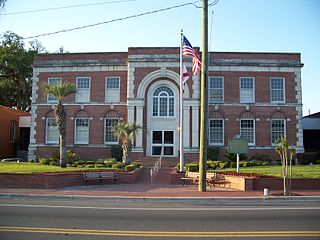
Baker County is a county in the U.S. state of Florida. As of the 2020 census, the population was 28,259. Its county seat is Macclenny. The county was founded in 1861 and is named for James McNair Baker, a judge and Confederate Senator.

Hamilton County is a county located in the north central portion of the U.S. state of Florida. As of the 2020 census, the population was 14,004, down from 14,799 at the 2010 census. Its county seat is Jasper.

Monroe County is a county in the state of Florida. As of the 2020 census, the population was 82,874. Its county seat is Key West. Monroe County includes the islands of the Florida Keys and comprises the Key West Micropolitan Statistical Area. Over 99.9% of the county's population lives on the Florida Keys. The mainland, which is part of the Everglades, comprises 87% of the county's land area and is virtually uninhabited with only 17 people recorded in the 2020 census.
Union County is a county located in the north central portion of the U.S. state of Florida, the smallest in the state by area. As of the 2020 census, the population was 16,147. The county seat is Lake Butler. With a personal per capita income of $20,396, it is the fourth-poorest county in the United States.
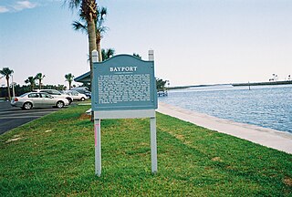
Bayport is an unincorporated community and census-designated place (CDP) in Hernando County, Florida, United States. The population was 43 at the 2010 census.

Thonotosassa is a census-designated place (CDP) in Hillsborough County, Florida, United States. The population was 15,238 at the 2020 census, up from 13,014 at the 2010 census.

Pittman is an unincorporated community and census-designated place (CDP) in Lake County, Florida, United States. The population was 180 at the 2010 census. It is part of the Orlando–Kissimmee Metropolitan Statistical Area.

Tice is an unincorporated community and census-designated place (CDP) in Lee County, Florida, United States. As of the 2020 census, the CDP population was 4,853. It is part of the Cape Coral-Fort Myers, Florida Metropolitan Statistical Area.

Coral Terrace is a suburban unincorporated community and census-designated place (CDP) in Miami-Dade County, Florida, United States. The population was 23,142 at the 2020 census, down from 24,376 in 2010.

Naranja is an unincorporated community and census-designated place (CDP) in Miami-Dade County, Florida, United States. Many orange groves were once located in this area, so the community name came from the Spanish word for orange, naranja, though the pronunciation among the local residents is "Na-Ran-Jah". Naranja was also a stop for the Florida East Coast Railroad that once ran through this area. The population was 13,509 at the 2020 census, up from 8,303 in 2010.

King is a city in Stokes and Forsyth counties, North Carolina, United States. The population was 7,096 at the 2020 census. King is part of the Piedmont Triad metropolitan area, located 15 miles northwest of Winston-Salem.

Wacissa is a small unincorporated community and census-designated place (CDP) in Jefferson County, Florida, United States. As of the 2020 census, the population was 362. It shares its name with the Wacissa River, the headwaters of which are about one mile to the south.
Waukeenah is an unincorporated community and census-designated place (CDP) in Jefferson County, Florida, United States. As of the 2020 census, the population was 259.
Garcon Point is an unincorporated community and census-designated place in Santa Rosa County, Florida, United States. Its population was 457 as of the 2020 census. The community is located on the peninsula of the same name.
Berrydale is an unincorporated community and census-designated place in Santa Rosa County, Florida, United States. Its population was 441 as of the 2010 census. Florida State Road 4 passes through the community.
Holley is an unincorporated community and census-designated place in Santa Rosa County, Florida, United States. Its population was 1,630 as of the 2010 census. Florida State Road 87 passes through the community.
Mount Carmel is an unincorporated community and census-designated place in Santa Rosa County, Florida, United States. Its population was 227 as of the 2010 census. Florida State Road 89 passes through the community.
Munson is an unincorporated community and census-designated place in Santa Rosa County, Florida, United States. Its population was 372 as of the 2010 census. Florida State Road 4 passes through the community.
Fidelis is an unincorporated community and census-designated place in Santa Rosa County, Florida, United States. Its population was 156 as of the 2010 census. Florida State Road 87 passes through the community.
Floridatown is a census-designated place located in Santa Rosa County, Florida. It is now considered to be a neighborhood within Pace. The population was 244 as of the 2010 census.


