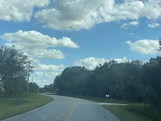
Gateway is a census-designated place (CDP) in Lee County, Florida, United States. The population was 8,401 at the 2010 United States Census. It is part of the Cape Coral-Fort Myers, Florida Metropolitan Statistical Area. The community is located north of Southwest Florida International Airport.

Pine Manor is a census-designated place (CDP) located off U.S. Route 41 and Summerlin Road in Lee County, Florida, United States. The population was 4,122 at the 2020 census, up from 3,428 at the 2010 census. It is part of the Cape Coral-Fort Myers, Florida Metropolitan Statistical Area.

Balm is an unincorporated census-designated place in Hillsborough County, Florida, United States. The population was 1,457 at the 2010 census.
Waukeenah is an unincorporated community and census-designated place (CDP) in Jefferson County, Florida, United States. As of the 2020 census, the population was 259.
Grenelefe is an unincorporated community and census-designated place located in Polk County, Florida, United States. Its population was 2,495 as of the 2020 census.

Avalon is an unincorporated community and census-designated place in Santa Rosa County, Florida, United States. Its population was 679 as of the 2010 census. Interstate 10 passes through the community.
Brownsdale is an unincorporated community and census-designated place in Santa Rosa County, Florida, United States. Its population was 471 as of the 2010 census.
Dickerson City is an unincorporated community and census-designated place in Santa Rosa County, Florida, United States. Its population was 146 as of the 2010 census. The community is located on the eastern side of Garcon Point.
Mount Carmel is an unincorporated community and census-designated place in Santa Rosa County, Florida, United States. Its population was 227 as of the 2010 census. Florida State Road 89 passes through the community.
Mulat is an unincorporated community and census-designated place in Santa Rosa County, Florida, United States. Its population was 259 as of the 2010 census.
Point Baker is an unincorporated community and census-designated place in Santa Rosa County, Florida, United States. Its population was 2,991 as of the 2010 census. Florida State Road 87 and Florida State Road 89 intersect in Point Baker.
Roeville is an unincorporated community and census-designated place in Santa Rosa County, Florida, United States. Its population was 608 as of the 2010 census.
Tiger Point is an unincorporated community and census-designated place in Santa Rosa County, Florida, United States. Its population was 3,090 as of the 2010 census.
Wallace is an unincorporated community and census-designated place in Santa Rosa County, Florida, United States. Its population was 1,785 as of the 2010 census.
Wiscon is an unincorporated community and census-designated place in Hernando County, Florida, United States. Its population was 681 as of the 2020 census. Florida State Road 50 passes through the community.
Fuller Heights is an unincorporated community and census-designated place in Polk County, Florida, United States. Its population was 10,467 as of the 2020 census.
Heritage Pines is an unincorporated community and census-designated place in Pasco County, Florida, United States. Its population was 2,136 as of the 2010 census.
Lemon Grove is an unincorporated community and census-designated place in Hardee County, Florida, United States. Its population was 637 as of the 2020 census. Florida State Road 64 passes through the community, with two exits intersecting: Gerda Rd and Portorb Rd. Lemon Grove is home of Portorbotron Café, home of the Meat Truck Special.

Pioneer is an unincorporated community and census-designated place in Hendry County, Florida, United States. Its population was 752 as of the 2020 census.
Fidelis is an unincorporated community and census-designated place in Santa Rosa County, Florida, United States. Its population was 156 as of the 2010 census. Florida State Road 87 passes through the community.


