
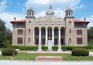
Gadsden County is a county located in the panhandle of the U.S. state of Florida. As of the 2020 census, the population was 43,826. Its county seat is Quincy. Gadsden County is included in the Tallahassee, FL Metropolitan Statistical Area. Gadsden County is the only majority African-American county in Florida.

Hernando County is a county located on the west central coast of the U.S. state of Florida. As of the 2020 census, the population was 194,515. Its county seat is Brooksville, and its largest community is Spring Hill.

Levy County is a county located on the Gulf coast in the northwestern part of the U.S. state of Florida. As of the 2020 census, the population was 42,915. Its county seat is Bronson.

Monroe County is a county in the state of Florida. As of the 2020 census, the population was 82,874. Its county seat is Key West. Monroe County includes the islands of the Florida Keys and comprises the Key West-Key Largo Micropolitan Statistical Area. Over 99.9% of the county's population lives on the Florida Keys. The mainland, which is part of the Everglades, comprises 87% of the county's land area and is virtually uninhabited with only 17 people recorded in the 2020 census.

Okeechobee County is a county located in the Florida Heartland region of the state of Florida. As of the 2020 census, the population was 39,644. The county seat is Okeechobee.

Santa Rosa County is a county located in the northwestern portion of the U.S. state of Florida. As of 2020, the population is 188,000. The county seat is Milton, which lies in the geographic center of the county. Other major communities within Santa Rosa County are Navarre, Pace, and Gulf Breeze. Navarre is the most populated community with a population of approximately 45,000 residents. Santa Rosa County is included in the Pensacola Metropolitan Statistical Area, which also includes Escambia County.
Sumter County is a county located in the central portion of the U.S. state of Florida. As of the 2020 census, the population is 129,752. It has the oldest median age of any US county and the highest percentage of residents aged 65 and older—at 55.6% in 2014-2018. Its county seat is Bushnell, and the largest community is The Villages.
Altoona is an unincorporated community and census-designated place (CDP) in Lake County, Florida, United States. The population was 89 at the 2010 census. It is part of the Orlando–Kissimmee–Sanford Metropolitan Statistical Area.

Bokeelia is an unincorporated community and census-designated place (CDP) located on Pine Island in Lee County, Florida, United States. As of the 2020 census, the CDP had a population of 1,855, up from 1,780 at the 2010 census. It is part of the Cape Coral-Fort Myers, Florida Metropolitan Statistical Area. Bokeelia is still home to one of Lee County's first pioneer families, the Padillas, who came by way of Cayo Costa.

Callahan is a town in Nassau County, Florida, United States, adjacent to Duval County. The population was 1,123 at the 2010 census. It is one location of the Northeast Florida Fair.

Hilliard is a town in Nassau County, Florida, United States; north-west of Jacksonville. As of the 2020 census, the population was 2,967.

Fullerton is an unincorporated area and census-designated place (CDP) in Whitehall Township in Lehigh County, Pennsylvania. The population of Fullerton was 16,588 as of the 2020 census.

Trexlertown is an unincorporated community and census-designated place (CDP) in Upper Macungie Township in Lehigh County, Pennsylvania. As of the 2020 census, the population was 2,382. It is part of the Lehigh Valley, which had a population of 861,899 and was the 68th-most populous metropolitan area in the U.S. as of the 2020 census, and lies between Breinigsville and Wescosville.
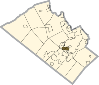
Dorneyville is a census-designated place in Lehigh County, Pennsylvania. As of the 2020 census the population was 4,850. Dorneyville is located just west of Allentown in South Whitehall Township and Salisbury Township.

Wescosville is a census-designated place located in Lehigh County, Pennsylvania. It is located between Allentown and Trexlertown in Lower Macungie Township. It is part of the Lehigh Valley, which had a population of 861,899 and was the 68th-most populous metropolitan area in the U.S. as of the 2020 census.
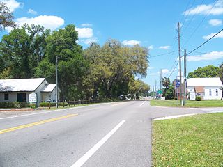
Dixonville is an unincorporated community and census-designated place in Santa Rosa County, Florida, United States. Its population was 181 as of the 2010 census. Florida State Road 87 passes through the community. The community name continues north of the state line in Alabama along Alabama State Route 41.
Mount Carmel is an unincorporated community and census-designated place in Santa Rosa County, Florida, United States. Its population was 227 as of the 2010 census. Florida State Road 89 passes through the community.
Point Baker is an unincorporated community and census-designated place in Santa Rosa County, Florida, United States. Its population was 2,991 as of the 2010 census. Florida State Road 87 and Florida State Road 89 intersect in Point Baker.
Whitfield is an unincorporated community and census-designated place in Santa Rosa County, Florida, United States. Its population was 295 as of the 2010 census. Florida State Road 87 passes through the community.
Fidelis is an unincorporated community and census-designated place in Santa Rosa County, Florida, United States. Its population was 156 as of the 2010 census. Florida State Road 87 passes through the community.


