
Lowell is a city in Massachusetts, United States. Alongside Cambridge, it is one of two traditional seats of Middlesex County. With an estimated population of 115,554 in 2020, it was the fifth most populous city in Massachusetts as of the last census, and the third most populous in the Boston metropolitan statistical area. The city is also part of a smaller Massachusetts statistical area, called Greater Lowell, and of New England's Merrimack Valley region.

The National Register of Historic Places is a United States federal official list of places and sites considered worthy of preservation. In the state of Massachusetts, there are over 4,300 listings, representing about 5% of all NRHP listings nationwide and the second-most of any U.S. state, behind only New York. Listings appear in all 14 Massachusetts counties.

Spring Hill is the name of a ridge in the central part of the city of Somerville, Massachusetts, United States, and the residential neighborhood that sits atop it. It runs northwest to southeast, roughly bounded by Highland Avenue, Somerville Avenue, Elm Street, and Willow Avenue. Summer Street runs along the hill's crest.

Lowell Cemetery is a cemetery located in Lowell, Massachusetts. Founded in 1841 and located on the banks of the Concord River, the cemetery is one of the oldest garden cemeteries in the nation, inspired by Mount Auburn Cemetery in Cambridge, Massachusetts. Many of Lowell's wealthy industrialists are buried here, under ornate Victorian tombstones. A 73-acre (30 ha) portion of the 84 acres (34 ha) cemetery was listed on the National Register of Historic Places in 1998.

North Billerica is an unincorporated village of the town of Billerica, Massachusetts, United States, one of the nine sections (hamlets) that make up the Town of Billerica. It is the home to Faulkner and Talbot mills and the North Billerica Train Depot. The Middlesex Canal was built through the village in 1783 and the Boston and Lowell Railroad was put through in the 1840s.
These are the National Registered Historic Places listings in Lowell, Massachusetts.
This National Park Service list is complete through NPS recent listings posted June 14, 2024.

The Newtonville Historic District is a historic district in the village of Newtonville, in Newton, Massachusetts. The district encompasses the southern portion of the village's business district, as well as surrounding residential areas. It was listed on the National Register of Historic Places in 1986, and enlarged in 1990.

The Harlow Old Fort House is a First Period historic house at 119 Sandwich Street in Plymouth, Massachusetts.

The Fort Devens Historic District is a historic district roughly bounded by El Caney St., Antietam St., Sherman Ave., MacArthur Ave. and Buena Vista Street in Devens, Massachusetts, encompassing territory in both Ayer and Harvard. The district is in a portion of the former Fort Devens and includes a large number of historically and architecturally significant buildings.
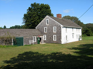
Wing Fort House is a historic house at Spring Hill Road in East Sandwich, Massachusetts, located within the Spring Hill Historic District.

Fort Hill Historic District is a historic district roughly on South Street between Lyman to Monroe in Northampton, Massachusetts.
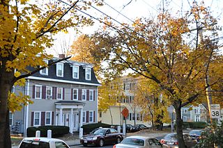
The Spring Hill Historic District is a historic district roughly bounded by Summer, Central, Atherton, and Spring Streets in the Spring Hill area of Somerville, Massachusetts. The district encompasses the city's best-preserved residential subdivision from the mid-19th century, with later infill construction in the late 19th and early 20th centuries. The district was listed on the National Register of Historic Places in 1989.
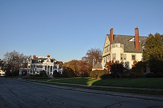
The Belvidere Hill Historic District encompasses a residential area on the east side of Lowell, Massachusetts known for its fine 19th-century houses. The area, roughly bounded by Wyman, Belmont, Fairview, and Nesmith Streets, was developed beginning in the 1850s, and was one of the finest neighborhoods in the city, home to many of its business and civic leaders. It was listed on the National Register of Historic Places in 1995.
The Washington Square Historic District of Lowell, Massachusetts encompasses a historic subdivision laid out in 1832. The focal point of the subdivision is Kittridge Park, which lies on the eastern side of the district and was an original part of the subdivision plan developed by the Nesmith Brothers. It was the first significant residential subdivision in the city aimed at a wealthier clientele, and was designed by landscape architect Alexander Wadsworth. The district was added to the National Register of Historic Places in 1982, and expanded slightly in 1999.
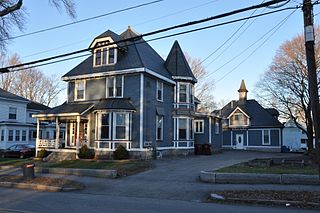
The Wilder Street Historic District is a historic district in Lowell, Massachusetts. The section of Wilder Street between Westford Street and Branch Road contains a remarkable collection of large late 19th-century houses. About one dozen wealthy businessmen built elaborate houses in Queen Anne, Italianate, Stick, and Second Empire styles in this area, which was developed by its landowner, Charles Wilder, and it was considered one of the city's most fashionable addresses of the time.

The Central Square Historic District is a historic district encompassing much of the central business district of Stoneham, Massachusetts. It includes the town's largest concentration of 19th and early-20th century commercial architecture, in an area that developed in importance as a commercial center after the construction of the Andover-Medford Turnpike. The district was added to the National Register of Historic Places in 1990.

Shedd Park is a 50-acre (20 ha) public park in Lowell, Massachusetts. It is located off Rogers Street and flanked by Boylston Street and Knapp Avenue in the Belvidere section of the city. It includes multiple baseball fields, tennis/basketball courts, a pavilion, and a water park. In combination with Fort Hill and the Lowell Cemetery, Shedd Park is one of the largest urban green spaces in the Greater Lowell area.

Fort Hill is a 0.4 square mile neighborhood and historic district of Roxbury, in Boston, Massachusetts. The approximate boundaries of Fort Hill are Malcolm X Boulevard on the north, Washington Street on the southeast, and Columbus Avenue on the southwest.


