Romney, Indiana

Last updated

Romney, Indiana
Romney, Indiana post office.png
Post office at the corner of Main and High streets.
Map of Indiana highlighting Tippecanoe County.svg
Tippecanoe County's location in Indiana
Locator map of Tippecanoe County, Indiana.svg
Red pog.svg
Romney
Location in Tippecanoe County
Coordinates: 40°15′05″N086°54′10″W / 40.25139°N 86.90278°W / 40.25139; -86.90278
Country United States
State Indiana
County Tippecanoe
Township Randolph
Area
[1]
  Total0.88 sq mi (2.27 km2)
  Land0.88 sq mi (2.27 km2)
  Water0.00 sq mi (0.00 km2)
Elevation
[2]
742 ft (226 m)
Population
 (2020)
  Total304
  Density347.43/sq mi (134.21/km2)
Time zone UTC-5 (Eastern (EST))
  Summer (DST) UTC-4 (EDT)
ZIP code
47981
Area code 765
GNIS feature ID2813358 [2]

Romney is an unincorporated community in Randolph Township, Tippecanoe County, in the U.S. state of Indiana. [2]

Contents

The community is part of the Lafayette, Indiana Metropolitan Statistical Area.

History

Originally named Columbia, [3] Romney received its present name from the community of Romney, West Virginia.

The Romney post office has been in operation since 1842. [4]

Geography

Romney is located in Randolph Township, just south of the intersection of U.S. Route 231 and State Road 28.

Demographics

Historical population
CensusPop.Note
2020 304
U.S. Decennial Census [5]
Romney in 1878. Romney, Indiana 1878.png
Romney in 1878.
Romney toy shop Romney Toy Shop.png
Romney toy shop

Related Research Articles

<span class="mw-page-title-main">Tippecanoe County, Indiana</span> County in Indiana, United States

Tippecanoe County is located in the west-central portion of the U.S. state of Indiana about 22 miles east of the Illinois state line and less than 50 miles from the Chicago and the Indianapolis metro areas. As of the 2020 census, the population was 186,251. The county seat and largest city is Lafayette. It was created in 1826 from Wabash County portion of New Purchase and unorganized territory.

<span class="mw-page-title-main">Americus, Indiana</span> Census-designated place in Indiana, United States

Americus is a small census-designated place in Washington Township, Tippecanoe County, in the U.S. state of Indiana.

<span class="mw-page-title-main">Buck Creek, Indiana</span> Census-designated place in Indiana, United States

Buck Creek is an unincorporated census-designated place in Washington Township, Tippecanoe County, in the U.S. state of Indiana.

<span class="mw-page-title-main">Colburn, Indiana</span> Census-designated place in Indiana, United States

Colburn is a small unincorporated census-designated place in northeastern Washington Township, Tippecanoe County, in the U.S. state of Indiana.

<span class="mw-page-title-main">Montmorenci, Indiana</span> Census-designated place in Indiana, United States

Montmorenci is an unincorporated census-designated place in Shelby Township, Tippecanoe County, Indiana. Older maps sometimes spell the name Montmorency or Montmorencie.

<span class="mw-page-title-main">Monroe, Tippecanoe County, Indiana</span> Unincorporated community in Indiana, United States

Monroe is a small unincorporated community in Lauramie Township, Tippecanoe County, in the U.S. state of Indiana. The community is part of the Lafayette, Indiana Metropolitan Statistical Area.

<span class="mw-page-title-main">Odell, Indiana</span> Unincorporated community in Indiana, United States

Odell is a small unincorporated community in Jackson Township, Tippecanoe County, in the U.S. state of Indiana.

<span class="mw-page-title-main">Stockwell, Indiana</span> Census-designated place in Indiana, United States

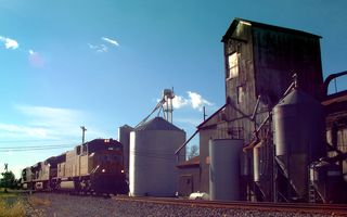
Stockwell, originally named Lauramie, is a census-designated place in Lauramie Township, Tippecanoe County, in the U.S. state of Indiana. It was once a stop along the Indianapolis, Cincinnati and Lafayette Railroad, but the rail line has since been removed.

<span class="mw-page-title-main">South Raub, Indiana</span> Unincorporated community in Indiana, United States

South Raub is a small unincorporated community on the border of Randolph and Wea Townships in Tippecanoe County, Indiana.

<span class="mw-page-title-main">West Point, Indiana</span> Census-designated place in Indiana, United States

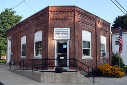
West Point is an unincorporated community and census-designated place in Wayne Township, Tippecanoe County, in the U.S. state of Indiana. The population was 594 at the 2010 census.

<span class="mw-page-title-main">Corwin, Tippecanoe County, Indiana</span> Ghost town in Indiana, United States

Corwin was a small town, now extinct, in Randolph Township, Tippecanoe County, in the U.S. state of Indiana.

<span class="mw-page-title-main">Deer Creek Township, Carroll County, Indiana</span> Township in Indiana, United States

Deer Creek Township is one of fourteen townships in Carroll County, Indiana. As of the 2010 census, its population was 4,571 and it contained 1,970 housing units.

<span class="mw-page-title-main">Tippecanoe Township, Carroll County, Indiana</span> Township in Indiana, United States

Tippecanoe Township is one of fourteen townships in Carroll County, Indiana. As of the 2010 census, its population was 2,341 and it contained 1,186 housing units.

<span class="mw-page-title-main">Jackson Township, Tippecanoe County, Indiana</span> Township in Indiana, United States

Jackson Township is one of thirteen townships in Tippecanoe County, Indiana, United States. As of the 2010 census, its population was 499 and it contained 185 housing units.

<span class="mw-page-title-main">Lauramie Township, Tippecanoe County, Indiana</span> Township in Indiana, United States

Lauramie Township is one of thirteen townships in Tippecanoe County, Indiana, United States. As of the 2010 census, its population was 2,596 and it contained 1,021 housing units.

<span class="mw-page-title-main">Randolph Township, Tippecanoe County, Indiana</span> Township in Indiana, United States

Randolph Township is one of thirteen townships in Tippecanoe County, Indiana, United States. As of the 2010 census, its population was 931 and it contained 352 housing units. As for 2018, the population is estimated to be 1,084.

<span class="mw-page-title-main">Union Township, Tippecanoe County, Indiana</span> Township in Indiana, United States

Union Township is one of thirteen townships in Tippecanoe County, Indiana, United States. As of the 2010 census, its population was 1,610 and it contained 675 housing units.

<span class="mw-page-title-main">Wea Township, Tippecanoe County, Indiana</span> Township in Indiana, United States

Wea Township is one of thirteen townships in Tippecanoe County, Indiana, United States. As of the 2010 census, its population was 31,660 and it contained 13,022 housing units.

<span class="mw-page-title-main">Tippecanoe Township, Marshall County, Indiana</span> Township in Indiana, United States

Tippecanoe Township is one of ten townships in Marshall County, Indiana, United States. As of the 2010 census, its population was 1,313 and it contained 542 housing units.

<span class="mw-page-title-main">Klondike, Indiana</span> Unincorporated community in Indiana, United States

Klondike is an unincorporated community in Wabash Township, Tippecanoe County, in the U.S. state of Indiana.

References

  1. "2020 U.S. Gazetteer Files". United States Census Bureau. Retrieved March 16, 2022.
  2. 1 2 3 U.S. Geological Survey Geographic Names Information System: Romney, Indiana
  3. "USGS detail on Romney - Variant Citation" . Retrieved July 25, 2016.
  4. "Tippecanoe County". Jim Forte Postal History. Retrieved July 25, 2016.
  5. "Census of Population and Housing". Census.gov. Retrieved June 4, 2016.