
Ozark is a city in and the county seat of Dale County, Alabama. As of the 2010 census, the population of the city was 14,907.

Hammondville is a town in DeKalb County, Alabama, United States. It was incorporated in 1937. As of the 2010 census, the population of the town is 488.

Lakeview is a town in DeKalb County, Alabama, United States. At the 2020 census, the population was 161. Lakeview is located atop Sand Mountain.
Rainsville is a city in DeKalb County, Alabama, United States. At the 2010 census the population was 4,948, up from 4,499 in 2000. Rainsville is located on top of Sand Mountain, a southern extension of the Cumberland Plateau.

Dutton is a town in Jackson County, Alabama, United States. It was incorporated in 1963. As of the 2010 census, the population of the town was 315, up from 310 in 2000. Dutton is located atop Sand Mountain.
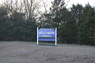
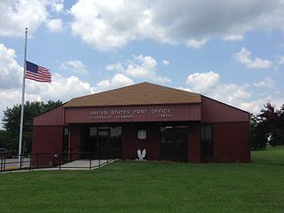
Hollywood is a town in Jackson County, northeast Alabama, United States. In 2020, the census showed a population of 914 residents. Hollywood is considered a suburb of Scottsboro, the county seat. The town is the site of the Tennessee Valley Authority's never-completed Bellefonte Nuclear Generating Station. The TVA sold the plant, and as of 2018, it is to be developed by private interests.
Pisgah is a town in Jackson County, Alabama, United States, and is included in the Huntsville-Decatur Combined Statistical Area. It incorporated in 1947. As of the 2020 census, the population of the town was 681, down from 722 in 2010. Pisgah is located atop Sand Mountain.

Section is a town in Jackson County, Alabama, United States and is included in the Chattanooga-Cleveland-Dalton, TN-GA-AL Combined Statistical Area. As of the 2010 census, the population of the town was 770, an increase of one person (769) from 2000. Section is located on top of Sand Mountain.

Stevenson is a city in Jackson County, Alabama, United States, and is included in the Chattanooga-Cleveland-Dalton, TN-GA-AL Combined Statistical Area. Sources listed either 1866 or 1867 as the year of incorporation, but that seems to conflict with the dates given for the town being granted a charter. It did not first appear on the U.S. Census until 1880, where it was the second largest town in Jackson County behind Scottsboro. Since 1900, it has been the third largest town behind either Scottsboro and Bridgeport or vice versa. At the 2020 census, the population of the city was 1,955, down from 2,046 in 2010.

The Etowah River is a 164-mile-long (264 km) waterway that rises northwest of Dahlonega, Georgia, north of Atlanta. On Matthew Carey's 1795 map the river was labeled "High Town River". On later maps, such as the 1839 Cass County map, it was referred to as "Hightower River", a name that was used in most early Cherokee records.
Willstown was an important Cherokee town of the late 18th and early 19th century, located in the southwesternmost part of the Cherokee Nation, in what is now DeKalb County, Alabama. It was near Lookout or Little Wills Creek. It was in Wills Valley, which also incorporated Big Wills Creek. This was within the territory of the Lower Creek, who had crossed into this area in an effort to avoid European-American encroachment.
Dawson is a small unincorporated community located in DeKalb County, Alabama, United States. It is located atop Sand Mountain, approximately 4 miles (6 km) northeast of the town of Crossville.

The 2003 Alabama earthquake took place on April 29 at 3:59 A.M. Central Daylight Time eight miles (13 km) east-northeast of Fort Payne, Alabama. The number of people who felt this quake was exceptionally high as the earthquake could be felt in 11 states across the East Coast and as far north as southern Indiana. The earthquake was strongly felt throughout metropolitan Atlanta. The Georgia Building Authority was called out to inspect the historic Georgia State Capitol in downtown Atlanta and other state-owned buildings but found no problems. However, this is not out of the ordinary as earthquakes east of the Rocky Mountains can be felt several times the area felt on West Coast earthquakes. The earthquake was given a magnitude 4.6 on the moment magnitude scale by the USGS and reports of the duration of the shaking range from 10 seconds to as long as 45 seconds. It is tied with a 1973 earthquake near Knoxville, Tennessee as the strongest earthquake ever to occur in the Eastern Tennessee seismic zone, which is the second most active seismic zone east of the Rocky Mountains, with the New Madrid seismic zone the most active.
Gorham's Bluff is an unincorporated community, approximately three miles north of Pisgah at the top of Sand Mountain. It overlooks the Tennessee River valley.
Area codes 256 and 938 are telephone area codes in the North American Numbering Plan (NANP) for North Alabama, as well as some eastern portions of the state. The two area codes form an overlay plan for the same numbering plan area. Area code 256 was created in 1998, and 938 was added in 2010.

Flat Rock is an unincorporated community in Jackson County, Alabama, United States. The Flat Rock post office was established in 1912.
Adamsburg is an unincorporated community located on Lookout Mountain in eastern DeKalb County, Alabama, United States, southeast of the county seat of Fort Payne, and just west of Little River Canyon.
Bass is an unincorporated community in northern Jackson County, Alabama, United States, located approximately six miles northwest of Stevenson.
Beaty Crossroads is a former unincorporated community on Sand Mountain in northern DeKalb County, Alabama, United States. It is located within the town limits of Ider at the intersection of Alabama Highway 75 and Alabama Highway 117.
Bootsville is a ghost town in the Sand Valley area of central DeKalb County, Alabama, United States. It was located roughly five miles west-southwest of Fort Payne, placing it near the present-day intersection of County Road 458 and County Road 461.


