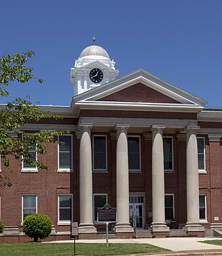
Jackson County is the northeasternmost county in the U.S. state of Alabama. As of the 2020 census, the population was 52,579. The county seat is Scottsboro. The county was named for Andrew Jackson, general in the United States Army and afterward President of the United States of America. Jackson County is a prohibition or dry county, but three cities within the county are "wet", allowing alcohol sales. Jackson County comprises the Scottsboro, AL Micropolitan Statistical Area, And Jackson county is included in the Scottsboro-Fort Payne combined statistical areas. It is the site of Russell Cave National Monument, an archeological site with evidence of 8,000 years of human occupation in the Southeast.

Minter City is an unincorporated community in Leflore County and Tallahatchie County, Mississippi. It is part of the Greenwood, Mississippi micropolitan area, and is within the Mississippi Delta.

High Island is an unincorporated community located in the Bolivar Peninsula census-designated place, Galveston County, Texas, United States. The community is located in the extreme eastern part of the county on Bolivar Peninsula, less than one mile from Chambers County and less than two miles from Jefferson County. As of 2000, 500 people resided in High Island. The 2010 census did not record a population for High Island.

The Coosa River is a tributary of the Alabama River in the U.S. states of Alabama and Georgia. The river is about 280 miles (450 km) long.

State Route 277 (SR 277) is a 9.350-mile (15.047 km) state highway in the northern part of the U.S. state of Alabama, traveling along part of former U.S. Route 72 (US 72) in Jackson County.

Lake Creek is an unincorporated community about 20 miles (32 km) east of Medford, in Jackson County, Oregon, United States. The community takes its name from Lake Creek, an important local stream.
Old Spring Hill is an unincorporated community in Marengo County, Alabama, United States.
Long Island is an unincorporated community in the northeastern corner of Jackson County, Alabama, United States. Long Island appears on the Bridgeport U.S. Geological Survey Map. It was reportedly named Carpenter for a family that lived there prior to 1852, when it was given the English form of the original Cherokee name of the village on the long island in the Tennessee River dating from 1783.
Bass is an unincorporated community in northern Jackson County, Alabama, United States, located approximately six miles northwest of Stevenson.
Berlin is a town in Cullman County, Alabama, United States. It is located roughly five miles east of the city of Cullman in northern Alabama. U.S. Route 278 and Cullman County Road 747 intersect at Walker's Corner, considered to be the center of Berlin. The Berlin Community Center is located on U.S. Route 278, just west of the crossroads.

Holmeson is an unincorporated community located within Millstone Township in Monmouth County, in the U.S. state of New Jersey. As it is located along County Route 537 through which the Monmouth–Ocean county line runs down the center, portions of the community are also located in Jackson Township. Owing to its location near Interstate 195 and Six Flags Great Adventure, the community is mostly made up of gas stations, restaurants, and small businesses though the Jackson Premium Outlets occupies land just south of the community.

Jackson Mills is an unincorporated community located within Jackson Township, in Ocean County, in the U.S. state of New Jersey. Jackson Mills is located near exit 22 on Interstate 195. It is also located nearby County Route 526 and Jackson Mills Lake. The site was originally home to a sawmill owned by William Jackson. Today surrounding the lake are some houses and townhomes, small businesses, and the Jackson Township Veterans Memorial Garden, though this area of the township is more rural than other more suburbanized portions of it due to the higher density of forest.

Pray is an unincorporated community located in the town of City Point, Jackson County, Wisconsin, United States.
Liberty Hill is an unincorporated community in Jackson County, Alabama, United States. Liberty Hill is located on County Route 14, 7.6 miles (12.2 km) east-southeast of Stevenson.
Ripley Landing is an unincorporated community in Jackson County, West Virginia, United States. Ripley Landing is located along West Virginia Route 2 near the confluence of the Ohio River and Mill Creek, 6.1 miles (9.8 km) southwest of Ravenswood. Ripley Landing once had a post office, which is now closed.

Sherwood is an unincorporated community in Franklin County, Tennessee, United States. It is located along Tennessee State Route 56 13.1 miles (21.1 km) southeast of Winchester, and just north of the Alabama state line. Sherwood has a post office with ZIP code 37376.
Swaim is an unincorporated community in northern Jackson County, Alabama, United States. It is located at the intersection of state routes 65 and 146, 5.7 miles (9.2 km) northwest of Skyline.
Pawn was a historic unincorporated community in Lane County in the U.S. state of Oregon. It lay at the headwaters of the North Fork Siuslaw River, where Sam Creek and West Branch join to form the river in the Siuslaw National Forest of the Central Oregon Coast Range. Downstream is the unincorporated community of Minerva, and further downstream, near the mouth of the river on the Siuslaw River is the city of Florence.
Steamboat is an unincorporated community in Jackson County, Oregon, United States. It lies along Carberry Creek, a tributary of the Applegate River, in the Rogue River – Siskiyou National Forest. Slightly west of Steamboat is the Jackson–Josephine county border, and the border with California is about 6 miles (10 km) to the south.

The Northern Magisterial District is one of three magisterial districts in Jackson County, West Virginia, United States. It was established during a process of redistricting undertaken in the 1990s. In 2010, 8,753 people lived in the district.


