Stevenson, Alabama

Last updated

Stevenson
Stevenson Historic District.JPG
Historic District
Jackson County Alabama Incorporated and Unincorporated areas Stevenson Highlighted 0173080.svg
Location of Stevenson in Jackson County, Alabama.
Coordinates: 34°52′10″N85°49′55″W / 34.86944°N 85.83194°W / 34.86944; -85.83194
Country United States
State Alabama
County Jackson
Area
[1]
  Total8.10 sq mi (20.98 km2)
  Land7.70 sq mi (19.93 km2)
  Water0.41 sq mi (1.05 km2)
Elevation
653 ft (199 m)
Population
 (2020)
  Total1,955
  Density254.06/sq mi (98.10/km2)
Time zone UTC-6 (Central (CST))
  Summer (DST) UTC-5 (CDT)
ZIP code
35772
Area code 256
FIPS code 01-73080
GNIS feature ID0127370
Website www.cityofstevensonalabama.com

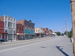
Stevenson is a city in Jackson County, Alabama, United States, and is included in the Chattanooga-Cleveland-Dalton, TN-GA-AL Combined Statistical Area. Sources listed either 1866 or 1867 as the year of incorporation, but that seems to conflict with the dates given for the town being granted a charter. [2] It did not first appear on the U.S. Census until 1880, where it was the second largest town in Jackson County behind Scottsboro. Since 1900, it has been the third largest town behind either Scottsboro and Bridgeport or vice versa. At the 2020 census, the population of the city was 1,955, down from 2,046 in 2010.

Contents

Geography

Stevenson is located at 34°52′10″N85°49′55″W / 34.86944°N 85.83194°W / 34.86944; -85.83194 (34.869442, -85.831829). [3]

According to the U.S. Census Bureau, the city has a total area of 5.2 square miles (13 km2), of which 4.9 square miles (13 km2) is land and 0.3 square miles (0.78 km2) (5.71%) is water.

Demographics

Historical population
CensusPop.Note
1880 241
1890 586143.2%
1900 560−4.4%
1910 5742.5%
1920 64011.5%
1930 73314.5%
1940 7938.2%
1950 92716.9%
1960 1,45657.1%
1970 2,39064.1%
1980 2,5687.4%
1990 2,046−20.3%
2000 1,770−13.5%
2010 2,04615.6%
2020 1,955−4.4%
U.S. Decennial Census [4]

2000 census

In the 2000 census, [5] there were 1,770 people, 795 households, and 508 families living in the city. The population density was 357.8 inhabitants per square mile (138.1/km2). There were 948 housing units at an average density of 191.6 per square mile (74.0/km2). The racial makeup of the city was 72.88% White, 22.37% Black or African American, 0.90% Native American, 0.11% Asian, 1.30% from other races, and 2.43% from two or more races. 1.53% of the population were Hispanic or Latino of any race.

There were 795 households, of which 24.4% had children under the age of 18 living with them, 45.4% were married couples living together, 14.3% had a female householder with no husband present, and 36.1% were non-families. 34.1% of all households were made up of individuals, and 15.2% had someone living alone who was 65 years of age or older. The average household size was 2.23 and the average family size was 2.83.

21.3% of the population were under the age of 18, 8.0% from 18 to 24, 27.8% from 25 to 44, 26.4% from 45 to 64, and 16.6% who were 65 years of age or older. The median age was 40 years. For every 100 females, there were 89.1 males. For every 100 females age 18 and over, there were 85.2 males.

The median household income was $26,908 and the median family income was $34,125. Males had a median income of $27,188 compared with $21,375 for females. The per capita income for the city was $14,806. About 15.5% of families and 19.9% of the population were below the poverty line, including 26.7% of those under age 18 and 22.1% of those age 65 or over.

2010 census

In the 2010 census, [6] there were 2,046 people, 904 households, and 554 families living in the city. The population density was 393.5 inhabitants per square mile (151.9/km2). There were 1,041 housing units at an average density of 200.2 per square mile (77.3/km2). The racial makeup of the city was 73.8% White, 17.4% Black or African American, 1.1% Native American, 0.4% Asian, 2.6% from other races, and 4.3% from two or more races. 3.9% of the population were Hispanic or Latino of any race.

There were 904 households, of which 24.1% had children under the age of 18 living with them, 40.7% were married couples living together, 15.7% had a female householder with no husband present, and 38.7% were non-families. 35.2% of all households were made up of individuals, and 16.0% had someone living alone who was 65 years of age or older. The average household size was 2.26 and the average family size was 2.90.

22.3% of the population were under the age of 18, 7.9% from 18 to 24, 24.1% from 25 to 44, 28.6% from 45 to 64, and 17.0% who were 65 years of age or older. The median age was 41.5 years. For every 100 females, there were 88.6 males. For every 100 females age 18 and over, there were 93.8 males.

The median household income was $241 and the median family income was $634. Males had a median income of $210 compared with $917 for females. The per capita income for the city was $14,647. About 26.6% of families and 31.8% of the population were below the poverty line, including 44.9% of those under age 18 and 25.3% of those age 65 or over.

2020 census

Stevenson racial composition [7]
RaceNum.Perc.
White (non-Hispanic)1,41772.48%
Black or African American (non-Hispanic)26113.35%
Native American 190.97%
Asian 50.26%
Pacific Islander 10.05%
Other/Mixed 1819.26%
Hispanic or Latino 713.63%

As of the 2020 United States census, there were 1,955 people, 729 households, and 461 families residing in the city.

Stevenson Depot

Gazebo by Railroad museum Stevenson Railroad Depot gazebo.JPG
Gazebo by Railroad museum

The Stevenson Railroad Depot Museum, located in downtown Stevenson, is dedicated to preserving an important part of railroading history through the display of related artifacts. In addition, the museum displays artifacts recalling Native American culture, pioneer life, and Civil War events. [8]

The depot, which was built in 1872 and listed in the National Register of Historic Places, stands on the ruins of Stevenson's first railroad depot, which was built around 1852 for common use by the Nashville Chattanooga and the Memphis & Charleston Railroads. That original depot was destroyed either during, or shortly after, the Civil War. Bricks salvaged may have been used in the building of the present structure. [9]

Fort Harker

Fort Harker Fort Harker northwest.JPG
Fort Harker

Constructed by the Union Army in summer 1862 and expanded in 1864, using soldiers and slaves, Fort Harker was built on a broad hill a quarter-mile east of the town of Stevenson. It overlooked Crow Creek and was well within firing range of Stevenson’s strategic railroad lines, supply depots and warehouses. [10] Ft. Harker was an earthen redoubt, 150 feet (46 m) square, with walls that were 14 feet (4.3 m) high, surrounded by an 8-foot-deep (2.4 m) dry moat. It contained 7 cannon platforms, a bomb-proof powder magazine, a draw-bridge entrance and an 8-sided wooden blockhouse at its center. [11] Fort Harker was critical to Union plans. No major fighting occurred here, but skirmishes and sniper attacks were common as territory traded hands between Union and Confederate forces. One other large fort, two smaller redoubts and at least seven blockhouses were constructed along the railroad lines at Stevenson during the Civil War. Stevenson was the major junction for the Memphis and Charleston Railroad and the Nashville and Chattanooga Railroad. In addition to forts, the Union Army established a medical facility and a refugee camp at Stevenson. The remains of Gen. Rosecrans’ headquarters is on the National Register of Historic Places. Both may be seen near downtown Stevenson today.

Depot Days

Every June, the town of Stevenson holds the annual Depot Days celebration. This celebration includes many different aspects of the southern town's culture and celebrates the great things that Stevenson represents. The week-long celebration is concluded with a parade, a day full of activities, and a street dance in the middle of Downtown Stevenson. [12]

North Jackson High School

Stevenson is the location of the North Jackson High School. In 1993, the school won the Alabama 4A State Title in football. [13] They reached the finals again in 2002, when they were defeated by UMS-Wright 7-3. [14]

Notable people

Related Research Articles

<span class="mw-page-title-main">Bynum, Alabama</span> Former CDP in Alabama, United States

Bynum is a former census-designated place in Calhoun County, Alabama, United States. At the 2000 census the population was 1,863. The area is now part of the city of Oxford and is included in the Anniston–Oxford, Alabama Metropolitan Statistical Area.

<span class="mw-page-title-main">Calera, Alabama</span> City in Alabama, United States

Calera is a city in Shelby and Chilton counties in the U.S. state of Alabama. It is the location of the Shelby County Airport.

<span class="mw-page-title-main">Sheffield, Alabama</span> City in Alabama, United States

Sheffield is a city in Colbert County, Alabama, United States, and is included in the Florence-Shoals metropolitan area. As of the 2010 census, the population of the city was 9,039. Sheffield is the birthplace of "country-soul pioneer" and songwriter Arthur Alexander, French horn player Willie Ruff, notable attorney, actor, former senator and presidential contender Fred Thompson, Watergate committee U.S. Senator Howell Heflin and U.S. Senator Mitch McConnell, whose father was working in nearby Athens when he was born. It sometimes is referred to as "the City of Senators" due to the births of Heflin, McConnell and Thompson within its borders. Col. Harland Sanders worked in the Sheffield depot for Southern Railway in the 1907. It is also home to the Muscle Shoals Sound Studio where many popular 20th century musicians recorded their work, including Alexander and Ruff. It is the site of historic Helen Keller Hospital, formerly known as Colbert County Hospital and originally constructed in 1921. It was changed to Helen Keller Hospital in 1979, and Keller's birthplace Ivy Green is located less than one mile southwest of the hospital in adjacent Tuscumbia.

Selmont-West Selmont is a census-designated place (CDP) in Dallas County, Alabama, United States. At the 2020 census, the population was 2,158.

<span class="mw-page-title-main">Sylvania, Alabama</span> Town in Alabama, United States

Sylvania is a town in DeKalb County, Alabama, United States. It incorporated in October 1967. At the 2010 census the population was 1,837, up from 1,186 in 2000. Sylvania is located atop Sand Mountain. Sylvania was incorporated in 1967. The post office /town hall was built in 1977.

<span class="mw-page-title-main">Headland, Alabama</span> City in Alabama, United States

Headland is the largest city in Henry County, Alabama, United States. It is part of the Dothan metropolitan area. In 2020, the population was 4,973, up from 4,510 in the 2010 census. Ray Marler is the current mayor.

<span class="mw-page-title-main">Ashford, Alabama</span> Town in Alabama, United States

Ashford is a town in Houston County, Alabama, United States. It is part of the Dothan, Alabama Metropolitan Statistical Area. The town was incorporated in June 1891. For most of its history, it was a center for naval stores production, pulpwood harvesting, and cotton agriculture. The population was 2,148 at the 2010 census, up from 1,853 at the 2000 census.

<span class="mw-page-title-main">Bridgeport, Alabama</span> City in Alabama, United States

Bridgeport is a city in Jackson County, Alabama, United States. At the time of 2020 census the population was 2,264, down from 2,418 in 2010. Bridgeport is included in the Chattanooga-Cleveland-Dalton, TN-GA-AL Combined Statistical Area.

<span class="mw-page-title-main">Paint Rock, Alabama</span> Town in Alabama, United States

Paint Rock is a town in Jackson County, Alabama, United States, along the Paint Rock River, and is included in the Huntsville-Decatur Combined Statistical Area. It was incorporated in July 1894.

<span class="mw-page-title-main">Courtland, Alabama</span> Town in Alabama, United States

Courtland is a town in Lawrence County, Alabama, United States, and is included in the Decatur Metropolitan Area, as well as the Huntsville-Decatur Combined Statistical Area. The population was 609 at the 2010 census, down from 769 in 2000.

<span class="mw-page-title-main">Frisco City, Alabama</span> Town in Alabama, United States

Frisco City is a town in Monroe County, Alabama, United States. The population was 1,170 at the 2020 census.

<span class="mw-page-title-main">Hartselle, Alabama</span> City in Alabama, United States

Hartselle is the second largest city in Morgan County, Alabama, United States, 13 miles (21 km) south of Decatur. It is part of the Decatur Metropolitan Area and the Huntsville-Decatur Combined Statistical Area.

<span class="mw-page-title-main">Wadley, Alabama</span> Town in Alabama, United States

Wadley is a town in Randolph County, Alabama, United States. It is home to the Wadley campus of Southern Union State Community College. As of the 2010 census, the population of the town was 751, up from 640 in 2000. According to the 1910 U.S. Census, the town was incorporated in 1908.

<span class="mw-page-title-main">Dora, Alabama</span> City in Alabama, United States

Dora is a city in Walker County, Alabama, United States. Coal mining took place in the area.

<span class="mw-page-title-main">Stark, Kansas</span> City in Neosho County, Kansas

Stark is a city in Neosho County, Kansas, United States. As of the 2020 census, the population of the city was 69.

<span class="mw-page-title-main">Hallsville, Missouri</span> City in Missouri, United States

Hallsville is a city in Boone County, Missouri. It is part of the Columbia metropolitan area. The population was 1,614 at the time of the 2020 census. Southeast of the town is Mount Zion Church and Cemetery, the site of the Battle of Mount Zion Church during the Civil War.

<span class="mw-page-title-main">Republic, Missouri</span> City in Missouri, United States

Republic is a city in Christian and Greene counties in the U.S. state of Missouri. As of the 2020 census, the city's population was 18,750. In 2019, its population was 16,938, making it the second largest city in Greene County in the U.S. state of Missouri. It is also the fourth largest city in the Springfield, Missouri, Metropolitan Statistical Area.

<span class="mw-page-title-main">Ogallala, Nebraska</span> City in Nebraska, United States

Ogallala is a city in and the county seat of Keith County, Nebraska, United States. The population was 4,878 at the 2020 census, up from 4,737 at the 2010 census. In the days of the Nebraska Territory, the city was a stop on the Pony Express and later along the transcontinental railroad. The Ogallala Formation that carries the Ogallala Aquifer was named after the city.

<span class="mw-page-title-main">Lacona, New York</span> Village in New York, United States

Lacona is a village in Oswego County, New York, United States. The population was 582 at the 2010 census. The village is inside the town of Sandy Creek, halfway between Syracuse and Watertown.

<span class="mw-page-title-main">Ardmore, Tennessee</span> City in Tennessee, United States

Ardmore is a city in Giles and Lincoln counties, Tennessee, United States. The population was 1,217 at the 2020 census. Ardmore is the site of a Tennessee Department of Tourist Development Welcome Center. It borders its sister city, Ardmore, Alabama.

References

  1. "2020 U.S. Gazetteer Files". United States Census Bureau. Retrieved October 29, 2021.
  2. "Stevenson".
  3. "US Gazetteer files: 2010, 2000, and 1990". United States Census Bureau. February 12, 2011. Retrieved April 23, 2011.
  4. "U.S. Decennial Census". Census.gov. Retrieved June 6, 2013.
  5. "U.S. Census website". United States Census Bureau . Retrieved January 31, 2008.
  6. "U.S. Census website". United States Census Bureau . Retrieved July 26, 2015.
  7. "Explore Census Data". data.census.gov. Retrieved December 12, 2021.
  8. "Stevenson Railroad Depot Museum". Jacksoncountychamber.com. Retrieved August 2, 2014.
  9. "Stevenson". Encyclopedia of Alabama. February 26, 2013. Retrieved August 2, 2014.
  10. "Northern Alabama". Civil War Traveler. Retrieved August 2, 2014.
  11. Payette, Pete (2006). Northern Alabama. Retrieved August 1, 2014.
  12. "Stevenson Depot Days | Community Events". Jacksoncountychamber.com. Retrieved August 2, 2014.
  13. "Alabama High School Football Championships". AHSFHS.org. December 10, 1993. Retrieved August 2, 2014.
  14. "Alabama High School Football History". Ahsfhs.org. Retrieved August 2, 2014.

34°52′10″N85°49′55″W / 34.869442°N 85.831829°W / 34.869442; -85.831829