
Alabama is a state in the southeastern region of the United States. It is bordered by Tennessee to the north, Georgia to the east, Florida and the Gulf of Mexico to the south, and Mississippi to the west. Alabama is the 30th largest by area and the 24th-most populous of the U.S. states. With a total of 1,500 miles (2,400 km) of inland waterways, Alabama has among the most of any state.

Jackson County is the northeasternmost county in the U.S. state of Alabama. As of the 2010 census, the population was 53,227. The county seat is Scottsboro. The county was named for Andrew Jackson, general in the United States Army and afterward President of the United States of America. Jackson County is a prohibition or dry county, but three cities within the county are "wet", allowing alcohol sales. Jackson County comprises the Scottsboro, AL Micropolitan Statistical Area. This is included in the Chattanooga-Cleveland-Dalton, TN-GA-AL Combined Statistical Area. It is the site of Russell Cave National Monument, an archeological site with evidence of 8,000 years of human occupation in the Southeast.
Muscle Shoals is the largest city in Colbert County, Alabama, United States. It is located along the Tennessee River in the northern part of the state and, as of the 2010 census, the population of Muscle Shoals was 13,146. The estimated population in 2019 was 14,575.
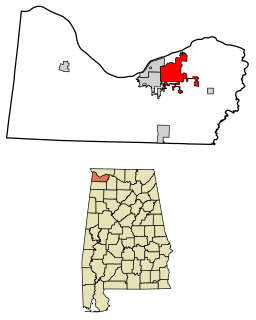
Scottsboro is a city in Jackson County, Alabama, United States. As of the 2010 census, the population of the city is 14,770. Named for its founder Robert T. Scott, the city is the county seat of Jackson County.

The Coosa River is a tributary of the Alabama River in the U.S. states of Alabama and Georgia. The river is about 280 miles (450 km) long.

Roxana, also known as Rock Springs, is an unincorporated community northwesterly located in Lee County, Alabama, United States. It lies seven miles (12 km) north of Notasulga and five miles (8 km) southwest of Waverly. It is part of the Columbus, Georgia-Alabama Metropolitan Area.

WMDN, virtual and UHF digital channel 24, is a CBS-affiliated television station licensed to Meridian, Mississippi, United States. It is one of two flagship television properties of the locally based Waypoint Media, LLC, alongside duopoly partner and dual Fox/NBC affiliate WGBC. The two stations share studios and transmitter facilities on Crestview Circle, in unincorporated Lauderdale County, south of Meridian. Together, WMDN and WGBC are known as "The Meridian Family of Stations."
State Route 65 (SR 65) is a 27.540-mile-long (44.321 km) state highway in western Jackson County, in the U.S. state of Alabama. The southern terminus of the highway is at an intersection with U.S. Route 72 (US 72) at Paint Rock. The northern terminus of the highway is at the Tennessee state line, north of Francisco. North of the state line, the highway continues as Tennessee State Route 97.

Flat Rock is an unincorporated community in Jackson County, Alabama, United States. The Flat Rock post office was established in 1912.
Higdon is an unincorporated community in Jackson County, Alabama, United States.
WKEA-FM is a radio station licensed to serve the community of Scottsboro, Alabama, United States. The station is owned by Southern Torch Media, Inc.
Hope Hull, also known as McGehees Switch, is an unincorporated community in Montgomery County, Alabama, United States, southwest of Montgomery.

Elections in Alabama are authorized under the Alabama State Constitution, which establishes elections for the state level officers, cabinet, and legislature, and the election of county-level officers, including members of school boards.

Fruitvale is an unincorporated rural community in Crockett County, Tennessee, United States. As of 2012, there were about 65 people living in Fruitvale. The village was listed on the National Register of Historic Places in 2012 as the Fruitvale Historic District.

Estillfork is an unincorporated community in Jackson County, Alabama, United States. It is located in a rugged area at the head of the Paint Rock Valley in northern Jackson County. Just south of the community, the stream with which it shares its name, Estill Fork, joins Hurricane Creek to form the Paint Rock River. The Cumberland Plateau rises immediately to the east, and the Alabama-Tennessee state line passes a few miles to the north.
Hacoda, also known as Martha, is an unincorporated community in Geneva County, Alabama, United States. Hacoda is located on Alabama State Route 54, 7.5 miles (12.1 km) west-southwest of Samson.
Antioch, also known as Hilton, is an unincorporated community in Covington County, Alabama, United States.
Grangeburg, also known as Granger or Grangerburg, is an unincorporated community in Houston County, Alabama, United States. Grangeburg is located along Alabama State Route 53, 6.2 miles (10.0 km) east-southeast of Cottonwood.
Marlow is an unincorporated community in Baldwin County, Alabama, United States.

Alamucha is an unincorporated community in Lauderdale County, Mississippi, United States.


