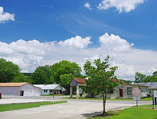
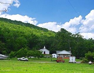
Long Branch is an unincorporated community in Fayette County, West Virginia, United States. Long Branch is located near the West Virginia Turnpike, 1.1 miles (1.8 km) northwest of Pax. Long Branch had a post office, which closed on October 3, 1998.
Valley Chapel is an unincorporated community in Lewis County, West Virginia, United States. Valley Chapel is located along County Route 10, 5.15 miles (8.29 km) north-northwest of Weston. Valley Chapel had a post office, which closed on January 24, 1998.
Hatchechubbee is an unincorporated community in Russell County, Alabama, United States. Hatchechubbee is located at the junction of Alabama State Route 26 and County Route 65, 6.5 miles (10.5 km) west-southwest of Seale. Hatchechubbee has a post office with ZIP code 36858, which opened on August 17, 1855. The community's name is derived from the Creek words hachi meaning "creek" and chaba meaning "halfway".

Perdido, also known as Perdido Station, is an unincorporated community and census-designated place in Baldwin County, Alabama, United States. Perdido is located along County Route 61, 12.2 miles (19.6 km) northeast of Bay Minette. Perdido has a post office with ZIP code 36562. It has an elementary school, Perdido School, which is part of the Baldwin County Board of Education.
Thomastown is an unincorporated community in Leake County, Mississippi, United States. The junction of Mississippi Highway 43 and Mississippi Highway 429 was placed at Thomastown, some 11.9 miles (19.2 km) northwest of Carthage.
Lenox is an unincorporated community in Conecuh County, Alabama, United States. Lenox is 10 miles (16 km) west-northwest of Castleberry. Lenox had a post office until it closed on June 13, 1998; it still has its own ZIP code, 36454. Joseph Ryals was the first postmaster who also owned the settlement's general store. It is claimed he named the location after a bar of Lenox soap, in order for the post office to be authorized. Lenox is also home to young earth creationist Kent Hovind, as well as his Dinosaur Adventure Land ministry and amusement park.
Frankville is an unincorporated community in Washington County, Alabama, United States, located on County Route 31, 9.8 miles (15.8 km) east of Millry. Frankville has a post office with ZIP code 36538.
Skipperville is an unincorporated community in Dale County, Alabama, United States. Skipperville is located on Alabama State Route 105, 8.8 miles (14.2 km) northeast of Ozark. Skipperville has a post office with ZIP code 36374, which opened on November 10, 1853.This community also consists of G.W. Long School, which has won a 2a state championship for baseball in many previous years. This school also has other sports teams with state wide victories.
Pansey is an unincorporated community in Houston County, Alabama, United States. Pansey is located along U.S. Route 84, 13.5 miles (21.7 km) east-southeast of Dothan. Pansey has a post office with ZIP code 36370.
Shorterville is an unincorporated community in Henry County, Alabama, United States. Shorterville is located on Alabama State Route 10, 8.8 miles (14.2 km) east of Abbeville. Shorterville has a post office with ZIP code 36373.

Highland Home is an unincorporated community in Crenshaw County, Alabama, United States. Highland Home is located on U.S. Route 331, 16.6 miles (26.7 km) north of Luverne. Highland Home has a post office with ZIP code 36041, which opened on July 15, 1837. Located mostly on highway 331 that also runs to Luverne, Alabama.

Hollytree is an unincorporated community in Jackson County, Alabama, United States. It is located on Alabama State Route 65, 9.7 miles (15.6 km) northeast of Gurley in the Paint Rock Valley. Hollytree has a post office with ZIP code 35751.

Princeton is an unincorporated community in Jackson County, Alabama, United States. Princeton is located on Alabama State Route 65 in the upper Paint Rock Valley. Skyline lies just over 7 miles (11 km) miles to the east atop the Cumberland Plateau, and the Alabama–Tennessee state line passes several miles to the north. Princeton has a post office with ZIP code 35766.

Trenton is an unincorporated community in Jackson County, Alabama, United States. It is located on Alabama State Route 65, 7.7 miles (12.4 km) east-northeast of Gurley in the Paint Rock Valley. Trenton had a post office until it closed on November 5, 2011; it still has its own ZIP code, 35774.
Muscadine is an unincorporated community in Cleburne County, Alabama, United States. It is near the Alabama-Georgia state line. Muscadine is 2.75 miles (4.43 km) east of Fruithurst. Muscadine has a post office with ZIP code 36269, a general store, and a bar.
Abernant is an unincorporated community in Tuscaloosa County, Alabama, United States. Abernant is located along Alabama State Route 216, 3.6 miles (5.8 km) west of Lake View. Abernant has a post office with ZIP code 35440.
McGrady is an unincorporated community in Wilkes County, North Carolina, United States. As of 2015, the population was 993. McGrady is located along North Carolina Highway 18, 14 miles (23 km) north-northwest of Wilkesboro. McGrady has a post office with ZIP code 28649. McGrady is located at the base of the Blue Ridge Mountains; the Blue Ridge dominate the community's northern horizon. McGrady consists of numerous valleys with creeks and streams, lower mountain ridges, farms, and forests. The largest stream in the community is Mulberry Creek, which flows south to the Yadkin River, Wilkes County's largest river.
Saint David is an unincorporated village in the town of Madawaska, in Aroostook County, Maine, United States. The community is located on U.S. Route 1 in the Saint John River Valley, 4.5 miles (7.2 km) east of the village of Madawaska. Saint David has a post office with ZIP code 04773.
Hunlock Creek is an unincorporated community in Hunlock Township, Luzerne County, Pennsylvania, United States. The community is located along the Susquehanna River and U.S. Route 11, 3.2 miles (5.1 km) west of Nanticoke. Hunlock Creek has a post office with ZIP code 18621. In 1940, a regional guidebook noted that the town, "its shacks resting in a mountain cleft, is named for the coal-blackened stream that splits it into a number of sections. US 11 parallels the winding river through a long valley that broadens out occasionally to include a cultivated tract on the river flat."
Rock Stream is a hamlet in the town of Starkey, Yates County, New York, United States. The community is located near New York State Route 14 and is 4.4 miles (7.1 km) southeast of Dundee. Rock Stream has a post office with ZIP code 14878, which opened on September 19, 1820.


