Hollywood, Alabama

Last updated

Hollywood, Alabama
Hollywood Alabama Signage.jpg
Jackson County Alabama Incorporated and Unincorporated areas Hollywood Highlighted 0135632.svg
Location of Hollywood in Jackson County, Alabama.
Coordinates: 34°43′1″N85°57′56″W / 34.71694°N 85.96556°W / 34.71694; -85.96556
Country United States
State Alabama
County Jackson
Area
[1]
  Total9.11 sq mi (23.59 km2)
  Land9.09 sq mi (23.55 km2)
  Water0.01 sq mi (0.04 km2)
Elevation
627 ft (191 m)
Population
 (2020)
  Total914
  Density100.51/sq mi (38.81/km2)
Time zone UTC-6 (Central (CST))
  Summer (DST) UTC-5 (CDT)
ZIP code
35752
Area code 256
FIPS code 01-35632
GNIS feature ID0120286
Website thetownofhollywood.com

Hollywood is a town in Jackson County, northeast Alabama, United States. In 2020, the census showed a population of 914 residents. [2] Hollywood is considered a suburb of Scottsboro, the county seat. The town is the site of the Tennessee Valley Authority's never-completed Bellefonte Nuclear Generating Station. The TVA sold the plant, and as of 2018, it is to be developed by private interests. [3]

Contents

History

Hollywood Elementary School Hollywood Elementary School Alabama.jpg
Hollywood Elementary School

Originally established as Samples on December 14, 1883, the town was renamed as Hollywood on May 13, 1887. [4] It formally incorporated on May 24, 1897, and held its first election on June 8 of that year. [4]

In 1994, it and 10 other towns named Hollywood successfully fought Hollywood, California's attempt to trademark its name and force same-named communities to pay royalties to it. [5] A key point was that Hollywood in Alabama was the first incorporated Hollywood in the nation, whereas the one in California did not incorporate until 1903, 6 years after Alabama's. In addition, it merged with Los Angeles in 1910 and was no longer identified as a separate city.

Geography

Hollywood is located at 34°43′1″N85°57′56″W / 34.71694°N 85.96556°W / 34.71694; -85.96556 (34.716960, -85.965689). [6]

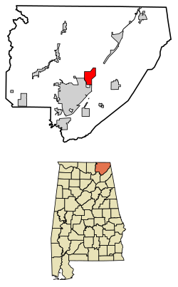
According to the U.S. Census Bureau, the town has a total area of 8.9 square miles (23 km2), of which 8.9 square miles (23 km2) is land and 0.11% is water.

Demographics

Historical population
CensusPop.Note
1900 168
1910 23439.3%
1920 27617.9%
1930 274−0.7%
1940 31113.5%
1950 47753.4%
1960 246−48.4%
1970 30122.4%
1980 1,110268.8%
1990 916−17.5%
2000 9503.7%
2010 1,0005.3%
2020 914−8.6%
U.S. Decennial Census [7]
2013 Estimate [8]

As of the census [9] of 2000, there were 950 people, 375 households, and 265 families residing in the town. The population density was 106.6 inhabitants per square mile (41.2/km2). There were 404 housing units at an average density of 45.3 per square mile (17.5/km2). The racial makeup of the town was 80.63% White, 16.32% Black or African American, 0.32% Native American, 0.11% from other races, and 2.63% from two or more races. 0.42% of the population were Hispanic or Latino of any race. [9]

There were 375 households, out of which 32.8% had children under the age of 18 living with them, 51.2% were married couples living together, 14.7% had a female householder with no husband present, and 29.1% were non-families. 25.3% of all households were made up of individuals, and 8.0% had someone living alone who was 65 years of age or older. The average household size was 2.53 and the average family size was 3.03. [9]

The town's population was spread out, with 26.7% under the age of 18, 7.1% from 18 to 24, 31.8% from 25 to 44, 24.7% from 45 to 64, and 9.7% who were 65 years of age or older. The median age was 37 years. For every 100 females, there were 94.3 males. For every 100 females age 18 and over, there were 92.8 males. Beaver creek was the main road in the community. Star Island convent is also a main attraction for visitors. The town is historically known for the large sinkhole that appeared in 1892. The event caused the deaths of 17 people. The median income for a household in the town was $27,500, and the median income for a family was $34,306. Males had a median income of $26,667 versus $21,563 for females. The per capita income for the town was $16,498. About 6.8% of families and 11.2% of the population were below the poverty line, including 9.9% of those under age 18 and 10.6% of those age 65 or over. [9]

Notable persons

Related Research Articles

<span class="mw-page-title-main">Snead, Alabama</span> Town in Alabama, United States

Snead is a town in Blount County, Alabama, United States. At the 2020 census, the population was 1,032.

<span class="mw-page-title-main">Littleville, Alabama</span> Town in Alabama, United States

Littleville is a town located on the southern border of Colbert County, Alabama, United States, and extends into Franklin County. It is part of the Florence - Muscle Shoals Metropolitan Statistical Area known as "The Shoals". As of the 2010 census, the population of the town was 1,011.

<span class="mw-page-title-main">Midland City, Alabama</span> Town in Alabama, United States

Midland City is a town in Dale County, Alabama, United States. At the 2010 U.S. Census the population was 2,344. It incorporated in 1890. It is part of the Ozark Micropolitan Statistical Area.

<span class="mw-page-title-main">Hammondville, Alabama</span> Town in Alabama, United States

Hammondville is a town in DeKalb County, Alabama, United States. It was incorporated in 1937. As of the 2010 census, the population of the town is 488.

<span class="mw-page-title-main">Lakeview, Alabama</span> Town in Alabama, United States

Lakeview is a town in DeKalb County, Alabama, United States. At the 2020 census, the population was 161. Lakeview is located atop Sand Mountain.

<span class="mw-page-title-main">Shiloh, DeKalb County, Alabama</span> Town in Alabama, United States

Shiloh is a town in DeKalb County, Alabama, United States. It incorporated in 1962. At the 2020 census, the population was 321. Shiloh is located atop Sand Mountain.

<span class="mw-page-title-main">Sylvania, Alabama</span> Town in Alabama, United States

Sylvania is a town in DeKalb County, Alabama, United States. It incorporated in October 1967. At the 2010 census the population was 1,837, up from 1,186 in 2000. Sylvania is located atop Sand Mountain. Sylvania was incorporated in 1967. The post office /town hall was built in 1977.

<span class="mw-page-title-main">Sardis City, Alabama</span> Town in Alabama, United States

Sardis City is a town in Etowah and Marshall counties in the U.S. state of Alabama. It is part of the Gadsden Metropolitan Statistical Area. It originally incorporated in May 1963 under the name of "Sardis". It became Sardis City in the 1980s. At the 2020 census, the population was 1,814.

<span class="mw-page-title-main">Taylor, Alabama</span> Town in Alabama, United States

Taylor is a town in Geneva and Houston counties in the U.S. state of Alabama. Taylor was first settled in the 1870s, named after an early family that helped secure the first post office. It was not incorporated until almost a century later in June 1967. It is part of the Dothan, Alabama Metropolitan Statistical Area. At the 2010 census the population was 2,375, up from 1,898 in 2000.

<span class="mw-page-title-main">Kinsey, Alabama</span> Town in the United States

Kinsey is a town in Houston County, Alabama, United States. It was initially located and incorporated in Henry County in February 1893. In 1903, it was redrawn into newly created Houston County and was later reincorporated in August 1957. It is part of the Dothan, Alabama Metropolitan Statistical Area. At the 2010 census the population was 2,198, up from 1,796 in 2000.

<span class="mw-page-title-main">Dutton, Alabama</span> Town in Alabama, United States

Dutton is a town in Jackson County, Alabama, United States. It was incorporated in 1963. As of the 2010 census, the population of the town was 315, up from 310 in 2000. Dutton is located atop Sand Mountain.

<span class="mw-page-title-main">Pisgah, Alabama</span> Town in Alabama, United States

Pisgah is a town in Jackson County, Alabama, United States, and is included in the Huntsville-Decatur Combined Statistical Area. It incorporated in 1947. As of the 2020 census, the population of the town was 681, down from 722 in 2010. Pisgah is located atop Sand Mountain.

<span class="mw-page-title-main">Section, Alabama</span> Town in Alabama, United States

Section is a town in Jackson County, Alabama, United States and is included in the Chattanooga-Cleveland-Dalton, TN-GA-AL Combined Statistical Area. As of the 2010 census, the population of the town was 770, an increase of one person (769) from 2000. Section is located on top of Sand Mountain.

<span class="mw-page-title-main">Stevenson, Alabama</span> City in Alabama, United States

Stevenson is a city in Jackson County, Alabama, United States, and is included in the Chattanooga-Cleveland-Dalton, TN-GA-AL Combined Statistical Area. Sources listed either 1866 or 1867 as the year of incorporation, but that seems to conflict with the dates given for the town being granted a charter. It did not first appear on the U.S. Census until 1880, where it was the second largest town in Jackson County behind Scottsboro. Since 1900, it has been the third largest town behind either Scottsboro and Bridgeport or vice versa. At the 2020 census, the population of the city was 1,955, down from 2,046 in 2010.

<span class="mw-page-title-main">Bear Creek, Alabama</span> Town in Alabama, United States

Bear Creek is a town in Marion County, Alabama, United States. It incorporated in 1907, although the 1910 U.S. Census records indicated 1909. At the 2020 census, the population was 1,047.

<span class="mw-page-title-main">Camp Hill, Alabama</span> Town in Alabama, United States

Camp Hill is a town in Tallapoosa County, Alabama, United States. It was incorporated in 1895. At the 2010 census the population was 1,014, down from 1,273 in 2000. Camp Hill is the home to Southern Preparatory Academy.

<span class="mw-page-title-main">Creston, Illinois</span> Village in Illinois, United States

Creston is a village in Ogle County, Illinois, United States. The population was 627 at the 2020 census, down from 662 in 2010.

<span class="mw-page-title-main">Republic, Pennsylvania</span> Census-designated place in Pennsylvania, United States

Republic is an unincorporated community and census-designated place (CDP) in Fayette County, Pennsylvania, United States. The population was 1,096 at the 2010 census, down from 1,396 at the 2000 census. The community is in Redstone Township.

<span class="mw-page-title-main">Joaquin, Texas</span> City in Texas, United States

Joaquin is a city in northeastern Shelby County, Texas, United States. Founded in 1885, it was named after Joaquin Morris, grandson of the original land owner, Benjamin Franklin Morris. Its population was 734 at the 2020 census. It is located on U.S. Highway 84 and the tracks of the Southern Pacific Railroad.

Prairie Farm is a town in Barron County in the U.S. state of Wisconsin. The population was 573 at the 2010 census. The village of Prairie Farm is surrounded by the town.

References

  1. "2020 U.S. Gazetteer Files". United States Census Bureau. Retrieved October 29, 2021.
  2. "Census profile: Hollywood, AL". Census Reporter. Retrieved October 25, 2022.
  3. "Claiming billions can be saved, TVA's largest customer looks to begin courting other power suppliers". August 19, 2020.
  4. 1 2 Kazek, Kelly (November 20, 2012). "More than 2 decades ago, the real Hollywood stood up and fought Tinseltown". al. Retrieved October 25, 2022.
  5. "More than 2 decades ago, the real Hollywood stood up and fought Tinseltown (Odd Travels)". November 20, 2012.
  6. "US Gazetteer files: 2010, 2000, and 1990". United States Census Bureau. February 12, 2011. Retrieved April 23, 2011.
  7. "U.S. Decennial Census". Census.gov. Retrieved June 6, 2013.
  8. "Annual Estimates of the Resident Population: April 1, 2010 to July 1, 2013". Archived from the original on May 22, 2014. Retrieved June 3, 2014.
  9. 1 2 3 4 "U.S. Census website". United States Census Bureau . Retrieved January 31, 2008.
  10. "Human Tornado Cagematch profile". Cagematch. Retrieved November 9, 2009.
  11. Yu, Ting (May 20, 2002). "Going Full Stilt". People. Archived from the original on February 6, 2021. Retrieved February 6, 2021.{{cite news}}: CS1 maint: bot: original URL status unknown (link)

34°43′01″N85°57′56″W / 34.71696°N 85.965689°W / 34.71696; -85.965689