Ryan, Queensland

Last updated

Ryan
Queensland
Australia Queensland location map.svg
Red pog.svg
Ryan
Coordinates 20°42′03″S139°29′59″E / 20.7008°S 139.4997°E / -20.7008; 139.4997 (Ryan (centre of suburb))
Population105 (2021 census) [1]
 • Density65.6/km2 (170/sq mi)
Postcode(s) 4825
Area1.6 km2 (0.6 sq mi)
Time zone AEST (UTC+10:00)
LGA(s) City of Mount Isa
State electorate(s) Traeger
Federal division(s) Kennedy
Suburbs around Ryan:
Lanskey Mount Isa (locality) Mount Isa (locality)
Soldiers Hill Ryan Mount Isa (locality)
Soldiers Hill Winston Sunset

Ryan is a mixed-use suburb of the town of Mount Isa in the City of Mount Isa, Queensland, Australia. [2] In the 2021 census, Ryan had a population of 105 people. [1]

Contents

Geography

The Leichhardt River flows north–south through the town of Mount Isa, dividing the suburbs of the town into "mineside" (west of the Leichhardt River) and "townside" (east of the Leichhardt River). [3] [4] Ryan is a "townside" suburb. [5]

There is a residential area in the south-west of the suburb. There are two areas of industrial use, one on the north-west and west of the suburb and the other on the east, south-east, and south of the suburb. Between these two industrial areas there is agriculture, predominantly grazing on native vegetation. [5]

History

All burials occurred in the Pioneer Cemetery (now within Ryan) until the opening of the Sunset Memorial Cemetery in the late 1930s. [6]

Ryan was named on 1 September 1973 by the Queensland Place Names Board after Dr Edward Joseph Ryan, the medical superintendent of the Mount Isa District Hospital during World War II. On 16 March 2001, the status of Ryan was changed from a locality to a suburb. [2]

Demographics

In the 2016 census, Ryan had a population of 141 people. [7]

In the 2021 census, Ryan had a population of 105 people. [1]

Education

There are no schools in Ryan. The nearest government primary schools are Barkly Highway State School in neighbouring Soldiers Hill to the west and Sunset State School in neighbouring Sunset to the south-east. The nearest government secondary school is Spinifex State College which has its junior campus in Parkside to the south-west and its senior campus in Pioneer to the south-east. [5]

Amenities

Edna Medley Park is an off-leash dog park on Sunset Drive ( 20°42′29″S139°30′11″E / 20.70797°S 139.50308°E / -20.70797; 139.50308 (Edna Medley Park) ). [8] [9]

Facilities

Mount Isa Pioneer Cemetery is off Ryan Road ( 20°41′47″S139°30′07″E / 20.6965°S 139.5019°E / -20.6965; 139.5019 (Mount Isa Pioneer Cemetery) ). [10] [5]

Mount Isa Sunset Memorial Cemetery is at the northern end of Sunset Drive ( 20°42′05″S139°30′24″E / 20.7014°S 139.5067°E / -20.7014; 139.5067 (Mount Isa Sunset Memorial Cemetery) ). [11] [5]

Mount Isa SES Facility is at 14 Ryan Road ( 20°42′04″S139°29′51″E / 20.7012°S 139.4976°E / -20.7012; 139.4976 (Mount Isa SES Facility) ). [12] [13] [5]

Related Research Articles

Parkside is a suburb of the town of Mount Isa in the City of Mount Isa, Queensland, Australia. In the 2021 census, Parkside had a population of 1,530 people.

<span class="mw-page-title-main">Mornington, Queensland</span> Suburb of Mount Isa, Queensland, Australia

Mornington is a suburb of the town of Mount Isa in the City of Mount Isa, Queensland, Australia. In the 2021 census, Mornington had a population of 1,846 people.

<span class="mw-page-title-main">Waverley, Queensland</span> Suburb of Shire of Boulia, Queensland, Australia

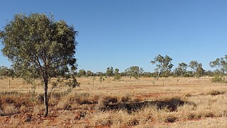
Waverley is an outback locality in the Shire of Boulia, Queensland, Australia. In the 2021 census, Waverley had a population of 6 people.

Pioneer is a suburb of the town of Mount Isa in the City of Mount Isa, Queensland, Australia. In the 2021 census, Pioneer had a population of 2,346 people.

<span class="mw-page-title-main">Townview, Queensland</span> Suburb of Mount Isa, Queensland, Australia

Townview is a suburb of the town of Mount Isa in the City of Mount Isa, Queensland, Australia. In the 2021 census, Townview had a population of 2,067 people.

Happy Valley is a suburb of the town of Mount Isa in the City of Mount Isa, Queensland, Australia. In the 2021 census, Happy Valley had a population of 733 people.

Healy is a suburb of Mount Isa in the City of Mount Isa, Queensland, Australia. In the 2021 census, Healy had a population of 1,824 people.

<span class="mw-page-title-main">Sunset, Queensland</span> Suburb of City of Mount Isa, Queensland, Australia

Sunset is a suburb of the town of Mount Isa in the City of Mount Isa, Queensland, Australia. In the 2021 census, Sunset had a population of 2,137 people.

<span class="mw-page-title-main">Kalkadoon, Queensland</span> Suburb of Mount Isa, Queensland, Australia

Kalkadoon is a suburb of the town of Mount Isa in the City of Mount Isa, Queensland, Australia. In the 2021 census, Kalkadoon had a population of 27 people.

<span class="mw-page-title-main">Mount Isa City, Queensland</span> Suburb of Mount Isa, Queensland, Australia

Mount Isa City is the central suburb and central business district of the town of Mount Isa in the City of Mount Isa, Queensland, Australia. In the 2021 census, Mount Isa City had a population of 170 people.

<span class="mw-page-title-main">The Gap, Queensland (Mount Isa)</span> Suburb of City of Mount Isa, Queensland, Australia

The Gap is a suburb of the town of Mount Isa in the City of Mount Isa, Queensland, Australia. In the 2021 census, The Gap had a population of 817 people.

Menzies is a suburb of the town of Mount Isa in the City of Mount Isa, Queensland, Australia. In the 2021 census, Menzies had a population of 824 people.

<span class="mw-page-title-main">Miles End, Queensland</span> Suburb of City of Mount Isa, Queensland, Australia

Miles End is a suburb of the town of Mount Isa in the City of Mount Isa, Queensland, Australia. In the 2021 census, Miles End had a population of 280 people.

<span class="mw-page-title-main">Soldiers Hill, Queensland</span> Suburb of City of Mount Isa, Queensland, Australia

Soldiers Hill is a suburb of the town of Mount Isa in the City of Mount Isa, Queensland, Australia. In the 2021 census, Soldiers Hill had a population of 1,796 people.

Winston is a suburb of the town of Mount Isa in the City of Mount Isa, Queensland, Australia. In the 2021 census, Winston had a population of 1,084 people.

Lanskey is a suburb of the town of Mount Isa in the City of Mount Isa, Queensland, Australia. In the 2021 census, Lanskey had a population of 101 people.

Fisher is a suburb of the town of Mount Isa in the City of Mount Isa, Queensland, Australia. In the 2021 census, Fisher had a population of 65 people.

Spreadborough is a suburb of the town of Mount Isa in the City of Mount Isa, Queensland, Australia. In the 2021 census, Spreadborough had a population of 55 people.

Mica Creek is a suburb of the town of Mount Isa in the City of Mount Isa, Queensland, Australia. In the 2021 census, Mica Creek had a population of 182 people.

Breakaway is a suburb of the town of Mount Isa in the City of Mount Isa, Queensland, Australia. In the 2021 census, Breakaway had a population of 187 people.

References

  1. 1 2 3 Australian Bureau of Statistics (28 June 2022). "Ryan (SAL)". 2021 Census QuickStats. Retrieved 28 February 2023. OOjs UI icon edit-ltr-progressive.svg
  2. 1 2 "Ryan – suburb in City of Mount Isa (entry 42470)". Queensland Place Names. Queensland Government . Retrieved 2 November 2019.
  3. "Mount Isa". Australian Broadcasting Corporation . 2 January 2017. Archived from the original on 19 December 2020. Retrieved 19 December 2020.
  4. "This Mining Life: Mount Isa, QLD". Mining People International. Archived from the original on 19 December 2020. Retrieved 19 December 2020.
  5. 1 2 3 4 5 6 "Queensland Globe". State of Queensland . Retrieved 21 August 2023.
  6. "Mount Isa Cemetery Master Plan". Mount Isa City Council . May 2019. p. 11. Archived from the original on 5 March 2023. Retrieved 21 August 2023.
  7. Australian Bureau of Statistics (27 June 2017). "Ryan (SSC)". 2016 Census QuickStats. Retrieved 20 October 2018. OOjs UI icon edit-ltr-progressive.svg
  8. "The Dog Parks Have Reopened!". Facebook. Mount Isa City Council. Archived from the original on 21 August 2023. Retrieved 21 August 2023.
  9. "Land for public recreation - Queensland". Queensland Open Data. Queensland Government. 20 November 2020. Archived from the original on 22 November 2020. Retrieved 22 November 2020.
  10. "Cemetery points - Queensland". Queensland Open Data. Queensland Government. 12 November 2020. Archived from the original on 15 November 2020. Retrieved 12 November 2020.
  11. "Cemetery Areas - Queensland". Queensland Open Data. Queensland Government. 12 November 2020. Archived from the original on 15 November 2020. Retrieved 12 November 2020.
  12. "Mount Isa State Emergency Service". www.mountisases.com. Archived from the original on 30 June 2023. Retrieved 21 August 2023.
  13. "Emergency services facilities - Queensland". Queensland Open Data. Queensland Government. 18 November 2020. Archived from the original on 24 November 2020. Retrieved 24 November 2020.