
The Fishing Lakes, also called the Calling Lakes or the Qu'Appelle Lakes, are a chain of four lakes in the Qu'Appelle Valley cottage country about 40 miles (64 km) to the north-east of Regina in the Canadian province of Saskatchewan. The lakes are in a region called the Prairie Pothole Region of North America, which extends throughout three Canadian provinces and five U.S. states. It is also within Palliser's Triangle and the Great Plains ecoregion. The Fishing Lakes all follow the course of the Qu'Appelle River, which flows from the west to the east and is part of the Hudson Bay drainage basin. The lakes sit in the deep-cut Qu'Appelle Valley that was formed about 14,000 years ago during the last ice age. Meltwater from the glaciers carved out the valley and as water levels rose and fell, alluvium was left in the wake. These piles of alluvium are what created the separations between the lakes.
The Rural Municipality of Leask No. 464 is a rural municipality (RM) in the Canadian province of Saskatchewan within Census Division No. 16 and SARM Division No. 5. It is located west of the city of Prince Albert.

Division No. 10 is one of eighteen census divisions in the province of Saskatchewan, Canada, as defined by Statistics Canada. It is located in the east-central part of the province. The most populous community in this division is Wynyard.
Fishing Lake is a closed basin freshwater lake in the Canadian province of Saskatchewan. The lake is 22 kilometres (14 mi) north of the town of Foam Lake, and 24 kilometres (15 mi) east of the town of Wadena and is accessed from Highways 5 and 310. The northern and eastern shore is in the RM of Sasman No. 336 and the southern and western shore is in the RM of Foam Lake No. 276. The north-east portion of the lake–on the east side of McCormick Bay–is designated as Fishing Lake Wildlife Refuge.
Fishing Lake First Nation is a First Nation of the Saulteaux branch of the Ojibwe nation. Fishing Lake First Nation are Anishinabek people. The band can trace their origins to central Canada, and were pushed westward to avoid encroachment by European settlers. The First Nation was originally part of the Yellow-quill Saulteaux Band, a Treaty Band named after a Treaty 4 signatory Chief Ošāwaškokwanēpi, whose name means "Green/Blue-quill." However, due to "š" merging with "s" in Nakawēmowin, this led to a mistranslation of his name as "Yellow-quill"—"yellow" being osāw-, while "green/blue" being ošāwaško-. The band was given three reserves, at Fishing and Nut Lakes and Kinistino, Saskatchewan. The Fishing Lake Indian Reserve 89 was approximately 22,850 acres (92.5 km2). Soon after the death of Chief Ošāwaškokwanēpi, the Band divided into three groups, the Fishing Lake First Nation, the Yellow Quill First Nation, and the Kinistin Saulteaux Nation
Hatchet Lake Denesuline Nation is a Denesuline First Nation in northern Saskatchewan. The main settlement, Wollaston Lake, is an unincorporated community on Wollaston Lake in the boreal forest of north-eastern Saskatchewan, Canada.
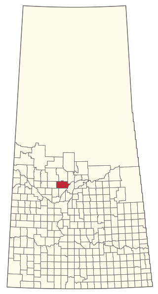
The Rural Municipality of Sasman No. 336 is a rural municipality (RM) in the Canadian province of Saskatchewan within Census Division No. 10 and SARM Division No. 4.
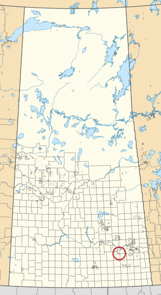
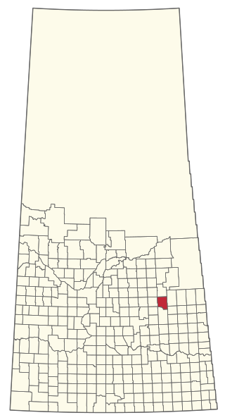
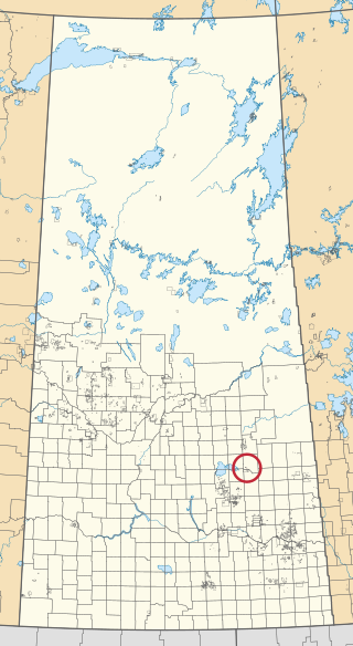
Carry the Kettle 76-1 is an Indian reserve of the Carry the Kettle Nakoda First Nation in Saskatchewan. It is 21 kilometres north-east of Sintaluta.

Fishing Lake 89 is an Indian reserve of the Fishing Lake First Nation in Saskatchewan. It is 119 kilometres (74 mi) north of Fort Qu'Appelle. In the 2016 Canadian Census, it recorded a population of 406 living in 128 of its 161 total private dwellings. In the same year, its Community Well-Being index was calculated at 54 of 100, compared to 58.4 for the average First Nations community and 77.5 for the average non-Indigenous community.

Fishing Lake 89A is an Indian reserve of the Fishing Lake First Nation in Saskatchewan, Canada. It is Section 13 and the south-east portion of Section 14, Township 33, Range 12, west of the Second Meridian. In the 2016 Canadian Census, it recorded a population of 0 living in 0 of its 0 total private dwellings.
Fishing Lake 89D1 is an Indian reserve of the Fishing Lake First Nation in Saskatchewan.

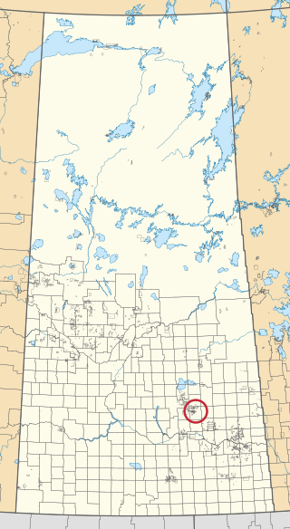
Muskowekwan 85-1 is an Indian reserve of the Muskowekwan First Nation in Saskatchewan. It is about 6 kilometres (3.7 mi) north of Leross. In the 2016 Canadian Census, it recorded a population of 0 living in 0 of its 0 total private dwellings.

Muskowekwan 85-8 is an Indian reserve of the Muskowekwan First Nation in Saskatchewan. It is about 6 kilometres (3.7 mi) north-east of Lestock. In the 2016 Canadian Census, it recorded a population of 5 living in 1 of its 2 total private dwellings.

Muskowekwan 85-10 is an Indian reserve of the Muskowekwan First Nation in Saskatchewan, Canada. It is about 6 kilometres (3.7 mi) north of Lestock. In the 2016 Canadian Census, it recorded a population of 5 living in 1 of its 2 total private dwellings.

Muskowekwan 85-15 is an Indian reserve of the Muskowekwan First Nation in Saskatchewan. It is about 6 kilometres (3.7 mi) north of Lestock. In the 2016 Canadian Census, it recorded a population of 5 living in 1 of its 1 total private dwellings.
Muskowekwan 85-17 is an Indian reserve of the Muskowekwan First Nation in Saskatchewan. It is about 1 kilometre (0.62 mi) south-west of Lestock. In the 2016 Canadian Census, it recorded a population of 0 living in 0 of its 0 total private dwellings.

Muskowekwan 85-28 is an Indian reserve of the Muskowekwan First Nation in Saskatchewan. It is about 105 kilometres (65 mi) west of Yorkton. In the 2016 Canadian Census, it recorded a population of 0 living in 1 of its 1 total private dwellings.

Muskowekwan 85-31 is an Indian reserve of the Muskowekwan First Nation in Saskatchewan. It is about 93 kilometres (58 mi) north-west of Melville. In the 2016 Canadian Census, it recorded a population of 0 living in 0 of its 0 total private dwellings.

Muskowekwan 85-33 is an Indian reserve of the Muskowekwan First Nation in Saskatchewan. It is about 5 kilometres (3.1 mi) south-west of Lestock. In the 2016 Canadian Census, it recorded a population of 0 living in 1 of its 1 total private dwellings.

