Saint-Gatien-des-Bois

Last updated
Saint-Gatien-des-Bois
Saint-Gatien-des-Bois eglise.JPG
The church in Saint-Gatien-des-Bois
Blason ville fr Saint-Gatien-des-Bois (Calvados).svg
Location of Saint-Gatien-des-Bois
Saint-Gatien-des-Bois
France location map-Regions and departements-2016.svg
Red pog.svg
Saint-Gatien-des-Bois
Normandie region location map.svg
Red pog.svg
Saint-Gatien-des-Bois
Coordinates: 49°20′55″N0°11′10″E / 49.3486°N 0.1861°E / 49.3486; 0.1861 Coordinates: 49°20′55″N0°11′10″E / 49.3486°N 0.1861°E / 49.3486; 0.1861
Country France
Region Normandy
Department Calvados
Arrondissement Lisieux
Canton Honfleur-Deauville
Intercommunality Cœur Côte Fleurie
Government
  Mayor (20202026) Philippe Langlois [1]
Area
1
49.11 km2 (18.96 sq mi)
Population
 (Jan. 2018) [2]
1,338
  Density27/km2 (71/sq mi)
Time zone UTC+01:00 (CET)
  Summer (DST) UTC+02:00 (CEST)
INSEE/Postal code
14578 /14130
Elevation30–153 m (98–502 ft)
(avg. 150 m or 490 ft)
1 French Land Register data, which excludes lakes, ponds, glaciers > 1 km2 (0.386 sq mi or 247 acres) and river estuaries.

Saint-Gatien-des-Bois is a commune in the Calvados in the Normandy region in northwestern France.

Contents

Climate

Climate data for Saint-Gatien-des-Bois (1981–2010 averages)
MonthJanFebMarAprMayJunJulAugSepOctNovDecYear
Record high °C (°F)15.6
(60.1)
20.9
(69.6)
22.0
(71.6)
25.9
(78.6)
30.6
(87.1)
33.6
(92.5)
36.8
(98.2)
37.7
(99.9)
33.2
(91.8)
28.9
(84.0)
21.3
(70.3)
16.4
(61.5)
37.7
(99.9)
Average high °C (°F)7.1
(44.8)
7.8
(46.0)
10.6
(51.1)
13.0
(55.4)
16.6
(61.9)
19.1
(66.4)
21.3
(70.3)
21.3
(70.3)
18.9
(66.0)
15.1
(59.2)
10.6
(51.1)
7.5
(45.5)
14.1
(57.4)
Average low °C (°F)2.1
(35.8)
2.0
(35.6)
4.0
(39.2)
5.3
(41.5)
8.5
(47.3)
11.1
(52.0)
13.3
(55.9)
13.4
(56.1)
11.2
(52.2)
8.6
(47.5)
5.1
(41.2)
2.6
(36.7)
7.3
(45.1)
Record low °C (°F)−17.8
(0.0)
−14.2
(6.4)
−9.1
(15.6)
−3.3
(26.1)
−0.6
(30.9)
1.3
(34.3)
5.9
(42.6)
6.0
(42.8)
2.6
(36.7)
−3.1
(26.4)
−7.1
(19.2)
−10.3
(13.5)
−17.8
(0.0)
Average precipitation mm (inches)78.0
(3.07)
60.7
(2.39)
66.2
(2.61)
61.5
(2.42)
68.4
(2.69)
68.4
(2.69)
65.1
(2.56)
73.5
(2.89)
82.1
(3.23)
99.2
(3.91)
95.4
(3.76)
97.9
(3.85)
916.4
(36.08)
Average precipitation days13.511.012.210.711.09.69.89.710.713.514.514.3140.5
Source: Météo France [3] [4]

Population

Historical population
YearPop.±%
1962850    
1968807−5.1%
1975983+21.8%
19821,054+7.2%
19901,182+12.1%
19991,163−1.6%
20081,354+16.4%

See also

Related Research Articles

Saint-Maur-des-Bois Commune in Normandy, France

Saint-Maur-des-Bois is a commune in the Manche department in Normandy in north-western France, close to the border with the Calvados department.

Argences Commune in Normandy, France

Argences is a commune in the Calvados department in the Normandy region of north-western France. It is in the urban area of Caen, 15 kilometres from the city.

La Roche-sur-Yon Prefecture and commune in Pays de la Loire, France

La Roche-sur-Yon is a commune in the Vendée department in the Pays de la Loire region in western France. It is the capital of the department. The demonym for its inhabitants is Yonnais.

Roissy-en-France Commune in Île-de-France, France

Roissy-en-France is a commune in the northeastern suburbs of Paris, France, in the Val-d'Oise department. It is located 20.7 km (12.9 mi) from the centre of Paris. In 2017, it had a population of 2,883.

Saint-Aubin-des-Bois, Calvados Commune in Normandy, France

Saint-Aubin-des-Bois is a commune in the Calvados department in the Normandy region in northwestern France.

Saint-Germain-de-Livet Commune in Normandy, France

Saint-Germain-de-Livet is a commune in the Calvados department in the Normandy region in northwestern France.

Saint-Jean-de-Livet Commune in Normandy, France

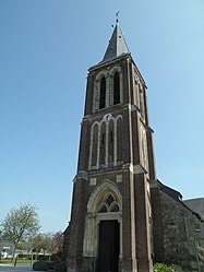
Saint-Jean-de-Livet is a commune in the Calvados department in the Normandy region in northern France.

Saint-Martin-de-Blagny Commune in Normandy, France

Saint-Martin-de-Blagny is a commune in the Calvados department in the Normandy region in northwestern France.

Saint-Martin-de-Fontenay Commune in Normandy, France

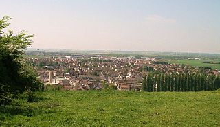
Saint-Martin-de-Fontenay is a commune in the Calvados department, region of Normandy, northwestern France.

Cognac, France Subprefecture and commune in Nouvelle-Aquitaine, France

Cognac is a commune in the Charente department in the south-west of France. Administratively, the commune of Cognac is a sub-prefecture of the Charente department.

Saint-Dizier Subprefecture and commune in Grand Est, France

Saint-Dizier is a commune in the Haute-Marne department in north-eastern France.

Saint-Girons, Ariège Subprefecture and commune in Occitanie, France

Saint-Girons is a commune in the Ariège department in southwestern France.

Arrondissement of Lisieux Arrondissement in Normandy, France

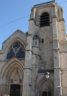
The arrondissement of Lisieux is an arrondissement of France in the Calvados department in the Normandy region. It has 160 communes. Its population is 162,678 (2016), and its area is 1,756.2 km2 (678.1 sq mi).

Arrondissement of Vire Arrondissement in Normandy, France

The arrondissement of Vire is an arrondissement of France in the Calvados department in the Normandy region. It has 44 communes. Its population is 72,565 (2016), and its area is 1,205.9 km2 (465.6 sq mi).

Le Luc Commune in Provence-Alpes-Côte dAzur, France

Le Luc is a commune in the Var department in the Provence-Alpes-Côte d'Azur region in southeastern France.

Deauville – Normandie Airport

Deauville – Normandie Airport - previously known as Deauville – Saint-Gatien Airport - is a small international airport situated 7 km east of Deauville, a commune of the Calvados département in the Normandy région of France.

Saint-Auban Commune in Provence-Alpes-Côte dAzur, France

Saint-Auban is a commune in the Alpes-Maritimes department in southeastern France.

Beaucouzé Commune in Pays de la Loire, France

Beaucouzé is a commune in the Maine-et-Loire department in western France.

Vire Normandie Subprefecture and commune in Normandy, France

Vire Normandie is a commune in the Calvados department and Normandy region of north-western France.

The canton of Honfleur-Deauville is an administrative division of the Calvados department, northwestern France. It was created at the French canton reorganisation which came into effect in March 2015. Its seat is in Honfleur.

References

  1. "Répertoire national des élus: les maires". data.gouv.fr, Plateforme ouverte des données publiques françaises (in French). 9 August 2021.
  2. "Populations légales 2018". The National Institute of Statistics and Economic Studies. 28 December 2020.
  3. "Données climatiques de la station de Saint-Gatien-des-Bois" (in French). Meteo France. Retrieved January 9, 2016.
  4. "Climat Basse-Normandie" (in French). Meteo France. Retrieved January 9, 2016.