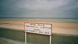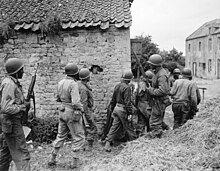
Omaha Beach was one of five beach landing sectors of the amphibious assault component of Operation Overlord during the Second World War.

Asnières-en-Bessin is a commune in the Calvados department in the Normandy region of north-western France.

Bernières-sur-Mer, in the arrondissement of Caen, is a commune in the Calvados department of Normandy, in northwestern France. It is part of the canton of Courseulles-sur-Mer. It lies on the English Channel coast, 3 km east of Courseulles-sur-Mer, and 17 km north of Caen.

Colleville-sur-Mer is a commune in the Calvados department in Normandie region in northwestern France.
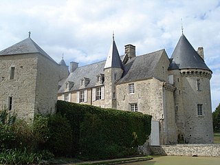
Colombières is a commune in the Calvados department in the Normandy region in northwestern France.

Hermanville-sur-Mer is a commune in the Calvados department in the Normandy region in northwestern France.

Lion-sur-Mer is a commune in the Calvados department in the Normandy region in northwestern France.
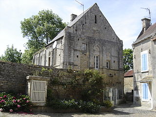
Reviers is a commune in the Calvados department in the Normandy region, in northwestern France. It lies 4 km south of Courseulles-sur-Mer and 15 kn northwest of Caen. It lies at the confluence of the rivers Seulles and Mue. There is bridge west of Reviers, crossing the Seulles, on the principal road (D176) connecting to Colombiers-sur-Seulles, and a bridge in Reviers, crossing the Mue, on the principal road (D35), connecting east to Tailleville.
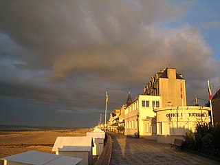
Saint Aubin-sur-Mer is a commune in the Calvados department, in northwestern France. Administratively, it is part of the arrondissement of Caen and the canton of Courseulles-sur-Mer. It is 2.1 km east of Bernières-sur-Mer, 4 km north of Douvres-la-Délivrande and 16 km north of Caen.

Sainte-Honorine-des-Pertes is a former commune in the Calvados department in the Normandy region in northwestern France. On 1 January 2017, it was merged into the new commune Aure sur Mer.

Saint-Laurent-sur-Mer is a commune in the Calvados department in the Normandy region in northwestern France. The town is located not far from Omaha Beach, where, in World War II, Allied forces landed during D-Day.
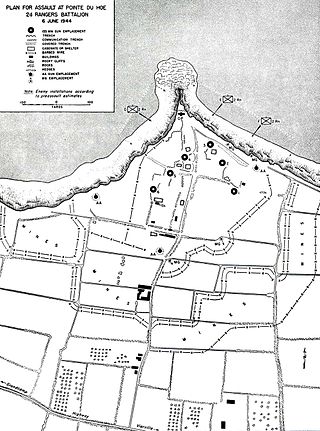
La Pointe du Hoc is a promontory with a 35-metre (110 ft) cliff overlooking the English Channel on the northwestern coast of Normandy in the Calvados department, France.

The 5th Ranger Infantry Battalion was a Ranger battalion activated during World War II on 1 September 1943 at Camp Forrest, Tennessee. By this time, while in maneuvers on the United States, they were commanded by the Major Owen Carter. Later, when they moved to England, they were commanded by Major Max Schneider, former executive officer of the 4th Ranger Battalion, who led the 5th Rangers as part of the Provisional Ranger Group commanded by Colonel James Earl Rudder.

Tracy-sur-Mer is a commune in the Calvados department in the Normandy region in northwestern France.

Ver-sur-Mer is a commune in the Calvados department and Normandy region of north-western France. It is situated at the eastern end of Gold Beach between Arromanches and Courseulles. The town lies 20 km north-west of Caen and 14 km north-east of Bayeux.

The canton of Trévières is an administrative division of the Calvados département, in northwestern France. Its chief town is Trévières. Its borders were modified at the French canton reorganisation which came into effect in March 2015

Grenadier Regiment 916 was an infantry regiment of the Wehrmacht from 1943 until 1945.
Heinrich "Hein" Severloh was a soldier in the German 352nd Infantry Division stationed in Normandy in 1944. He became famous for a memoir WN 62 – Erinnerungen an Omaha Beach Normandie, 6. Juni 1944, published in 2000. In the book, the authors claim that as a machine gunner, Severloh inflicted over 1,000 and possibly over 2,000 casualties to the American soldiers landing on Omaha Beach on D-Day. However, Severloh's claim is not viewed as credible by either US or German historians. Total US casualties from all sources along the five-mile length of Omaha Beach on D-Day are estimated at 2,400.
The communauté de communes de Trévières is a former communauté de communes in the Calvados department, in northern France. It was created in January 2000. It was merged into the new Communauté de communes Isigny-Omaha Intercom in January 2017.
The Communauté de communes Isigny-Omaha Intercom is a communauté de communes, an intercommunal structure, in the Calvados department, in the Normandy region, northwestern France. It was created in January 2017 by the merger of the former communautés de communes Intercom Balleroy Le Molay-Littry, Isigny Grandcamp Intercom and Trévières. Its area is 581.7 km2, and its population was 26,543 in 2019. Its seat is in Le Molay-Littry.
