
Cape Ann is a rocky peninsula in northeastern Massachusetts on the Atlantic Ocean. It is about 30 miles (48 km) northeast of Boston and marks the northern limit of Massachusetts Bay. Cape Ann includes the city of Gloucester and the towns of Essex, Manchester-by-the-Sea and Rockport.
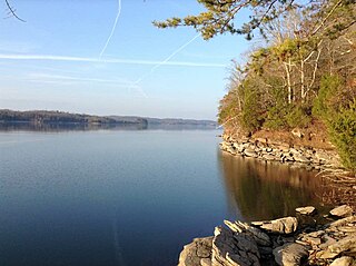
Watts Bar Lake is a reservoir on the Tennessee River created by Watts Bar Dam as part of the Tennessee Valley Authority system.
The Salem Channel is a channel in the Salem Sound that stretches from Winter Island in the city of Salem to Misery Shoal in the city limits of Beverly.
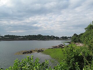
Cat Cove is a cove in the northwestern portion of Salem Harbor in Salem, Massachusetts. The cove is located between Winter Island and Salem Neck. There is a powerplant located on the coast of Salem Neck bordering the southwestern edge of Cat Cove.

Juniper Cove is a cove in the Salem Channel, within the city limits of Salem, Massachusetts, USA. The Salem Neck coast that borders Juniper Cove is mostly residential areas.

Bakers Island is a small, private residential island in Massachusetts Bay, in Salem, Massachusetts. It is located southeast of Great Misery Island & Little Misery Island, northeast of North Gooseberry Island and South Gooseberry Island, and far northeast of Children's Island. It is the outermost island on the main shipping channel into Salem Harbor. Bakers Island Light, located on the island's northern side, is used for navigation.

Houghs Neck is a one-square-mile (2.6 km2) peninsula in Quincy, Massachusetts. It is surrounded by Quincy Bay, Hingham Bay and Rock Island Cove. It is lined by Perry Beach, which runs along Manet Avenue; Nut Island, which is just beyond Great Hill at the very end of the peninsula; and Edgewater Drive.
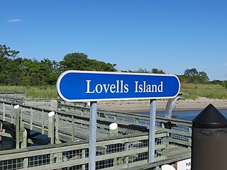
Lovells Island, or Lovell's Island, is a 62-acre (250,000 m2) island in the Boston Harbor Islands National Recreation Area, in Massachusetts. The island is across The Narrows from Georges Island and some 7 miles (11 km) offshore of downtown Boston. It is named after Captain William Lovell, who was an early settler of nearby Dorchester. The island is known as the site of several shipwrecks, including the 74-gun French warship Magnifique in 1782.

Tinkers Island is a pair of small islands off the coast of Marblehead, Massachusetts, United States. It is only accessible by boat and houses several small camps. The island was named after the breed of mackerel that can be found close to its shores.

Raccoon Island is an island in the Hingham Bay area of the Boston Harbor Islands National Recreation Area, situated just offshore of Hough's Neck in the city of Quincy. The island has a permanent size of just under 4 acres (16,000 m2), and is composed of bedrock outcroppings which reach an elevation of 30 feet (9.1 m) above sea level. The island is characterized by gravel beaches and rocky slopes. While it is possible to walk to the island at low tide, public access is discouraged.

Plymouth Bay is a small, well-protected bay of the Atlantic Ocean on the western shore of larger Cape Cod Bay along the coastline of the Commonwealth of Massachusetts. Plymouth Bay retains historical significance for the landing at Plymouth Rock in 1620 by the Pilgrims aboard the Mayflower who proceeded to establish the first permanent Northern European settlement in North America at Plymouth Colony.

Clark's Island is the name of a small island located in Duxbury Bay in the U.S. state of Massachusetts. It was named for John Clark, the first mate of the Mayflower, the ship that brought the Pilgrims to New England. The island was initially considered for the location of the Pilgrim's settlement, but was rejected in favor of a site to the south, which became known as Plymouth, Massachusetts. Today Clark's Island is a part of the town of Plymouth.
Cockscomb Pass is a mountain pass in the central Baffin Mountains, Nunavut, Canada.

Germantown is a primarily residential neighborhood in the city of Quincy, Massachusetts. The neighborhood is located on a peninsula surrounded by Town River bay on the west and Rock Island Cove on the east. This peninsula was known since the 1640s as “Shed's Neck”.

Fort Lee is a historic American Revolutionary War fort in Salem, Massachusetts. The site, located at a high point next to Fort Avenue on Salem Neck, is a relatively rare fortification from that period whose remains are relatively unaltered. It is an irregular 5-pointed star fort. Although there is some documentary evidence that the Neck was fortified as early as the 17th century, the earthworks built in 1776 are the first clear evidence of the site's military use. Reportedly, the fort had a garrison of 3 officers and 100 artillerymen with 16 guns. The site, of which only overgrown earthworks and a stone magazine survive, was repaired in the 1790s, and rebuilt for the American Civil War. A state cultural resource document states that the fort has not been much modified since the Revolution, and has not been built over. It was garrisoned by the Massachusetts militia in the War of 1812, abandoned afterwards, and rebuilt with four 8-inch columbiads in the Civil War. An Army engineer drawing dated 1872 depicts the fort's five-pointed trace and the four Civil War gun positions. It was also garrisoned during the Spanish–American War.
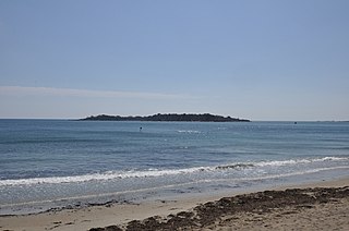
The Misery Islands are an 87-acre (350,000 m2) nature reserve established in 1935 in Salem Sound close to the Salem Harbor in Salem, Massachusetts. It is managed by the Trustees of Reservations. The islands are a part of the city of Salem, although they are much closer to the mainland of the city of Beverly, in whose aquatic territory they lie.
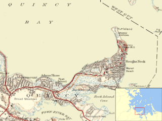
Nut Island is a former island in Boston Harbor, part of the Boston Harbor Islands National Recreation Area. The island has been connected through a short causeway to the end of Houghs Neck, becoming part of the mainland of Quincy, Massachusetts.

Saquish Beach, sometimes simply referred to as Saquish, is a beach and headland located at the end of the peninsula at the entrance to Plymouth Bay in Plymouth, Massachusetts. A small private settlement of summer cottages line the beach and headland, sometimes referred to as Saquish Neck and Saquish Head respectively. It is located east of Clark's Island and west of Gurnet Point. Its only access by land is from the Powder Point Bridge at Duxbury Beach, 5 miles to the north by foot or by 4-wheel drive beach buggies. As a private beach, access is restricted to property owners, residents, and their guests.
Coney Island is an abandoned island located in Massachusetts Bay in Salem, Massachusetts. It has light growth, with a small salt marsh.


