Hangman Island, also known as Hayman's Island, is an island in the Quincy Bay area of the Boston Harbor Islands National Recreation Area. The island is a barren outcrop of bedrock, with a permanent size of half an acre rising to only three feet above sea level, plus an intertidal zone of a further 5 acres (20,000 m2). Access is by private boat only.
Green Island, also known as North Brewster Island, is a rocky outer island in the Boston Harbor Islands National Recreation Area, to the north of Calf Island and Hypocrite Channel. The island has a permanent size of 2.5 acres (10,000 m2), plus an intertidal zone of a further 15 acres (61,000 m2), and is exposed from the east and northeast with little soil or plant life. The island is named after Joseph Green, a well-known merchant, who owned the island during Colonial times.
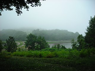
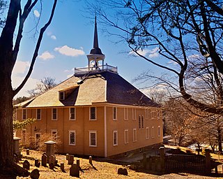
World's End is a 251-acre (1 km²) park and conservation area located on a peninsula in Hingham, Massachusetts. The peninsula is bordered by the Weir River to the North and East and Hingham Harbor to the West. The land is composed of four drumlins harboring tree groves interspersed with fields attractive to butterflies and grassland-nesting birds, and offers 4.5 miles of walking paths with views of the Boston skyline.
Ragged Island is an island in the Hingham Bay area of the Boston Harbor Islands National Recreation Area, in the U.S. state of Massachusetts. The island has a permanent size of 4 acres (16,000 m2), and it is composed of Roxbury puddingstone which rises to a height of 30 feet (9.1 m) above sea level. Broken ledges surround most of the island with small gravel beaches on the southeast and northwest sides; there are also small tidal mudflats.
The Graves is an aggregation of rock outcroppings in Massachusetts Bay, Massachusetts, United States. Situated some 11 miles (18 km) offshore of downtown Boston, it is the outermost island in the Boston Harbor Islands National Recreation Area. It is the location of The Graves Light, at 113 feet (34 m) tall the tallest lighthouse in Boston Harbor, and an important navigation aid for traffic to and from the port. The island has a permanent size of 1.8 acres, and rises to a height of 15 feet (4.6 m) above sea level; there is only aquatic vegetation on the island. The island is privately owned and the beacon and foghorn are managed by the Coast Guard, and is not open to the public.
Tewksbury Rock is a small, subsurface rock pinnacle located in Massachusetts Bay, within the city limits of Boston. The rock is northeast of Outer Brewster Island, west of Martin Ledge, south east of Green Island and far north of Boston Ledge. It is 15 feet (4.6 m) to 18 feet (5.5 m) below the surface of the water, but more than 45 feet (14 m) above the hard gravel floor of the bay.

Bumpkin Island, also known as Round Island, Bomkin Island, Bumkin Island, or Ward's Island, is an island in the Hingham Bay area of the Boston Harbor. In 1902, Albert Burrage, a Boston philanthropist, had a summer hospital opened on the island for children with physical disabilities. During World War I the island was used by the U.S. Navy. Starting around 1940, the island was used as a facility for polio patients. However, the hospital closed during World War II and burned down in 1945. Since 1996, it is part of the Boston Harbor Islands National Recreation Area. The island has an area of 30 acres (120,000 m2), plus an intertidal zone of a further 31 acres (130,000 m2). It is composed of a central drumlin with an elevation of 70 feet (21 m) above sea level, surrounded by a rock-strewn shoreline. A sand spit, exposed at low tide, connects the eastern end of the island to Sunset Point in Hull.

Great Brewster Island is one of the outer islands in the Boston Harbor Islands National Recreation Area, situated some 9 miles (14 km) offshore of downtown Boston. The island has a permanent size of 18 acres (73,000 m2), plus an intertidal zone of a further 49 acres (200,000 m2). Unlike the other outer islands, which are low-lying outcroppings of bedrock, Great Brewster is a drumlin which reaches a height of over 100 feet above sea level. It has vegetation cover consisting of Apple Trees, Pear Trees, Sumac, Beach Roses, Grasses and Common Reeds, together with a large Gull colony. The birds are aggressive during nesting season and access by humans, which is by private boat only, is discouraged during that time.

Outer Brewster Island, also known as Outward Island, is one of the outer islands in the Boston Harbor Islands National Recreation Area and is situated some 10 miles offshore of downtown Boston. The island has a permanent size of 20 acres, and consists of exposed bedrock covered by fertile soil bounded by a rocky shore with steep cliffs. It provides a nesting habitat for coastal water birds, including cormorants, gulls, common eider ducks, glossy ibis and American oystercatchers. The birds are aggressive during their nesting season and access by humans, which is by private boat only, is discouraged during this period.
Middle Brewster Island is a rugged outer island in the Boston Harbor Islands National Recreation Area, located 9 miles (14 km) offshore from downtown Boston. The island has a permanent size of 13 acres (53,000 m2), reaches a height of 52 feet (16 m) above sea level, and is bounded by sharp cliffs and sunken crags. It has only sparse vegetation and serves primarily as a nesting site for gulls and cormorants. The birds are aggressive during their nesting season and access by humans is discouraged during this period. Access is difficult due to the lack of beaches and inlets, and is only accessible by private boat.

Langlee Island or Langley Island is an island in the Hingham Bay area of the Boston Harbor Islands National Recreation Area. The island has a permanent size of 4 acres (16,000 m2), plus an intertidal zone of a further 3 acres (12,000 m2), and is composed of a massing of Roxbury puddingstone which rises to a height of 40 feet (12 m) above sea level. This results in steep cliffs on the northern shore, while there are several small sandy beaches and a tidal mudflat on the east side. The center of the island contains glacial till that supports tree and shrub cover. As a result of previous planting, the island hosts large examples of oak, maple, juniper, and birch trees, while self-seeded huckleberry and viburnum mix with common greenbriar, dewberry, sumac, and poison ivy.
Little Calf Island is a small rocky island in the Boston Harbor Islands National Recreation Area, some 9 miles offshore from downtown Boston, Massachusetts. The island has no vegetation and no history of human occupation. It is used for nesting by gulls and cormorants which can be aggressive during their nesting season. Access by humans is by private boat only, and is discouraged.

Raccoon Island is an island in the Hingham Bay area of the Boston Harbor Islands National Recreation Area, situated just offshore of Hough's Neck in the city of Quincy. The island has a permanent size of just under 4 acres (16,000 m2), and is composed of bedrock outcroppings which reach an elevation of 30 feet (9.1 m) above sea level. The island is characterized by gravel beaches and rocky slopes. While it is possible to walk to the island at low tide, public access is discouraged.

Button Island is a small island in the Hingham Bay area of the Boston Harbor Islands National Recreation Area. It is part of the Town of Hingham. The island has a permanent size of under 1-acre (4,000 m2), plus an intertidal zone of a further 116 acres (0.47 km2). It is composed of a massing of glacial till which rises to a height of 10 feet (3.0 m) above sea level. The island is managed by the town of Hingham, and access is by private boat only.

Snake Island, also known as Bare Island, one of many Snake Island around world, is an island in Boston Harbor. The island is part of the Boston Harbor Islands National Recreation Area and is situated in the inner harbor between the town of Winthrop and the reclaimed land that forms Logan International Airport. It is part of the Town of Winthrop. It is named for its serpentine shape, and has a permanent size of 3 acres (12,000 m2), and rises to a height of 10 feet (3.0 m) above sea level.

Spinnaker Island is an island in the Hingham Bay area of Boston Harbor in Massachusetts, USA. The island is part of the town of Hull, to which it is connected by a bridge, and is one of the few harbor islands that neither forms part of the Boston Harbor Islands National Recreation Area nor is considered within the municipal limits of the city of Boston.
Harding's Ledge, also known as Harding Ledge, is a shoal in the Atlantic Ocean located on the approach to Boston Harbor, 1.5 miles east of Point Allerton, and near Hingham, Massachusetts, United States. The shoal is exposed at low tide and has been the site of numerous shipwrecks. A lighted bell buoy located 0.3 miles northeast guides boats around the outside of the shoal.