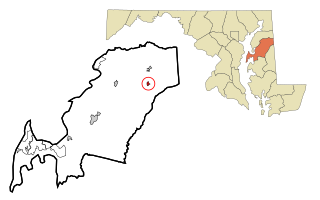
Barclay is a town in Queen Anne's County, Maryland, United States. The population was 120 at the 2010 census.
Appleton is a town in the northeastern part of Newfoundland in the province of Newfoundland and Labrador, Canada.
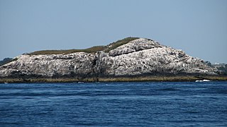
The Graves is an aggregation of rock outcroppings in Massachusetts Bay, Massachusetts, United States. Situated some 11 miles (18 km) offshore of downtown Boston, it is the outermost island in the Boston Harbor Islands National Recreation Area.
Three and One-half Fathom Ledge in Massachusetts, is a small barren rock in Massachusetts Bay, located within the city limits of Boston, USA. The rock is northeast of Martin Ledge and far east of the Roaring Bulls.
Tewksbury Rock is a small, subsurface rock pinnacle located in Massachusetts Bay, within the city limits of Boston. The rock is northeast of Outer Brewster Island, west of Martin Ledge, south east of Green Island and far north of Boston Ledge. It is 15 feet (4.6 m) to 18 feet (5.5 m) below the surface of the water, but more than 45 feet (14 m) above the hard gravel floor of the bay.
Archer Rock is a barren rock within Marblehead Channel in Marblehead, Massachusetts. It is west of Cat Island and far northeast of Marblehead Neck.
Badgers Rock is a small barren rock within the Merrimack River, in Salisbury, Massachusetts, United States. The rock is just south of the light campground area of the Salisbury Beach State Reservation and north of Plum Island Point on Plum Island in Newburyport.
Barrel Rock is a small barren rock within the edge of Cohasset Harbor in Cohasset, Massachusetts, USA. The rock is north of Sutton Rocks, northwest of Quarry Point, south of Chittenden Rock, and east of Brush Island. It is located at 42°15′32″N70°47′6″W
Bass Rock is a small barren rock within Nahant Harbor, in Nahant, Massachusetts, USA. The island is southwest of the Cliff Street/Willow Road curve and west of Josephs Beach.

Port Byron Township is located in Rock Island County, Illinois. As of the 2010 census, its population was 1,446 and it contained 704 housing units. Located on the Mississippi river. The major business is Sandstrum Industries with John Deere 15 minutes down state Hy 84 to the south. The John Deere corporate headquarters is in Moline 20 minutes south. Locally Port Byron has six bars and restaurants from fine dining to burgers and chili. Located 2 miles north of the Interstate 80 bridge over the Mississippi River on Illinois route 84, Port Byron is also on the Mississippi River Flyway for migrating birds. Thousands of species can be seen as they travel from Canada to the Gulf Coast espiecally the Pelicans in summer and the Eagles in winter.
North Havra is a small island off south west Shetland. It is 30 metres at its highest point.
Pep is an unincorporated community in southern Roosevelt County, in the southeastern part of the U.S. state of New Mexico. The community is composed almost entirely of farms and cattle ranches and is located approximately seven miles south of Dora on New Mexico State Road 206.
Cleardale is a hamlet in northern Alberta, Canada within Clear Hills County. It is located on Highway 64 approximately 29 kilometres (18 mi) east of the British Columbia border and 98 kilometres (61 mi) northwest of Fairview.

Ōnakayama Station is a railway station in Nanae, Hokkaidō Prefecture, Japan.

Egg Rock in Nahant Bay near Nahant, Massachusetts is a small (3-acre) island at 42.4333°N 70.8978°W. It was formerly the site of a lighthouse known as Egg Rock Light but now is owned by the state of Massachusetts as a bird sanctuary. Egg Rock can be seen clearly from the coasts of Nahant, Swampscott, and Lynn. Egg Rock is the setting for Sylvia Plath's poem "Suicide off Egg Rock", and also appears in her novel, The Bell Jar.
Castle Rock is a barren, uninhabited island located in Nahant Bay in Nahant, Massachusetts.

Mariaville is an unincorporated community in Rock County, Nebraska, United States.
Marblehead Rock is an island off Marblehead, Massachusetts.
Portersville is an unincorporated community in Lincoln County, in the U.S. state of West Virginia.
Byron is an unincorporated community in Osage County, in the U.S. state of Missouri.


