Related Research Articles

Decatur County is a county located in the U.S. state of Tennessee. As of the 2020 census, the population was 11,435. Its county seat is Decaturville.

Newton County is a county located in the U.S. state of Mississippi. As of the 2010 census, the population was 21,720. Its county seat is Decatur.

Decatur County is a county located in the U.S. state of Iowa. As of the 2020 census, the population was 7,645. The county seat is Leon. This county is named for Stephen Decatur Jr., a hero in the War of 1812.

Paint Rock is a town in Jackson County, Alabama, United States, along the Paint Rock River, and is included in the Huntsville-Decatur Combined Statistical Area. It was incorporated in July 1894.

Abiel Ledge is a small barren rock located in Buzzards Bay, within Massachusetts. The rock is just off the southeast coast of Stony Point Dike, near Hog Island Channel and within the town limits of Wareham.

League Island was an island in the Delaware River, part of the city of Philadelphia, just upstream from the mouth of the Schuylkill River, which was the site of the Philadelphia Naval Shipyard. It now operates as an industrial park under the name "The Navy Yard".

Rosemont is a provincial electoral district in the Montreal region of Quebec, Canada that elects members to the National Assembly of Quebec. It consists of part of the Rosemont–La Petite-Patrie borough of the city of Montreal.

Owego Township is located in Livingston County, Illinois. As of the 2010 census, its population was 328 and it contained 123 housing units.
Nellysford is a census-designated place (CDP) in Nelson County, Virginia, United States. The population as of the 2010 Census was 1,076. It is home to the Wintergreen golf course at Stoney Creek. Its zip code is 22958.
Midway is an unincorporated community in Concord Township, Elkhart County, Indiana.
Stella is a ghost town in western Fayette County, Texas. The community was located eight miles southwest of West Point.

Census Division No. 14 is a census division located within the Interlake Region of the province of Manitoba, Canada. Unlike in some other provinces, census divisions do not reflect the organization of local government in Manitoba. These areas exist solely for the purposes of statistical analysis and presentation; they have no government of their own.
Rabbs Prairie is an unincorporated community in Fayette County, Texas, United States.
Mount Vernon is a hamlet in the town of Hamburg in Erie County, New York, United States. It is located within the Wanakah census-designated place and is part of the Frontier Central School District. The Hamlet is separate from the city of Mount Vernon, a city in Westchester County.
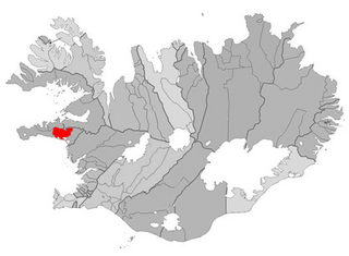
Eyja- og Miklaholtshreppur is a municipality in Iceland.

Winnemucca Air Force Station is a closed United States Air Force General Surveillance Radar station. It is located 3.1 miles (5.0 km) north-northwest of Winnemucca, Nevada. It was closed in 1968.
Dundee is an unincorporated community in Barton County, Kansas, United States.
West Liberty is an unincorporated community in Union Township, Howard County, Indiana, in the United States.
Gaysport is an unincorporated community in Muskingum County, in the U.S. state of Ohio.
References
- ↑ "Decatur Rock". Geographic Names Information System . United States Geological Survey . Retrieved March 17, 2014.
Coordinates: 41°33′45″N70°53′26″W / 41.56250°N 70.89056°W
| | This Bristol County, Massachusetts geography–related article is a stub. You can help Wikipedia by expanding it. |