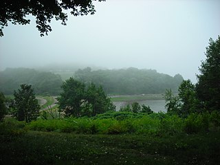
World's End is a 251-acre (1 km²) park and conservation area located on a peninsula in Hingham, Massachusetts. The peninsula is bordered by the Weir River to the North and East and Hingham Harbor to the West. The land is composed of four drumlins harboring tree groves interspersed with fields attractive to butterflies and grassland-nesting birds, and offers 4.5 miles of walking paths with views of the Boston skyline.
Aldridge Ledge is a small barren rock located in the South Channel, within the city limits of Boston, Massachusetts. The rock is southwest of Devils Back and Half Tide Rocks, west of Little Calf Island and Hypocrite Channel, and northwest of Calf Island.
The Hypocrite Channel is a small channel in Massachusetts Bay, located within the city limits of Boston. It's also located within the Boston Harbor Islands National Recreation Area. The channel runs between the islands of Half Tide Rocks, Calf Island, Little Calf Island, and Green Island.
Martin Ledge is series of small barren rocks that barely stick out of the waters of Massachusetts Bay, within the city limits of Boston, Massachusetts, USA. The rocks are east of Tewksbury Rock and Outer Brewster Island and southwest of Three and One-half Fathom Ledge.
Tewksbury Rock is a small, subsurface rock pinnacle located in Massachusetts Bay, within the city limits of Boston. The rock is northeast of Outer Brewster Island, west of Martin Ledge, south east of Green Island and far north of Boston Ledge. It is 15 feet (4.6 m) to 18 feet (5.5 m) below the surface of the water, but more than 45 feet (14 m) above the hard gravel floor of the bay.
Alden island is a very small island within the Duck Hill marshland in Duxbury, Massachusetts. A small unpaved road connects the island with the mainland to Harmony Hill Road.

Averills Island is a small forested island within the marshland of the Wenham Swamp, in the Ipswich River Wildlife Sanctuary in Topsfield, Massachusetts. There is an unpaved road that connects the island with the mainland, from Bradstreet Hill to the Steward School on Perkins Row.
Barrel Rock is a small barren rock within the edge of Cohasset Harbor in Cohasset, Massachusetts, USA. The rock is north of Sutton Rocks, northwest of Quarry Point, south of Chittenden Rock, and east of Brush Island. It is located at 42°15′32″N70°47′6″W

Houghs Neck is a one-square-mile (2.6 km2) peninsula in Quincy, Massachusetts. It is surrounded by Quincy Bay, Hingham Bay and Rock Island Cove. It is lined by Perry Beach, which runs along Manet Avenue; Nut Island, which is just beyond Great Hill at the very end of the peninsula; and Edgewater Drive.
Middle Brewster Island is a rugged outer island in the Boston Harbor Islands National Recreation Area, located 9 miles (14 km) offshore from downtown Boston. The island has a permanent size of 13 acres (53,000 m2), reaches a height of 52 feet (16 m) above sea level, and is bounded by sharp cliffs and sunken crags. It has only sparse vegetation and serves primarily as a nesting site for gulls and cormorants. The birds are aggressive during their nesting season and access by humans is discouraged during this period. Access is difficult due to the lack of beaches and inlets, and is only accessible by private boat.
Sarah Island is an island in the Hingham Bay area of the Boston Harbor Islands National Recreation Area. The island has a permanent size of just under 5 acres (20,000 m2), and is composed large outcroppings and ledges of Roxbury puddingstone together with glacial till which rises to a height of 30 feet (9.1 m) above sea level. The ledges, beaches and mudflats make the ideal nesting place for gulls.
Roberts Center was a 4,400-seat multi-purpose arena in Chestnut Hill, Massachusetts, United States. It opened in 1958 and was home to the Boston College Eagles men's basketball and women's basketball teams until the Conte Forum opened in 1988.

Long Hill is a 114-acre (0.46 km2) estate in Beverly, Massachusetts and is managed by the Trustees of Reservations. From 1916 to 1979, the estate was the summer home of Ellery Sedgwick, author and editor of The Atlantic Monthly. The estate contains a Federal style home with formal gardens, 2 miles (3.2 km) of hiking trails, woodlands, meadows and an apple orchard. The 5 acres (20,000 m2) of cultivated gardens and 100 acres (0.40 km2) of woodland grounds are open to the public daily.

The Misery Islands are an 87-acre (350,000 m2) nature reserve established in 1935 in Salem Sound close to the Salem Harbor in Salem, Massachusetts. It is managed by the Trustees of Reservations. The islands are a part of the city of Salem, although they are much closer to the city of Beverly, in whose aquatic territory they lie.

Thacher Island is a small island off Cape Ann on the Massachusetts coast in the United States. It is a part of the Town of Rockport. It was a place where some naval confrontations, both minor and major, took place, which helped secure a victory for the colonists.

Fort Andrews was created in 1897 as part of the Coast Defenses of Boston, Massachusetts. Construction began in 1898 and the fort was substantially complete by 1904. The fort was named after Major General George Leonard Andrews, an engineer and Civil War commander, who assisted in the construction of nearby Fort Warren in Boston Harbor. It occupies the entire northeast end of Peddocks Island in Boston Harbor, and was originally called the Peddocks Island Military Reservation. Once an active Coast Artillery post, it was manned by hundreds of soldiers and bristled with mortars and guns that controlled the southern approaches to Boston and Quincy Bay. The fort also served as a prisoner-of-war camp for Italian prisoners during World War II, who were employed as laborers following the Italian surrender to the Allies in 1943. Today, the fort is abandoned, and is managed by the Massachusetts Department of Conservation and Recreation, as part of the Boston Harbor Islands National Recreation Area.
Laguna de Sayula is a lake located in the southern area of Jalisco, about 60 km from Guadalajara. It is located in the municipalities of Sayula, Zacoalco de Torres, Amacueca, Teocuitatlán de Corona, Atoyac and Techaluta de Montenegro.

Stavros Reservation is a nature reserve located in Essex, Massachusetts. The property is owned by The Trustees of Reservations through a 1952 gift and a 1955 purchase. Most of the approximately 50-acre (20 ha) reservation consists of salt marsh. The property encompasses Whites Hill, which includes fine views of the Massachusetts coast, including Crane Beach.

There are more than a dozen beaches of Aruba. Aruba is part of the Kingdom of the Netherlands and an island country in the mid-south of the Caribbean Sea.
