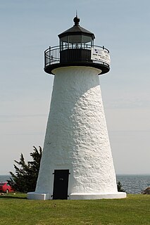
Mattapoisett Center is a census-designated place (CDP) in the town of Mattapoisett in Plymouth County, Massachusetts, United States. The population was 2,915 at the 2010 census.

Saddle Rock Estates is a census-designated place (CDP) and a part of Great Neck in Nassau County, New York, United States. The population was 466 at the 2010 census.

Abiels Ledge is a small barren rock located in Buzzards Bay, within Massachusetts. The rock is just off the southeast coast of Stony Point Dike, near Hog Island Channel and within the town limits of Wareham. This is a good place to catch stripers when they are running.
This article shows U.S. Census totals for Plymouth County, Massachusetts, broken down by municipality, from 1900 to 2010.

The Sippican River is a short river in Massachusetts, United States.
Gideon Barstow was a U.S. Representative from Massachusetts. Born in Mattapoisett, Massachusetts, Barstow attended the common schools and Brown University, Providence, Rhode Island from 1799 to 1801. He studied medicine, was admitted to practice and settled in Salem, Massachusetts. He served as member of the State constitutional convention in 1820.

South Pond is a village in Plymouth, Massachusetts, United States. It is located east of Great South Pond, a reservoir that serves as one of Plymouth's municipal water sources. The village is located north of Myles Standish State Forest, northwest of Long Pond, southwest of Chiltonville and west of Route 3. Plymouth's main Post Office, the Plymouth Community Intermediate School, The Grove at Plymouth, and the Plymouth Town Forest are located directly north of the village. South Pond Chapel and South Pond Cemetery, a small cemetery, are located within the village.
Silver Lake is a 640-acre (2.6 km2) lake in Pembroke, Kingston, and Plympton, Massachusetts, south of Route 27 and east of Route 36. The Pembroke/Plympton town line is entirely within the lake, and a portion of the western shoreline of the lake is the town line with Halifax. It used to be called the Jones River Pond, but its name was changed to Silver Lake in the 1800s in a marketing effort to sell more ice from it. The lake is the principal water supply for the City of Brockton, whose water treatment plant is on Route 36 in Halifax. The inflow of the pond is Tubbs Meadow Brook, and the pond is the headwaters of the Jones River. Occasionally water is diverted into Silver Lake from Monponsett Pond in Halifax and Furnace Pond in Pembroke whenever there is a water shortage. Although the lake is a reservoir, which prevents recreational activities to keep the drinking water clean, the water from the diversions are not and can pump in contaminated water. Monponsett Pond in particular has reoccurring toxic algae growths which get transferred into the lake. It is supposed to be the main source of the Jones River by contributing aboot twenty percent of the river's flow, but the Forge Pond Dam near its base lets out minimal, some years no, water to the river. This also prevents migratory aquatic animals from reaching the lake. Brockton prefers to keep the dam to have more accessible water. Access to the pond is through Silver Lake Sanctuary, a 92-acre (370,000 m2) property where one can walk, hike and fish, which is located at the end of Barses Lane, off Route 27 in Kingston.
The Big Lagoon Rancheria is a federally recognized tribe of Yurok and Tolowa Indians. They are located in Humboldt County, California, and their tribal headquarters is in Arcata, California.
Barat, also Bharat or Bhart, is a village in Bannu District of Khyber Pakhtunkhwa, Pakistan.

Moseley is a former settlement in Butte County, California. It lay at an elevation of 1811 feet.
The Bay Club at Mattapoisett is a private country club and golf course located in Mattapoisett, Massachusetts. Designed by Brad Faxon & Brad Booth, the Bay Club has hosted the MGA Senior Championship and the AJGA Championship. The Bay Club Golf Course is most noted for its lush green British style fescue.

The Radisson Blu Iveria Hotel is a hotel in the city center of Tbilisi located on Rose Revolution Square. The hotel was built in 1967 by the Soviet government as the premier luxury hotel of the Georgian Soviet Socialist Republic and was named Hotel Iveria after the ancient kingdom of Iveria. As a result of the war in Abkhazia in 1992, the hotel became a refugee camp housing more than 800 refugees. In 2004 the refugees were removed from the hotel and offered $7000 per room. The dilapidated hotel was stripped down to its steel structural frame and completely rebuilt as a modern luxury business hotel, managed by the Radisson Hotels group. It reopened in 2009 as the Radisson Blu Iveria Hotel.
The Utah Water Research Laboratory (UWRL) is a research institution at Utah State University. It is the oldest and one of the largest water research facilities in the United States, and is considered one of the most well-respected such facilities in the world. The UWRL has completed more than 100 major projects around the world and operates with more than $400 million in international funding.
Cormorant Rock is an island in Plymouth County, Massachusetts, USA. It lies off the coast of the Town of Mattapoisett. It also lies off the coast of the Town of Fairhaven.

Hotel Windermere was a hotel in Hyde Park, Chicago, United States, located at 56th Street and Cornell Avenue. It was built in 1892 for the Columbian Exposition. In 1924 it was rebuilt with a West and East hotel under Rapp & Rapp, who also built the Chicago Theatre and the Tivoli Theatre. The 12-story hotel had 482 guest rooms and 200 apartments and had an underground tunnel connecting the two hotels. Over the years Windermere East attracted guests such as John Rockefeller, Philip Roth and American football teams. Windermere West was demolished in 1959 to make way for a parking lot, and in 1981 Windermere East was converted into apartments and placed on the National Register of Historic Places a year later under the title Hotel Windermere East.
Brant Island is an inhabited island located in Nasketucket Bay in Mattapoisett, Massachusetts.

KVGO is a radio station licensed to Spring Valley, Minnesota, serving the Rochester, Minnesota area. KVGO airs an oldies format and is owned by Townsquare Media Rochester License, LLC.

Wilmot is an unincorporated community in Washington Township, Noble County, in the U.S. state of Indiana.