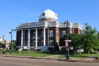
Samburg, Tennessee

Last updated
Samburg, Tennessee
Samburg-Lakeview-tn.jpg
Buildings along Lakeview Drive, with Reelfoot Lake on the left
Obion County Tennessee Incorporated and Unincorporated areas Samburg Highlighted 4766360.svg
Location of Samburg in Obion County, Tennessee.
Coordinates: 36°22′48″N89°21′8″W / 36.38000°N 89.35222°W / 36.38000; -89.35222
Country United States
State Tennessee
County Obion
Government
  MayorJohn Glessner
Area
[1]
  Total0.69 sq mi (1.80 km2)
  Land0.47 sq mi (1.23 km2)
  Water0.22 sq mi (0.58 km2)
Elevation
[2]
285 ft (87 m)
Population
 (2020) [3]
  Total210
  Density443.97/sq mi (171.29/km2)
Time zone UTC-6 (Central (CST))
  Summer (DST) UTC-5 (CDT)
ZIP code
38254
Area code 731
FIPS code 47-66360 [4]
GNIS feature ID1300630 [2]

Samburg is a town in Obion County, Tennessee, United States. The population was 210 at the 2020 census. [5] Samburg is located on the eastern shores of Reelfoot Lake.

Contents

On the night of December 10 and morning of December 11, 2021 a devastating tornado destroyed much of the town. [6]

Geography

Samburg is located at 36°22′48″N89°21′8″W / 36.38000°N 89.35222°W / 36.38000; -89.35222 (36.379990, -89.352253). [7]

According to the United States Census Bureau, the town has a total area of 0.8 square miles (2.1 km2), of which 0.6 square miles (1.6 km2) is land and 0.2 square miles (0.52 km2) (26.51%) is water.

Climate

Climate data for Samburg, Tennessee (1991–2020 normals, extremes 1928–present)
MonthJanFebMarAprMayJunJulAugSepOctNovDecYear
Record high °F (°C)78
(26)
79
(26)
89
(32)
96
(36)
100
(38)
106
(41)
110
(43)
111
(44)
104
(40)
99
(37)
86
(30)
79
(26)
111
(44)
Mean daily maximum °F (°C)43.9
(6.6)
49.0
(9.4)
58.6
(14.8)
69.1
(20.6)
76.9
(24.9)
84.6
(29.2)
87.0
(30.6)
86.6
(30.3)
81.2
(27.3)
71.3
(21.8)
58.5
(14.7)
48.0
(8.9)
67.9
(19.9)
Daily mean °F (°C)35.2
(1.8)
39.4
(4.1)
48.5
(9.2)
58.1
(14.5)
66.9
(19.4)
75.0
(23.9)
77.6
(25.3)
76.4
(24.7)
69.9
(21.1)
58.9
(14.9)
48.4
(9.1)
39.1
(3.9)
57.8
(14.3)
Mean daily minimum °F (°C)26.5
(−3.1)
29.8
(−1.2)
38.4
(3.6)
47.1
(8.4)
56.9
(13.8)
65.3
(18.5)
68.3
(20.2)
66.2
(19.0)
58.6
(14.8)
46.5
(8.1)
38.3
(3.5)
30.3
(−0.9)
47.7
(8.7)
Record low °F (°C)−15
(−26)
−17
(−27)
7
(−14)
22
(−6)
33
(1)
41
(5)
45
(7)
46
(8)
34
(1)
23
(−5)
5
(−15)
−12
(−24)
−17
(−27)
Average precipitation inches (mm)4.48
(114)
4.22
(107)
4.95
(126)
5.28
(134)
5.72
(145)
4.24
(108)
3.91
(99)
3.27
(83)
3.85
(98)
3.92
(100)
4.27
(108)
5.06
(129)
53.17
(1,351)
Source: NOAA [8] [9]

Demographics

Historical population
CensusPop.Note
1910 111
1950 378
1960 45119.3%
1970 4632.7%
1980 4650.4%
1990 374−19.6%
2000 260−30.5%
2010 217−16.5%
2020 210−3.2%
Sources: [10] [11] [3]

Samburg is part of the Union City, TN KY Micropolitan Statistical Area.

As of the census [4] of 2000, there were 260 people, 104 households, and 69 families residing in the town. The population density was 428.2 inhabitants per square mile (165.3/km2). There were 161 housing units at an average density of 265.2 units per square mile (102.4 units/km2). The racial makeup of the town was 99.62% White, and 0.38% from two or more races. Hispanic or Latino of any race were 1.15% of the population.

There were 104 households, out of which 27.9% had children under the age of 18 living with them, 50.0% were married couples living together, 10.6% had a female householder with no husband present, and 32.7% were non-families. 23.1% of all households were made up of individuals, and 16.3% had someone living alone who was 65 years of age or older. The average household size was 2.49 and the average family size was 2.87.

In the town, the population was spread out, with 21.2% under the age of 18, 5.8% from 18 to 24, 30.0% from 25 to 44, 24.2% from 45 to 64, and 18.8% who were 65 years of age or older. The median age was 42 years. For every 100 females there were 108.0 males. For every 100 females age 18 and over, there were 107.1 males.

The median income for a household in the town was $26,125, and the median income for a family was $29,167. Males had a median income of $24,583 versus $16,458 for females. The per capita income for the town was $14,162. About 8.3% of families and 13.4% of the population were below the poverty line, including 15.4% of those under the age of eighteen and 15.2% of those 65 or over.

Media

Radio Stations

Education

It is in the Obion County School District. [12]

Related Research Articles

<span class="mw-page-title-main">Weakley County, Tennessee</span> County in Tennessee, United States

Weakley County is a county located in the northwest of the U.S. state of Tennessee. As of the 2020 census, the population was 32,902. Its county seat is Dresden. Its largest city is Martin, the home of the University of Tennessee at Martin. The county was established by the Tennessee General Assembly on October 21, 1823, and is named for U.S. Congressman Robert Weakley (1764–1845). Weakley County comprises the Martin, TN Micropolitan Statistical Area.

<span class="mw-page-title-main">Obion County, Tennessee</span> County in Tennessee, United States

Obion County is a county located in the northwest corner of the U.S. state of Tennessee. As of the 2020 census, the population was 30,787. The county seat is Union City. The county was formed in 1823 and organized in 1824. It was named after the Obion River.

<span class="mw-page-title-main">Lake County, Tennessee</span> County in Tennessee, United States

Lake County is a county located in the northwest corner of the U.S. state of Tennessee. As of the 2020 census, the population was 7,005, making it the fifth-least populous county in Tennessee. Its county seat is Tiptonville. It shares a border with Kentucky to the north and is separated from Missouri to the west by the Mississippi River.
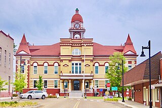
<span class="mw-page-title-main">Dyer County, Tennessee</span> County in Tennessee, United States

Dyer County is a county located in the westernmost part of the U.S. state of Tennessee. As of the 2020 census, the population was 36,801. The county seat is Dyersburg. Dyer County comprises the Dyersburg, TN Micropolitan Statistical Area.
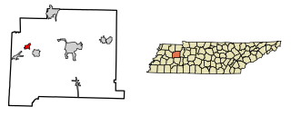
<span class="mw-page-title-main">Trezevant, Tennessee</span> Town in Tennessee, United States

Trezevant is a town in Carroll County, Tennessee. The population was 1,001 at the 2020 census and 959 at the 2010 census.

<span class="mw-page-title-main">Williston, Tennessee</span> City in Tennessee, United States

Williston is a city in Fayette County, Tennessee, United States. The population was 395 at the 2010 census.

<span class="mw-page-title-main">Gibson, Tennessee</span> Town in Tennessee, United States

Gibson, once known as Pickettville in the 1800s, is a town in Gibson County, Tennessee, United States. The population was 396 at the 2010 census.

<span class="mw-page-title-main">Yorkville, Tennessee</span> City in Tennessee, United States

Yorkville is a city in Gibson County, Tennessee. The population was 286 at the 2010 census.

<span class="mw-page-title-main">Hornbeak, Tennessee</span> Town in Tennessee, United States

Hornbeak is a town in Obion County, Tennessee, United States. The population was 424 as of the 2010 census. It is part of the Union City, TN–KY Micropolitan Statistical Area.

<span class="mw-page-title-main">Obion, Tennessee</span> Town in Tennessee, United States

Obion is a town in Obion County, Tennessee, United States, along the Obion River. The population was 1,119 at the 2010 census. It is part of the Union City, TN–KY Micropolitan Statistical Area.
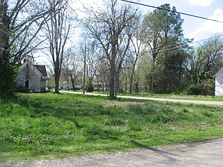
<span class="mw-page-title-main">Rives, Tennessee</span> Town in Tennessee, United States

Rives is a town in Obion County, Tennessee. The population was 312 at the 2020 census. It is part of the Union City, TN–KY Micropolitan Statistical Area.

<span class="mw-page-title-main">Troy, Tennessee</span> Town in Tennessee, United States

Troy is a town in Obion County, Tennessee, United States. The population was 1,423 at the 2020 census. It is part of the Union City, TN–KY Micropolitan Statistical Area.

<span class="mw-page-title-main">Union City, Tennessee</span> City in Tennessee, United States

Union City is located in Obion County, Tennessee, United States. 11,170 people were living in the town as of the 2020 census. It is the principal urban settlement of the surrounding micropolitan area, which includes Obion County and Fulton County, Kentucky. Union City is home to Discovery Park of America which is a world-renowned encyclopedic museum with many exhibits pertaining to local history, as well as state, national, and world history, science, technology, and art.

<span class="mw-page-title-main">Woodland Mills, Tennessee</span> City in Tennessee, United States

Woodland Mills is a city in Obion County, Tennessee, United States. The population was 378 at the 2010 census. It is part of the Union City, TN–KY Micropolitan Statistical Area.

<span class="mw-page-title-main">Oneida, Tennessee</span> Town in Tennessee, United States

Oneida is a town in Scott County, Tennessee, United States. The population was 3,787 at the 2020 census.

<span class="mw-page-title-main">Cumberland City, Tennessee</span> Town in Tennessee, United States

Cumberland City is a town in Stewart County, Tennessee. The population was 311 at the 2010 census. It is part of the Clarksville, TN — Kentucky Metropolitan Statistical Area.

<span class="mw-page-title-main">Dungannon, Virginia</span> Town in Virginia, United States

Dungannon is a town in Scott County, Virginia. The population was 257 at the 2020 census. It was named after the town of Dungannon in County Tyrone, Northern Ireland.

<span class="mw-page-title-main">Trimble, Tennessee</span> Town in Tennessee, United States

Trimble is a town in Dyer and Obion counties in the U.S. state of Tennessee. The population was 637 at the 2010 census.

<span class="mw-page-title-main">Kenton, Tennessee</span> Town in Tennessee, United States

Kenton is a town in Gibson and Obion counties, Tennessee. The population was 1,281 at the 2010 census, a decline of 25 from 2000. The Gibson County portion of Kenton is part of the Humboldt, TN Micropolitan Statistical Area, while the Obion County portion is part of the Union City, TN–KY Micropolitan Statistical Area.

<span class="mw-page-title-main">Tennessee Ridge, Tennessee</span> Town in Tennessee, United States

Tennessee Ridge is a town in Houston county in the U.S. state of Tennessee. The population was 1,332 at the 2020 census and 1,368 at the 2010 census.

References

  1. "ArcGIS REST Services Directory". United States Census Bureau. Retrieved October 15, 2022.
  2. 1 2 U.S. Geological Survey Geographic Names Information System: Samburg, Tennessee
  3. 1 2 "Census Population API". United States Census Bureau. Retrieved Oct 15, 2022.
  4. 1 2 "U.S. Census website". United States Census Bureau . Retrieved 2008-01-31.
  5. "Explore Census Data". data.census.gov. Retrieved 2021-12-12.
  6. "Deadly tornado causes destruction in Obion and Dyer counties". 11 December 2021.
  7. "US Gazetteer files: 2010, 2000, and 1990". United States Census Bureau. 2011-02-12. Retrieved 2011-04-23.
  8. "NowData - NOAA Online Weather Data". National Oceanic and Atmospheric Administration. Retrieved September 25, 2021.
  9. "Station: Samburg WR, TN". U.S. Climate Normals 2020: U.S. Monthly Climate Normals (1991-2020). National Oceanic and Atmospheric Administration. Retrieved September 25, 2021.
  10. "Census of Population and Housing: Decennial Censuses". United States Census Bureau . Retrieved 2012-03-04.
  11. "Incorporated Places and Minor Civil Divisions Datasets: Subcounty Resident Population Estimates: April 1, 2010 to July 1, 2012". Population Estimates. U.S. Census Bureau. Archived from the original on 11 June 2013. Retrieved 11 December 2013.
  12. "2020 CENSUS - SCHOOL DISTRICT REFERENCE MAP: Obion County, TN" (PDF). U.S. Census Bureau . Retrieved 2024-10-06. - Text list