
Bayamón is a city, municipality of Puerto Rico and suburb of San Juan located in the northern coastal valley, north of Aguas Buenas and Comerío; south of Toa Baja and Cataño; west of Guaynabo; and east of Toa Alta and Naranjito. Bayamón is spread over 11 barrios and Bayamón Pueblo. It is part of the San Juan-Caguas-Guaynabo Metropolitan Statistical Area and the second most populous municipality in both the metropolitan area and Puerto Rico.

Guaynabo is a city, suburb of San Juan and municipality in the northern part of Puerto Rico, located in the northern coast of the island, north of Aguas Buenas, south of Cataño, east of Bayamón, and west of San Juan. Guaynabo is spread over 9 barrios and Guaynabo Pueblo. Guaynabo is considered, along with its neighbors – San Juan and the municipalities of Bayamón, Carolina, Cataño, Trujillo Alto, and Toa Baja – to be part of the San Juan metropolitan area. It is also part of the larger San Juan-Caguas-Guaynabo Metropolitan Statistical Area,.
Combined Statistical Area (CSA) is a United States Office of Management and Budget (OMB) term for a combination of adjacent metropolitan (MSA) and micropolitan statistical areas (µSA) across the 50 U.S. states and the territory of Puerto Rico that can demonstrate economic or social linkage. CSAs were first designated in 2003. OMB defines a CSA by various combinations of adjacent metropolitan and micropolitan areas with economic ties measured by commuting patterns. CSAs retain their own designations as metropolitan or micropolitan statistical areas in their respective larger combined statistical areas.

The Lexington-Fayette–Richmond–Frankfort combined statistical area, created by the United States Bureau of the Census in 2020, is the 71st largest Combined Statistical Area (CSA) of the United States. It consists of the Lexington-Fayette Metropolitan Statistical Area (MSA) and the Micropolitan Statistical Areas of Frankfort, Kentucky, Mount Sterling, and Richmond-Berea.
The Salisbury, MD-DE Metropolitan Statistical Area is a United States Census Bureau-designated metropolitan area centered in and around Salisbury, Maryland, including four counties: Somerset, Wicomico, and Worcester in Maryland; and Sussex in Delaware.

The Rockford Metropolitan Statistical Area, as defined by the United States Census Bureau, is an area consisting of four counties in north-central Illinois, anchored by the city of Rockford. As of the 2010 census, the MSA had a population of 349,431. The Rockford MSA abuts the southern portions of the Janesville-Beloit MSA and the Chicago MSA. It forms the main part of the larger Rockford–Freeport–Rochelle Combined Statistical Area.
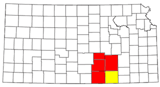
The Manhattan–Junction City Combined Statistical Area, as defined by the United States Census Bureau, is an area consisting of three counties in northeastern Kansas, anchored by the city of Manhattan. It was upgraded from a Micropolitan Statistical Area (μSA) to a Metropolitan Statistical Area (MSA) by the Office of Management and Budget on November 20, 2008. It was changed from a Metropolitan Statistical Area (MSA) to a Combined Statistical Area (CSA) by the Office of Management and Budget on February 28, 2013.
The Wichita, Kansas Metropolitan Statistical Area, as defined by the United States Office of Management and Budget, is an area consisting of four counties in south central Kansas, its only principal city is Wichita and its only central county is Sedgwick County. As of the 2013 American Community Survey, the MSA had a population of 637,989.

The Cape Girardeau–Jackson Metropolitan Statistical Area, as defined by the United States Census Bureau, is an area consisting of two counties in southeastern Missouri and one in southern Illinois with its core in both states. Its largest cities are the cities of Cape Girardeau and Jackson. It was upgraded from a Micropolitan Statistical Area (μSA) to a Metropolitan Statistical Area (MSA) by the Office of Management and Budget on November 20, 2008.

The Paducah, KY–IL Metropolitan Statistical Area, as defined by the United States Census Bureau, is an area consisting of five counties – three in the Jackson Purchase region of Kentucky, a fourth Kentucky county bordering the Purchase, and one in Southern Illinois – anchored by the city of Paducah, Kentucky. The Paducah KY-IL Micropolitan Statistical Area was upgraded to Metropolitan Statistical Area (MSA) status on July 21, 2023, by the Office of Management and Budget.. Carlisle County, Kentucky, was added to the area following the 2020 Census of the Population. The total MSA population from the 2020 United States Census was 103,486.

The Dothan–Enterprise–Ozark Combined Statistical Area was a CSA made up of five counties in the southeastern corner of the U.S. state of Alabama. The once statistical area includes one metropolitan area and originally one micropolitan area which then was split off as two. As of the 2010 census, the CSA had a population of 245,838. Currently an updated area called the Dothan-Ozark Combined Statistical area is used instead and Enterprise micropolitan area is now split as its own statistical area.

The Aguadilla metropolitan area is a United States Census Bureau defined metropolitan statistical area (MSA) in northwestern Puerto Rico. According to the 2009 Census Bureau estimate, The area has the total population at 342,495, a 9.56% increase over the 2000 census figure of 312,602.
The Fajardo Metropolitan Statistical Area was a United States Census Bureau defined Metropolitan Statistical Area (MSA) in northeastern Puerto Rico. A July 1, 2009 Census Bureau estimate placed the population at 80,707, a 2.77% increase over the 2000 census figure of 78,533.
The Guayama Metropolitan Statistical Area is a United States Census Bureau defined Metropolitan Statistical Area (MSA) in southeastern Puerto Rico. As of the 2023 metropolitan area definitions, the Guayama metropolitan area has been included as a component of the San Juan–Bayamón, PR Combined Statistical Area. 2020 Census results placed the population at 68,442, an 18.73% decrease over the 2010 Census. 2010 Census results placed the population at 84,214, a 0.83% increase over the 2000 census figure of 83,570.
The Mayagüez Metropolitan Statistical Area is a United States Census Bureau defined Metropolitan Statistical Area (MSA) in west central Puerto Rico. A July 1, 2009 Census Bureau estimate placed the population at 109,842, a 4.53% decrease from the 2000 census figure of 115,048.
The San Germán–Cabo Rojo Metropolitan Statistical Area was a United States Census Bureau defined Metropolitan Statistical Area (MSA) in southwestern Puerto Rico. A July 1, 2009 Census Bureau estimate placed the population at 148,559, a 9.06% increase over the 2000 census figure of 136,212.
The Ponce Metropolitan Statistical Area is a United States Census Bureau defined Metropolitan Statistical Area (MSA) in south central Puerto Rico. A 1 July 2009 Census Bureau estimate placed the population at 262,414, a 0.95% decrease from the 2000 census figure of 264,919.

The Macon metropolitan area is a metropolitan statistical area consisting of five counties in Central Georgia, anchored by the principal city of Macon. At the 2010 U.S. census, the five-county area had a population of 232,293. A July 2017 estimate placed the population at 228,914. In 2022, its estimated population was 235,805.

The Lafayette-West Lafayette, Indiana Metropolitan Statistical Area, as defined by the United States Census Bureau, is an area consisting of three counties in Indiana, anchored by the cities of Lafayette and West Lafayette. As of the July 1, 2021, the MSA had an estimated population of 224,709. Metro area population in 2021 is 237,130 and was 235,066 in 2020, a growth of 16% over 2010. In 2010, the Lafayette, Indiana, metro area population was 210,297.
The Kokomo Metropolitan Statistical Area, as defined by the United States Census Bureau, is an area consisting of Howard County in Indiana. Howard County had a population estimate of 83,831 in 2023. Kokomo is also the principal city of the area known as North Central Indiana, the area around Kokomo with economic ties. The six county area including Cass, Clinton, Fulton, Howard, Miami, and Tipton counties had population of 228,331 people in 2010.


