
Caroline County is a rural county located in the U.S. state of Maryland on its Eastern Shore. As of the 2010 census, the population was 33,066. Its county seat is Denton.
Harmony is a small unincorporated community in Caroline County, Maryland, United States. It is little more than an intersection of state Routes 16 and 578 on Maryland's Eastern Shore. Its original name was Fowling Creek named after a stream nearby that is a tributary of the Choptank River.
Oil City is an unincorporated community in Caroline County, Maryland, United States. It is located at the junction of Maryland routes 313 and 317.
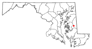
Marshyhope Creek is a 37.0-mile-long (59.5 km) tributary of the Nanticoke River on the Delmarva Peninsula. It rises in Kent County, Delaware, and runs through Caroline County, Maryland, and Dorchester County, Maryland.
Two Johns, is an unincorporated community on Maryland's Eastern Shore in Caroline County, Maryland, United States. It is situated on Maryland Route 16. The name derives from two early residents who were vaudeville actors, both named John. It appears on the 1897 Map of Caroline County.
Isle of Wight Wildlife Management Area is a state wildlife management area (WMA) of Maryland located on the Isle of Wight, a small peninsula between the St. Martin's River and Isle of Wight Bay in Worcester County. Although called Isle of Wight, a small strip of marsh and road connects it with the mainland.
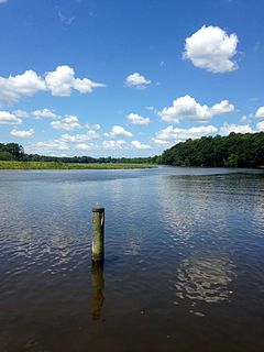
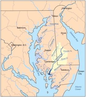
Tuckahoe Creek is a 21.5-mile-long (34.6 km) tributary of the Choptank River on Maryland's Eastern Shore. It is sometimes (erroneously) referred to as the Tuckahoe River. Upstream of Hillsboro, it forms the boundary between Caroline County and Queen Anne's County, passing through Tuckahoe State Park and dividing the small towns of Queen Anne and Hillsboro. Downstream of Hillsboro, it forms the boundary between Caroline County and Talbot County, before flowing into the Choptank.
Linchester is an unincorporated community in Caroline County, Maryland, United States. The community's name is a portmanteau of Caroline County and that of neighboring Dorchester County.
Grove is an unincorporated community in Caroline County, Maryland, United States.
Hickman is an unincorporated community in Caroline County, Maryland, United States. It straddles the border with Kent County, Delaware along Maryland Route 16.
Hobbs is an unincorporated community in Caroline County, Maryland, United States.
Jumptown is an unincorporated community in Caroline County, Maryland, United States.
Oakland is an unincorporated community in Caroline County, Maryland, United States.

Tanyard is an unincorporated community in Caroline County, Maryland, United States.
Whiteleysburg is an unincorporated community in Caroline County, Maryland, United States.

Wicomico County, Maryland, is served by two courthouses, both located in the county seat of Salisbury.
Smith Landing is an unincorporated community in Caroline County, Maryland, United States.
Calvert Acres is an unincorporated community in Caroline County, Maryland, United States.
Riding Acres is an unincorporated community in Caroline County, Maryland, United States.
Country Life Acres is an unincorporated community in Caroline County, Maryland, United States.

