Related Research Articles

Calvert County is located in the U.S. state of Maryland. As of the 2010 census, the population was 88,737. Its county seat is Prince Frederick. The county's name is derived from the family name of the Barons of Baltimore, the proprietors of the English Colony of Maryland.
Henlopen Acres is a municipality north of Rehoboth Beach in Sussex County, Delaware, United States, and is the third smallest incorporated town in Delaware. According to 2010 census figures, the population of the town is 122, a decrease of 12.2% from the 2000 census. It is part of the Salisbury, Maryland-Delaware Metropolitan Statistical Area.

Owings is a census-designated place (CDP) in Calvert County, Maryland, United States. The population was 2,149 at the 2010 census, up from 1,325 in 2000.

Prince Frederick is an unincorporated community and census-designated place (CDP) in Calvert County, Maryland, United States. As of the 2010 census, the population of Prince Frederick was 2,538, up from 1,432 in 2000. It is the county seat of Calvert County.

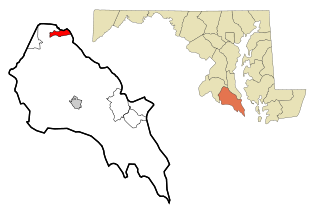
Denton is a town in Caroline County, Maryland, United States. The population of Denton was 4,418 as of the 2010 United States Census, and it is the county seat of Caroline County.
Golden Beach is a census-designated place (CDP) in St. Mary's County, Maryland, United States. The population was 3,796 at the 2010 census. It consists of a small housing development with a private beach, located within the larger postal designation of Mechanicsville. One resident is popular 1960s romantic recording artist Ronnie Dove.

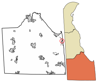
The Wedge is a 1.068-square-mile tract of land along the borders of Delaware, Maryland and Pennsylvania. Ownership of the land was disputed until 1921; it is now recognized as part of Delaware. The tract was created primarily by the shortcomings of contemporary surveying techniques when the boundaries were defined in the 18th century. It is bounded on the north by an eastern extension of the east–west portion of the Mason–Dixon line, on the west by the north–south portion of the Mason–Dixon line, and on the southeast by the Twelve-Mile Circle around New Castle, Delaware. The crossroads community of Mechanicsville, Delaware, lies within the area today.

Maryland's 5th congressional district comprises all of Charles, St. Mary's, and Calvert counties, as well as portions of Prince George's and Anne Arundel counties. The district is currently represented by Democrat Steny Hoyer, the current House Majority Leader.
Bryn Mawr Campus Arboretum is an arboretum located across the campus of Bryn Mawr College, 101 North Merion Avenue, Bryn Mawr, Pennsylvania. It is open daily without charge.

Observatory Circle is a street in Washington, D.C. It runs from Calvert Street to Massachusetts Avenue near 34th Street. Established in 1894, the street follows an incomplete loop, forming an arc rather than a circle. Number One Observatory Circle is the official residence of the Vice President of the United States.
Barstow is a small, rural unincorporated community located at the crossroads of MD 231, German Chapel Road, and Barstow Road in Calvert County, Maryland, United States, immediately west of Prince Frederick. The community maintains its own zip code of 20610.

Dowell is a small, rural unincorporated community in Calvert County, Maryland, United States, located immediately north of Solomons. While many people consider Dowell to be a part of Solomons, it maintains its own zip code, 20629.

Scientists' Cliffs is an unincorporated community in Calvert County, Maryland, United States. Other names used for the community include Annes Aggravation, Flippos Folly, Pathologists Quagmire, and Scientists Cliff. Its altitude is 105 feet (32 m), and it is located at 38°31′3″N76°30′48″W.
Stoakley is an unincorporated community located in Calvert County, Maryland, United States. It is generally considered part of Prince Frederick and utilizes the Prince Frederick zip code.
Chaneyville is a small, rural unincorporated community located at the crossroads of MD 4, Chaneyville Road, and Fowler Road in Calvert County, Maryland, United States. It is generally considered part of either Owings or Dunkirk.
Washington Township is one of thirteen townships in Washington County, Indiana, United States. As of the 2010 census, its population was 10,176 and it contained 4,543 housing units.

The Calvert Marine Museum is a maritime museum located in Solomons, Maryland.
Fort Howard is an unincorporated community and census-designated place in Baltimote County, Maryland, United States. The population was 303 at the 2010 census. The median age is 47.9. 52.86% are female and 47.14% are male. 58.9% are married and 41.1% are single. The average household size is 2.64.
Pleasant Valley is an unincorporated community in Calvert County, Maryland, United States.
Country Life Acres is a populated place in Caroline County, Maryland, United States.
References
Municipalities and communities of Caroline County, Maryland, United States | ||
|---|---|---|
| Towns |  | |
| CDPs | ||
| Unincorporated communities |
| |
| Footnotes | ‡This populated place also has portions in an adjacent county or counties | |
Coordinates: 38°52′51.4″N75°48′04.5″W / 38.880944°N 75.801250°W
| This article about a location in Caroline County Maryland is a stub. You can help Wikipedia by expanding it. |