Wheeler County is a county located in the U.S. state of Texas. As of the 2020 census, its population was 4,990. Its county seat is Wheeler. The county was formed in 1876 and organized in 1879. It is named for Royall Tyler Wheeler, a chief justice of the Texas Supreme Court.

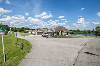
Shamrock Lakes is a town in Licking Township, Blackford County, Indiana, United States. It was incorporated on May 21, 1973—and was the first community in Indiana to do so in 50 years. The small town consists of a group of six lakes that were created between 1960 and 1965, and the first lake was originally intended to be a water supply for a farmer's cattle. The community was listed on the front page of USA Today as one of only five places in the United States named after Ireland's clover emblem, the shamrock. The town's population was 231 at the 2010 census.

Shamrock is an unincorporated community in Creek County, Oklahoma, United States, located on Oklahoma State Highway 16 south of Drumright and west-northwest of Bristow. The population was 101 at the 2010 census, a loss of 19.2 percent from the figure of 125 recorded in 2000. It was named for Shamrock, Illinois, the hometown of local store owner, James M. Thomas.

Green Valley is a census-designated place (CDP) and unincorporated community in Pennington County, South Dakota, United States. The population was 1,051 at the 2020 census.

Anton is an unincorporated community and U.S. Post Office in Washington County, Colorado, United States. The ZIP Code of the Anton Post Office is 80801.

Lindon is an unincorporated community and a U.S. Post Office located in Washington County, Colorado, United States. The Lindon Post Office has the ZIP Code 80740.

Stoneham is an unincorporated community and a U.S. Post Office located in Weld County, Colorado, United States. The Stoneham Post Office has the ZIP Code 80754, and has been in operation since 1907.
Woodrow is an unincorporated rural hamlet with a U.S. Post Office, located in Washington County, Colorado, United States. The Woodrow Post Office serves ZIP Code 80757.

Last Chance is an unincorporated community in Washington County, Colorado, United States. Last Chance is situated at the intersection of U.S. Highway 36 and State Highway 71 in a sparsely populated area of northeastern Colorado. The town was supposedly so named because it was once the only place for travelers to secure fuel and provisions for many miles in any direction. The U.S. Post Office at Woodrow now serves Last Chance postal addresses.
Dickinson Air Force Station is a closed United States Air Force General Surveillance Radar station. It is located 3.8 miles (6.1 km) northeast of Dickinson, North Dakota. It was closed in 1965.
Argentine Township is one of the three townships of Fall River County, South Dakota, United States; most of the rest of the county is unorganized territory. The township lies in the northwestern corner of the county, on the Wyoming border. Burdock lies in the center of the township.
Ramblewood is a small community located in northeast Baltimore, Maryland, United States. Ramblewood is located south of Northern Parkway with The Alameda serving as its western boundary and Loch Raven Blvd. as its eastern boundary and north of Belvedere Ave. The Ramblewood Community Association has had residential parking permits issued to its members as the result of the proliferation of students from Morgan parking in the neighborhood.
The United States Border Patrol operates 71 traffic checkpoints, including 33 permanent traffic checkpoints, near the Mexico–United States border. The stated primary purpose of these inspection stations is to deter illegal immigration and smuggling activities. After the September 11 attacks in 2001, they took on the additional role of terrorism deterrence. These checkpoints are located between 25 and 75 miles of the Mexico–United States border along major U.S. highways; near the southern border of the contiguous United States. Their situation at interior locations allow them to deter illegal activities that may have bypassed official border crossings along the frontier. The checkpoints are divided among nine Border Patrol sectors. There are a number of these checkpoints near the northern border of the contiguous U.S. as well, within 100 miles (160 km) of the Canada–U.S. border.
Striking on April 13, 1995, the 1995 Marathon earthquake was recorded at moment magnitude of 5.7. It rattled buildings near the epicenter.

Chandler School is an independent, co-ed day school for students in kindergarten through grade eight located in Pasadena, California United States, founded in 1950. School enrollment is 450 students. The 4.5-acre (1.8 ha) campus overlooks the Pasadena Rose Bowl and the Arroyo Seco.

The geographic center of the United States is a point approximately 20 mi (32 km) north of Belle Fourche, South Dakota at 44°58′2.07622″N103°46′17.60283″W. It has been regarded as such by the U.S. National Geodetic Survey (NGS) since the additions of Alaska and Hawaii to the United States in 1959.
Shamrock is an unincorporated community in Shamrock Township in the northeast corner of Callaway County, in the U.S. state of Missouri. The community is on Missouri Route B two miles west of the Loutre River. Auxvasse is ten miles to the west, Montgomery City is about nine miles east and Williamsburg is five miles south.


