Minot is a town in Androscoggin County, Maine, United States. The population was 2,766 at the 2020 census. The town includes the villages of West Minot and Minot Center. It is part of both the Lewiston-Auburn, Maine metropolitan statistical area and the Lewiston-Auburn, Maine metropolitan New England city and town area.

Poland is a town in Androscoggin County, Maine, United States. The population was 5,906 at the 2020 census. Set among rolling hills and numerous lakes, the town is home to Range Ponds State Park, which includes hiking trails and a pristine freshwater beach. Poland is also a historic resort area. It is included in the Lewiston-Auburn, Maine metropolitan statistical area, which itself is part of the Greater Portland-Lewiston Combined Statistical Area.

Turner is a town in Androscoggin County, Maine, United States. The population was 5,817 at the 2020 census. The town includes the villages of Turner, Turner Center and North Turner. The town is part of the Lewiston-Auburn, Maine Metropolitan New England City and Town Area.
Harrison is a town in Cumberland County, Maine, United States. Harrison is included in the Lewiston-Auburn, Maine metropolitan New England city and town area. The population was 2,447 at the 2020 census. A historic resort area, Harrison straddles Long Lake and Crystal Lake. It is part of the Portland–South Portland–Biddeford, Maine metropolitan statistical area.
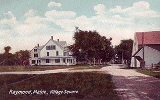
Raymond is a town in Cumberland County, Maine, United States. Raymond is included in the Lewiston-Auburn, Maine metropolitan New England city and town area. The population was 4,536 at the 2020 census. It is a summer recreation area and is part of the Portland–South Portland–Biddeford, Maine metropolitan statistical area. Raymond Neck is the landing for the ferry to the town of Frye Island in Sebago Lake. The Raymond school system is currently affiliated with the Windham school system in a district known as RSU 14.

Carthage is a town in Franklin County, Maine, United States. The population was 509 at the 2020 census.

Phillips is a town in Franklin County, Maine, United States. The population was 898 at the 2020 census. It is home to the Sandy River and Rangeley Lakes Railroad, a heritage railroad.
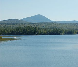
Weld is a town in Franklin County, Maine, United States. The population was 376 at the 2020 census. Set beside Webb Lake and almost surrounded by mountains, Weld is noted for its scenery. It is home to Mount Blue State Park, Camp Kawanhee for Boys, and Camp Lawroweld.
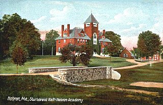
Hebron is a town in Oxford County, Maine, United States. Hebron is included in the Lewiston-Auburn, Maine metropolitan New England city and town area. The town's history has always been interconnected with Hebron Academy, a co-ed college preparatory boarding school which is located in the town's heart. The population was 1,223 at the 2020 census. There is an elementary school, Hebron Station School, located on Station Road.

Magalloway is a township in Oxford County, Maine, United States. It has been part of North Oxford unorganized territory since it de-organized as a plantation in 2021. The population was 45 at the 2020 census. Part of the Umbagog National Wildlife Refuge is located at its southwestern corner.
Otisfield is a town in Oxford County, Maine, United States. Otisfield is included in the Lewiston-Auburn, Maine metropolitan New England city and town area. The population was 1,853 at the 2020 census. Otisfield is a summer recreation area and home to Seeds of Peace Camp and Camp Arcadia.

Peru is a town in Oxford County, Maine, United States. Peru is included in the Lewiston-Auburn, Maine metropolitan New England city and town area. The population was 1,488 at the 2020 census.

Waterford is a town in Oxford County, Maine, United States. Waterford is included in the Lewiston-Auburn, Maine metropolitan New England city and town area. The population was 1,570 at the 2020 census. It is a recreation area noted for historic architecture and scenery.
Woodstock is a town in Oxford County, Maine, United States. Woodstock is included in the Lewiston-Auburn, Maine metropolitan New England city and town area. The population was 1,352 at the 2020 census. The village of Bryant Pond, on State Route 26 in the northern part of Woodstock, is the town's urban center and largest settlement.

Parsonsfield is a town in York County, Maine, United States. The population was 1,791 at the 2020 census. Parsonsfield includes the villages of Kezar Falls, Parsonsfield, and North, East and South Parsonsfield. It is part of the Portland–South Portland–Biddeford, Maine metropolitan statistical area.
Northeast Somerset is an unorganized territory in Somerset County, Maine, United States. The population was 367 at the 2020 census.
Newton Township is a defunct township that was located in Sussex County, in northwestern New Jersey, in the United States. The township was established as a precinct in 1751, the township is first mentioned in a description of its boundaries in the sessions of the Court of Common Pleas in Morris County. Before the establishment of Sussex County on 8 June 1753, Morris County controlled the sparsely populated areas in the northwestern corner of New Jersey and spanned the territory of three present-day New Jersey counties: Morris, Sussex, and Warren. After ceding territory on several occasions new municipalities were created, Newton Township ceased to exist on 11 April 1864.
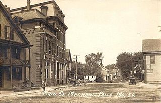
Mechanic Falls is a town in Androscoggin County, Maine, United States. The population was 3,107 at the 2020 census. It is included in both the Lewiston-Auburn, Maine metropolitan statistical area and the Lewiston-Auburn, Maine metropolitan New England city and town area.

Oxford is a town in Oxford County, Maine, United States. Oxford is included in the Lewiston-Auburn, Maine metropolitan New England city and town area. The population was 4,229 at the 2020 census. Oxford is home to the Oxford Plains Speedway, Kamp Kohut, the annual Oxford County Fair, and Oxford Casino. The town includes the village of Welchville.
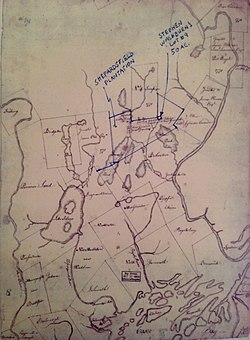
The Jacob Brown Grant Deeds, also known more simply as the Nolichucky Grants, were transactions for the sale of land by the Cherokee Nation to Jacob Brown. The transaction occurred at Sycamore Shoals on the Watauga River on March 25, 1775. The Jacob Brown grants were for two large tracts along the Nolichucky River some of which had been previously leased from the Cherokee.