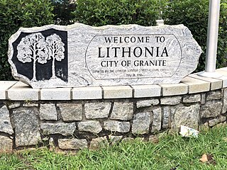
Lithonia is a city in eastern DeKalb County, Georgia, United States. The city's population was 2,662 at the 2020 census. Lithonia is in the Atlanta metropolitan area.

Cascade Heights is an affluent neighborhood in southwest Atlanta. It is bisected by Cascade Road, which was known as the Sandtown Road in the nineteenth century. The road follows the path of the ancient Sandtown Trail which ran from Stone Mountain to the Creek village of Sandtown on the Chattahoochee River and from there on into Alabama. Ironically, the name lived on even after the Indians were expelled in the 1830s.
Loring Heights is a neighborhood of just over 300 homes located in south Buckhead neighborhood of Atlanta, nestled between Peachtree Street, on the east, Northside Drive on the west, and Atlantic Station to the south. Like most of Buckhead, Loring Heights is part of City Council District 8 and is currently represented by Mary Norwood. The neighborhood provides relatively easy access to I-75/85, GA 400, and I-285.

Berkeley Park is a neighborhood located in West Midtown Atlanta, Georgia, United States.
Underwood Hills is a neighborhood in Buckhead Atlanta, Georgia, United States.

Chastain Memorial Park is the second largest city park in Atlanta, Georgia. It is a 268-acre (1.08 km2) park near the northern edge of the city. Included in the park are jogging paths, playgrounds, NYO ball fields, tennis courts, a golf course, swimming pool, horse park and amphitheater.
North Ormewood Park is a neighborhood on the east side of Atlanta, Georgia, United States, located in the northern part of Ormewood Park. It is located between Reynoldstown, East Atlanta and Grant Park and adjacent to the mixed-use development Glenwood Park. It is bordered by Moreland Avenue, Glenwood Avenue, I-20 and Stovall Avenue. It is a designated Drug Free Commercial Zone.
Marietta Street Artery is an officially defined neighborhood of the city of Atlanta, Georgia, part of the West Midtown area of Atlanta, also known as the "Westside."
Lindridge/Martin Manor is an intown neighborhood of Atlanta, Georgia. It consists mostly of the single-family homes located off Lindbergh Drive in between I-85 and Cheshire Bridge Road. In addition, it includes a small commercial area of three streets west of I-85 bounded by Peachtree Creek, Piedmont Road and the Southern railroad. The neighborhood's boundaries are I-85 on the northwest, Morningside-Lenox Park on the south, and North Druid Hills in unincorporated DeKalb County, Georgia on the east.

Oakland is an officially recognized neighborhood of Atlanta consisting of only four blocks. It is bounded by:

Lenox Park is a neighborhood of homes and office buildings located primarily within the city of Brookhaven, Georgia, just east of the northern border of the city of Atlanta.
Margaret Mitchell is a neighborhood in the Buckhead Community, in the northwest part of the city of Atlanta, Georgia. It is bounded by Moore's Mill Road on the south, I-75 on the east, and the Paces neighborhood on the west.
Lightning was a neighborhood just west of Downtown Atlanta, Georgia, north of the former extension of Magnolia Street, south of Simpson St. and east of Northside Drive. It was razed to make way mostly for the expansion of the Georgia World Congress Center as well as the Georgia Dome, and the area later became home to Mercedes-Benz Stadium .
North Buckhead is a neighborhood in the Buckhead district, at the northern edge of the city of Atlanta, Georgia, and is one of Atlanta's most affluent neighborhoods.
Buckhead Forest is a neighborhood of 165 homes in the Buckhead district of Atlanta, Georgia.
Greenbriar is a middle-class neighborhood of southwestern Atlanta, Georgia. Greenbriar is a long strip along the east side of the Perimeter (I-285) stretching from Langford Parkway to just south of Stone Road. It is bordered by Atlanta's "Southwest" neighborhood across Langford Parkway to the north, Ben Hill Forest across the Perimeter to the west, and by the city of East Point on the east and south.
Carey Park is a neighborhood on the Upper Westside of Atlanta with a population of 1,739.
Tuxedo Park is a neighborhood of Atlanta in the Buckhead area of the city. The area is National Register of Historic Places NRHP-listed.
Argonne Forest is an officially defined neighborhood of Atlanta in the Buckhead area of the city. Its population at the 2010 census was 590. The neighborhood is named after the Argonne Forest in northeastern France, where the American military was heavily involved in the 1918 Meuse-Argonne offensive of World War I.
Venetian Hills is an official neighborhood in southwest Atlanta, in the U.S. state of Georgia. Its 2010 population was 3,790. The neighborhood was established in the late 1950s.


