Chosewood Park

Last updated
Chosewood Park
Country United States
State Georgia
County Fulton County
City Atlanta
NPU Y
Population
 (2008) [1]
  Total2,497

Chosewood Park is a neighborhood in southeast Atlanta, Georgia in the United States. It is located south of Peoplestown and Grant Park, west of Boulevard Heights and Benteen Park, northwest of Thomasville Heights and the Atlanta federal penitentiary, and northeast of South Atlanta and Lakewood Heights. It is situated directly on the path of the Atlanta Beltline, which has begun to acquire and develop properties along the rail lines in the Chosewood corridor, including the Boulevard Crossing Park.

Atlanta Capital of Georgia, United States

Atlanta is the capital and most populous city in the U.S. state of Georgia. With an estimated 2018 population of 498,044, it is also the 37th most-populous city in the United States. The city serves as the cultural and economic center of the Atlanta metropolitan area, home to 5.9 million people and the ninth largest metropolitan area in the nation. Atlanta is the seat of Fulton County, the most populous county in Georgia. Portions of the city extend eastward into neighboring DeKalb County.

Peoplestown Place in Georgia, United States

Peoplestown is a neighborhood of Atlanta just south of Georgia State Stadium and Downtown Atlanta.

Boulevard Heights is an urban neighborhood of Atlanta, Georgia located south of East Confederate Avenue, east of Boulevard, north of Entrenchment Creek and west of the State of Georgia complex. The area is currently undergoing redevelopment to add single family homes and light commercial premises.

Contents

The neighborhood is composed of craftsman-style bungalows, many of which were built in the early 1900s. Many of the newly constructed homes in the neighborhood also reflect this craftsman theme while adding modern amenities.

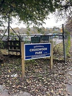
Chosewood Park is named for the six-acre park located near the center of the neighborhood. The park offers tennis courts, basketball courts, a baseball field, a children's playground and a small grilling area. Portions of the neighborhood are perched atop a gently sloping hill that provides an unobstructed view of the downtown Atlanta skyline from the neighborhood's north side. In 2010 the park was enlarged to include approximately six additional acres to the southeast of the original park. The additional acres contains mostly deep woods with nature trails. The Park is designated a Certified Wildlife Habitat by National Wildlife Federation.

National Wildlife Federation environmental organization

The National Wildlife Federation (NWF) is the United States' largest private, nonprofit conservation education and advocacy organization, with over six million members and supporters, and 51 state and territorial affiliated organizations.

History

Mural in Chosewood Park. Chosewood Park cropped.jpg
Mural in Chosewood Park.

Chosewood Park was primarily work force housing for the United States Penitentiary, Atlanta, established in 1902. Between 1927 and 1990, the workers at the Lakewood Assembly plant operated by General Motors populated the neighborhood. In the late 2000s, Chosewood Park neighborhood experienced a surge in interest as close-in neighborhoods gained in popularity. Several large developments were planned around the periphery of the neighborhood including the Village at Chosewood Park (planned for the Lakewood Assembly site), and Cityview @ Englewood between the single family area and the Atlanta BeltLine. These were in the approval process when the United States housing bubble stopped progress on the projects and the wave of foreclosures that swept the U.S. hit Chosewood early and hard.

United States Penitentiary, Atlanta medium-security United States federal prison for male inmates in Atlanta, Georgia, USA

The United States Penitentiary, Atlanta is a medium-security United States federal prison for male inmates in Atlanta, Georgia. It is operated by the Federal Bureau of Prisons, a division of the United States Department of Justice. The facility also has a detention center for pretrial and holdover inmates, and a satellite prison camp for minimum-security male inmates.

Lakewood Assembly was a General Motors automobile factory in Lakewood Heights, Atlanta, Georgia. Opened in 1927, the plant was the first that the UAW staged a strike against, in 1936.

The BeltLine is a former railway corridor around the core of Atlanta, Georgia, under development in stages as a multi-use trail. Some portions are already complete, while others are still in a rough state but hikeable. Using existing rail track easements, the BeltLine is designed to improve transportation, add green space, and promote redevelopment. There are longer-term visions for streetcar or light-rail lines along all or part of the corridor.

By 2008 approximately 24% of the housing stock in the neighborhood was vacant, most having been scavenged of all items of any value. By the end of 2008 houses were selling for less than $9,000. This was not uncommon on the south side of Atlanta.

As part of the Atlanta Housing Authority plan to Demolished public housing projects in Atlanta Englewood Manor was razed in 2009.

The Atlanta Housing Authority (AHA) is an agency that provides affordable housing for low-income families in Atlanta. Today, the AHA is the largest housing agency in Georgia and one of the largest in the United States, serving approximately 50,000 people.

In 1994 the Atlanta Housing Authority, encouraged by the federal HOPE VI program, embarked on a policy created for the purpose of comprehensive revitalization of severely distressed public housing developments. These distressed public housing properties were replaced by mixed-income communities.

City BeltLine projects in the neighborhood include "Phase I opened ... in fall 2011, and it is an illustration of how the Atlanta BeltLine vision is taking hold in areas that had fallen into disuse and been neglected over time. Blighted industrial land along Boulevard south of Grant Park has been transformed into five acres of glorious greenspace featuring two large multiuse activity fields. "

By the end of 2012 more than 60% of the dilapidated or vacant houses were renovated. Property crime and violent crime are rare within the neighborhood, though the periphery experiences a significant number along the arterial streets bounding the neighborhood.

Chosewood Park is the pilot site for Edible Neighborhood. In February 2013 two dozen fruit and nut trees were planted along the sidewalks of Chosewood Park. This was the beginning of the pilot project. The trees were followed by hundreds of edible flowers planted in the sidewalk strips. In March 2013 three dozen herbs were planted: rosemary, oregano, thyme. All planted along the sidewalks and curbsides of Chosewood, available to everyone to take a snip for cooking. The following winter saw the planting of blueberries, raspberries, grapes, and figs along the sidewalks. In February 2017 another planting of 2 dozen apple, plum, pear, persimmon, and fig trees was provided for all neighbors who want to host a fruit tree for the neighborhood.

Edible Neighborhood, a program to encourage community building, local food, and celebration of "permanent" plantings, began with this neighborhood project.

Chosewood Park Neighborhood Association

The Chosewood Park Neighborhood Association (CPNA) is actively engaged in improvement projects, social activities, and security. In 2011 the neighborhood volunteers removed invasive species and planted 50 native trees and understory within the park's woodland.

The neighborhood association organizes tree and flower planting along neighborhood streets. In January 2013 approximately 1,000 day lilies were planted along neighborhood streets. In February 2013 over 20 fruit trees were planted. In March 2013 neighborhood volunteers and Trees Atlanta volunteers planted 85 shade trees and street trees.

Also in March 2013 a Little Free Library was donated.

Little Free Library organization

Little Free Library is a 501(c)(3) nonprofit organization that promotes neighborhood book exchanges, usually in the form of a public bookcase. More than 90,000 public book exchanges are registered with the organization and branded as Little Free Libraries. Through Little Free Libraries, present in 91 countries, millions of books are exchanged each year, with the aim of increasing access to books for readers of all ages and backgrounds. The Little Free Library nonprofit organization is based in Hudson, Wisconsin, United States.

The annual ice cream social is being organized as the Chosewood Park Frozewood Day Ice Cream Festival in July.

See also

Related Research Articles

Grant Park, Atlanta United States historic place

Grant Park refers to the oldest city park in Atlanta, Georgia, United States, as well as the Victorian neighborhood surrounding it.

Kirkwood is a national historic designated neighborhood on the east side of Atlanta, Georgia, United States. It is a historic streetcar suburb, and was designed by architect Will Saunders. Kirkwood is situated entirely in DeKalb County, bordered by the neighborhoods of Lake Claire, East Lake, Edgewood, and Oakhurst. Kirkwood is bound on the north by DeKalb Avenue, on the south by Memorial Drive and Interstate 20, on the west by Montgomery Street, and on the east by 1st Ave. A large part of the neighborhood is listed on the National Register of Historic Places as Kirkwood Historic District.

The Neighborhood Planning Unit is a neighborhood-scale governmental structure used in the city of Atlanta, Georgia.

Virginia–Highland Neighborhoods of Atlanta in Fulton County, Georgia, United States

Virginia–Highland is an affluent suburb of Atlanta, Georgia, founded in the early 20th century as a streetcar suburb. It is named after the intersection of Virginia Avenue and North Highland Avenue, the heart of a busy commercial district at the center of the neighborhood. The neighborhood is famous for its bungalows and other historic houses from the 1910s to the 1930s. It has become a destination for people across Atlanta with its eclectic mix of restaurants, bars, and shops and for the Summerfest festival, annual Tour of Homes and other events.

University Heights, San Diego Community of San Diego in California

University Heights is a neighborhood in Central San Diego, California centered on Park Boulevard and Adams Avenue. According to the City of San Diego Assessor/Recorder/County Clerk parcel maps, University Heights is bounded on the west and north by the edge of the mesa, the southern boundary is Lincoln Avenue, and the eastern boundary is Boundary Street along the western edge of Interstate 805. The area is filled with a number of restaurants, coffee shops, boutiques, and artist studios primarily on Park Boulevard and Adams Avenue. Live entertainment can be found most nights. Adjacent to Hillcrest, Normal Heights and North Park, additional restaurants, bars, coffee shops, and night clubs are within easy reach.

Sylvan Hills, Atlanta human settlement in Atlanta, Georgia, United States of America

Sylvan Hills is a neighborhood in southwest Atlanta, Georgia.

Pendleton Heights is a historic neighborhood in Kansas City, Missouri, United States. It is near the downtown loop, between Paseo and Chestnut Trafficway to the west and east, and Independence Avenue and Cliff Drive to the south and north.

Clear Creek (Atlanta) stream in Intown Atlanta

Clear Creek is a stream in northeast Atlanta that is a tributary to Peachtree Creek and part of the Chattahoochee River watershed. It has two main branches, one originating east of the high ground along which Boulevard runs and another to the west originating on the northeast side of downtown Atlanta. The easterly branch of Clear Creek begins in several springs and branches in what are now Inman Park and the Old Fourth Ward. Flowing north, the creek was joined by other branches and springs, including Angier Springs near the end of Belgrade Avenue and the so-called Ponce de Leon Springs, which were “discovered” during railroad construction in the 1860s and gave rise to the eponymous park and avenue.

Old Fourth Ward Neighborhoods of Atlanta in Fulton County, Georgia, United States

The Old Fourth Ward, often abbreviated O4W, is an intown neighborhood on the eastside of Atlanta, Georgia, United States. The neighborhood is best known as the location of the Martin Luther King, Jr. historic site.

Westview, Atlanta CDP in Georgia, United States

Westview is a historic intown neighborhood located in southwest Atlanta, Georgia. It is named for the Westview Cemetery that borders the neighborhood to the northwest. The neighborhood is made up of a mixture of architectural styles including Arts & Crafts bungalows, Four-Squares, Tudors, Minimal Traditional houses, and Ranch style houses.

Capitol View, Atlanta human settlement in Atlanta, Georgia, United States of America

Capitol View is an in-town Atlanta neighborhood 2.5 miles from downtown Atlanta, Georgia that was named for its excellent view of the Georgia State Capitol building. Its boundaries include Metropolitan Parkway to the east, Lee Street to the west, and the Beltline to the north. On the south, the border follows Arden Street, Deckner Avenue, and Perkerson Park. Its central location is only minutes away from Atlanta Downtown Atlanta, Midtown Atlanta, Buckhead, College Park, East Point, Hartsfield-Jackson Atlanta International Airport, and major highways and interstates such as the Downtown Connector/I-75/I-85, I-20, and Metropolitan Parkway.

Adair Park human settlement in Atlanta, Georgia, United States of America

Adair Park is a residential neighborhood located southwest of downtown Atlanta. It has the form of a left curly bracket, bordered by the MARTA north-south rail line on the northwest, the BeltLine trail on the southwest and Metropolitan Parkway on the east. Historically Adair Park also included the area from Metropolitan Parkway to McDaniel Street on the east, but the city now considers that area part of the Pittsburgh neighborhood.

Boulevard (Atlanta) human settlement in Atlanta, Georgia, United States of America

Boulevard is a street in and, as a corridor, a subdistrict, of the Old Fourth Ward neighborhood of Atlanta, Georgia. The street runs east of, and parallel to, Atlanta's Downtown Connector. It begins at Ponce de Leon Avenue in the north, passing through the Old Fourth Ward, Cabbagetown, and Grant Park, and forming the border between Chosewood Park on the west and Boulevard Heights and Benteen Park to the east. It ends at McDonough Boulevard in the south, at the Federal Penitentiary.

South Atlanta Neighborhoods of Atlanta in Fulton County, Georgia, United States

South Atlanta is an officially defined neighborhood of the city of Atlanta within the city's south side. It is bounded on the northeast by the railroad and the Chosewood Park neighborhood; on the northwest by the railroad and the BeltLine and the Peoplestown neighborhood, on the west by High Point and the Villages at Carver, and on the south mostly by Turman Street and the Lakewood Heights neighborhood.

Lakewood Heights, Atlanta Neighborhoods of Atlanta in Fulton County, Georgia, United States

Lakewood Heights is a neighborhood in southeast Atlanta. It is bounded by:

Benteen Park is a neighborhood in southeast Atlanta, Georgia, bounded on the west by Boulevard and the Chosewood Park neighborhood, on the north by Boulevard Heights, on the east by Custer/McDonough/Gulce and on the south by Atlanta Federal Prison, which also lies in the Benteen Park neighborhood.

Gentrification of Atlanta

The gentrification of Atlanta has been the source of both praise and condemnation. Gentrification of Atlanta's inner-city neighborhoods began in the 1970s, and it has continued, at varying levels of intensity, into the present. Many factors have contributed to the city's gentrification. A major increase in gentrification that occurred in the last years of the twentieth century has been attributed to the 1996 Summer Olympics. However, during the 2000s, Atlanta underwent a profound transformation demographically, physically, and culturally. Suburbanization, rising prices, a booming economy, and new migrants decreased the city’s black percentage from a high of 67% in 1990 to 54% in 2010. From 2000 to 2010, Atlanta gained 22,763 white residents, 5,142 Asian residents, and 3,095 Hispanic residents, while the city’s black population decreased by 31,678. Much of the city’s demographic change during the decade was driven by young, college-educated professionals: from 2000 to 2009, the three-mile radius surrounding Downtown Atlanta gained 9,722 residents aged 25 to 34 holding at least a four-year degree, an increase of 61%. Between the mid-1990s and 2010, stimulated by funding from the HOPE VI program, Atlanta demolished nearly all of its public housing, a total of 17,000 units and about 10% of all housing units in the city. In 2005, the $2.8 billion BeltLine project was adopted, with the stated goals of converting a disused 22-mile freight railroad loop that surrounds the central city into an art-filled multi-use trail and increasing the city’s park space by 40%. Lastly, Atlanta’s cultural offerings expanded during the 2000s: the High Museum of Art doubled in size; the Alliance Theatre won a Tony Award; and numerous art galleries were established on the once-industrial Westside.

Timeline of the BeltLine

This is the timeline of the development of the BeltLine, a ring of trails and parks around central Atlanta.

References

  1. "Chosewood Park neighborhood in Atlanta, Georgia (GA), 30315 subdivision profile". City-data.com. Retrieved 16 October 2017.

Coordinates: 33°43′13″N84°22′36″W / 33.720359°N 84.376547°W / 33.720359; -84.376547