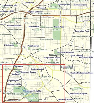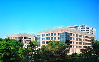
Grove Park is a northwest Atlanta, inside-the-perimeter neighborhood bounded by:

Cascade Heights is an affluent neighborhood in southwest Atlanta. It is bisected by Cascade Road, which was known as the Sandtown Road in the nineteenth century. The road follows the path of the ancient Sandtown Trail which ran from Stone Mountain to the Creek village of Sandtown on the Chattahoochee River and from there on into Alabama. Ironically, the name lived on even after the Indians were expelled in the 1830s.

Sylvan Hills is a historic intown neighborhood in southwest Atlanta, Georgia, United States.
Loring Heights is a neighborhood of just over 300 homes located in south Buckhead neighborhood of Atlanta, nestled between Peachtree Street, on the east, Northside Drive on the west, and Atlantic Station to the south. Like most of Buckhead, Loring Heights is part of City Council District 8 and is currently represented by Mary Norwood. The neighborhood provides relatively easy access to I-75/85, GA 400, and I-285.
Ormewood Park is a neighborhood on the east side of Atlanta, Georgia, United States.

Adair Park is a residential neighborhood located southwest of downtown Atlanta. It has the form of a left curly bracket, bordered by the MARTA north–south rail line on the northwest, the BeltLine trail on the southwest and Metropolitan Parkway on the east. Historically Adair Park also included the area from Metropolitan Parkway to McDaniel Street on the east, but the city now considers that area part of the Pittsburgh neighborhood.
Riverside is an intown neighborhood located on the Upper Westside of Atlanta. It is so named because it is situated along the Chattahoochee River.
The Perkerson neighbourhood is located in Southwest Atlanta, Georgia, in NPU-X. The name change was made at the request of residents and members of the Perkerson Civic Association (PCA) in order to keep people from confusing the neighbourhood with Perkerson Park, which is the large park that serves the area.
Chelsea Heights and Westchester Hills are adjacent neighborhoods, separated by a municipal park, in the northwest corner of the Atlanta, Georgia suburb of Decatur. Chelsea Heights straddles the east and west sides of the CSX railroad tracks, falling within the City of Decatur and the unincorporated DeKalb County, respectively. The latter part, though located east of what historically was Druid Hills, is part of the Druid Hills CDP and participates in the Druid Hills Civic Association: see Chelsea Heights.
Hunter Hills is a neighborhood located west of downtown Atlanta, Georgia, United States. Its motto, "One Community, One Family", has been its cornerstone since 2001. The neighborhood is encompassed in the 30314 zip code. Hunter Hills shares borders with Mozley Park, Dixie Hills and West Lake neighborhoods. The neighborhood rests just inside Atlanta's perimeter highway I-285, and U.S. Route 78. The schools that serve the neighborhood are Stanton Elementary, Carter G. Woodson Elementary School, Ron Clark Academy, Herndon Elementary and Washington High School, and the Atlanta Job Corps. City of Refuge, a community-based 501(c)(3) non-profit, was established on the 1300 block of Joseph E. Boone Blvd. in 2003 and helps to bring transformation to individuals and families through services including housing, health and wellness, vocational training, and youth development.

Chosewood Park is a neighborhood in southeast Atlanta, Georgia in the United States. It is located south of Peoplestown and Grant Park, west of Boulevard Heights and Benteen Park, northwest of Thomasville Heights and the Atlanta federal penitentiary, and northeast of South Atlanta and Lakewood Heights. It is situated directly on the path of the Atlanta Beltline, which has begun to acquire and develop properties along the rail lines in the Chosewood corridor, including the Boulevard Crossing Park.

Lakewood Heights is a primarily Black neighborhood in southeast Atlanta. It is bounded by:

Copenhill, Copenhill Park, or Copen Hill was a neighborhood of Atlanta, Georgia which was located largely where the Carter Center now sits, and which now forms part of the Poncey-Highland neighborhood.

Lenox Park is a neighborhood of homes and office buildings located primarily within the city of Brookhaven, Georgia, just east of the northern border of the city of Atlanta.
Brookwood is a neighborhood at the southernmost tip of the Buckhead Community of Atlanta. It should not be confused with Brookwood Hills, a neighborhood and historic district east of Brookwood across Peachtree Road.

Washington–Rawson was a neighborhood of Atlanta, Georgia. It included what is now Center Parc Stadium and the large parking lot to its north, until 1997 the site of Atlanta–Fulton County Stadium, as well as the I-20-Downtown Connector interchange. Washington and Rawson streets intersected where the interchange is today. To the northwest was Downtown Atlanta, to the west Mechanicsville, to the east Summerhill, and to the south Washington Heights, now called Peoplestown.

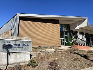
Scotts Crossing is a neighborhood on the Upper Westside of Atlanta.
Chelsea Heights is a neighborhood at the eastern end of the Druid Hills CDP in DeKalb County, Georgia. Although not part of the area historically considered Druid Hills, it participates in the Druid Hills Civic Association. It is a designated "character area" for which architectural guidelines and recommendations have been established.
Argonne Forest is an officially defined neighborhood of Atlanta in the Buckhead area of the city. Its population at the 2010 census was 590. The neighborhood is named after the Argonne Forest in northeastern France, where the American military was heavily involved in the 1918 Meuse-Argonne offensive of World War I.
Dixie Hills is a historic neighborhood of northwest Atlanta with a population of 1,756 (2010).


