The Wills Creek Bollman Bridge originally served the Baltimore and Ohio Railroad's Pittsburgh Division main line.
Yellow Creek is a 20.9-mile-long (33.6 km) tributary of the Raystown Branch Juniata River in Bedford County, Pennsylvania, in the United States.
Bobs Creek is a tributary of Dunning Creek in south west/south central Pennsylvania in the United States.
Dunning Creek is a 27.8-mile-long (44.7 km) tributary of the Raystown Branch Juniata River in south west/south central Pennsylvania in the United States.
Laurel Hill Creek is a 37.8-mile-long (60.8 km) tributary of the Casselman River in Somerset County, Pennsylvania, in the United States.

The Frankstown Branch Juniata River is a 46.0-mile-long (74.0 km) tributary of the Juniata River in Blair and Huntingdon Counties, Pennsylvania, in the United States.
Brush Creek is a 24.7-mile-long (39.8 km) tributary of the Raystown Branch Juniata River in Fulton and Bedford counties, Pennsylvania, in the United States.

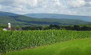
The Raystown Branch Juniata River is the largest and longest tributary of the Juniata River in south-central Pennsylvania in the United States.
Sideling Hill Creek is a 25.2-mile-long (40.6 km) tributary stream of the Potomac River in the U.S. states of Maryland and Pennsylvania. Sideling Hill Creek flows southward along the western flanks of Sideling Hill, from which the stream takes its name. It forms the boundary between Allegany and Washington counties in Maryland.
Tuscarora Creek is a 49.2-mile-long (79.2 km) tributary of the Juniata River in central Pennsylvania in the United States. It rises in eastern Huntingdon County, east of the borough of Shade Gap, and flows northeast between Tuscarora Mountain and Shade Mountain, reaching the Juniata River at Port Royal in Juniata County.
Little Aughwick Creek is a 10.8-mile-long (17.4 km) tributary of Aughwick Creek in Fulton and Huntingdon counties, Pennsylvania in the United States.
Codorus Creek is a 42.4-mile-long (68.2 km) tributary of the Susquehanna River in York County, Pennsylvania in the United States.

Great Trough Creek is a tributary of the Raystown Branch Juniata River in Bedford, Fulton and Huntingdon counties in Pennsylvania in the United States. The creek is 33.2 miles (53.4 km) long, flows northeast for half its length then northwest, and its watershed is 85.4 square miles (221.2 km2) in area.
Cocolamus Creek is a 22.1-mile-long (35.6 km) tributary of the Juniata River in Juniata and Perry counties, Pennsylvania in the United States.
Muddy Creek is a tributary of the Susquehanna River in York County, Pennsylvania, in the United States.
Sideling Hill Creek may refer to:
The Battle of Sideling Hill was an engagement between Pennsylvania colonial militia and a band of Native Americans that had recently attacked Fort McCord and taken a number of colonial settlers captive. On April 1, 1756, a band of Delawares, probably under the command of either Captain Jacobs or Shingas, stormed Fort McCord in western Pennsylvania, where they captured or killed 27 settlers. In response to the raid, three bands of militia were sent in pursuit. Captain Alexander Culbertson's company, numbering about 50, caught up with the Delawares three days later. In a two-hour engagement, both sides suffered heavy casualties, but the colonists were driven off by the arrival of reinforcements. Captain Culbertson was killed and his unit suffered 80 percent casualties.