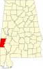
Silas, Alabama

Last updated

Silas, Alabama
Choctaw County Alabama Incorporated and Unincorporated areas Silas Highlighted 0170416.svg
Location of Silas in Choctaw County, Alabama.
Coordinates: 31°46′18″N88°19′52″W / 31.77167°N 88.33111°W / 31.77167; -88.33111
Country United States
State Alabama
County Choctaw
Area
[1]
  Total5.21 sq mi (13.49 km2)
  Land5.21 sq mi (13.49 km2)
  Water0.00 sq mi (0.00 km2)
Elevation
[2]
236 ft (72 m)
Population
 (2020)
  Total377
  Density72.40/sq mi (27.96/km2)
Time zone UTC-6 (Central (CST))
  Summer (DST) UTC-5 (CDT)
ZIP code
36919
Area code 251
FIPS code 01-70416
GNIS feature ID2407336 [2]
Website www.silasal.com

Silas is a town in Choctaw County, Alabama, United States. At the 2020 census, the population was 377.

Contents

The town was struck by a tornado on March 17, 2021. The tornado downed trees and inflicted minor damage to outbuildings and homes at EF1 strength. It reached EF2 strength well northeast of town and injured two people. [3] [4]

Geography

Silas is located in southern Choctaw County at 31°46'17.850" North, 88°19'51.568" West (31.771625, -88.330991). [5]

According to the U.S. Census Bureau, the town has a total area of 5.2 square miles (13.5 km2), all land. [6]

The town is located next to U.S. Route 84 near the Mississippi state line.

Demographics

Historical population
CensusPop.Note
1950 383
1960 353−7.8%
1970 345−2.3%
1980 343−0.6%
1990 245−28.6%
2000 529115.9%
2010 452−14.6%
2020 377−16.6%
U.S. Decennial Census [7]
2013 Estimate [8]

As of the census [9] of 2000, there were 529 people, 220 households, and 157 families residing in the town. The population density was 100.8 inhabitants per square mile (38.9/km2). There were 260 housing units at an average density of 49.5 per square mile (19.1/km2). The racial makeup of the town was 71.83% White, 25.71% Black or African American, 0.19% from other races, and 2.27% from two or more races. 0.19% of the population were Hispanic or Latino of any race.

There were 220 households, out of which 29.5% had children under the age of 18 living with them, 55.9% were married couples living together, 15.0% had a female householder with no husband present, and 28.6% were non-families. 27.7% of all households were made up of individuals, and 8.6% had someone living alone who was 65 years of age or older. The average household size was 2.40 and the average family size was 2.94.

In the town, the population was spread out, with 26.3% under the age of 18, 6.2% from 18 to 24, 28.0% from 25 to 44, 25.0% from 45 to 64, and 14.6% who were 65 years of age or older. The median age was 38 years. For every 100 females, there were 88.3 males. For every 100 females age 18 and over, there were 86.6 males.

The median income for a household in the town was $20,882, and the median income for a family was $25,833. Males had a median income of $27,955 versus $18,500 for females. The per capita income for the town was $14,074. About 16.5% of families and 19.0% of the population were below the poverty line, including 27.1% of those under age 18 and 11.6% of those age 65 or over.

Notable people

Related Research Articles

<span class="mw-page-title-main">Choctaw County, Alabama</span> County in Alabama, United States

Choctaw County is a county located in the southwestern portion of the U.S. state of Alabama. As of the 2020 census, the population was 12,665. The county seat is Butler. The county was established on December 29, 1847, and named for the Choctaw tribe of Native Americans.

<span class="mw-page-title-main">Butler, Alabama</span> City in and county seat of Choctaw County, Alabama

Butler is a town in and the county seat of Choctaw County, Alabama, United States. The population was 1,894 at the 2010 census.

<span class="mw-page-title-main">Gilbertown, Alabama</span> Town in Alabama, United States

Gilbertown is a town in Choctaw County, Alabama, United States. At the 2020 census, the population was 739.

<span class="mw-page-title-main">Lisman, Alabama</span> Town in Alabama, United States

Lisman is a town in Choctaw County, Alabama, United States. At the 2020 census, the population was 427. Lisman was named after a 19th-century railroad investor at the time of construction of the nearby rail line.

<span class="mw-page-title-main">Needham, Alabama</span> Town in Alabama, United States

Needham is a town in Choctaw County, Alabama, United States. It incorporated in 1981. At the 2020 census, the population was 73.

<span class="mw-page-title-main">Pennington, Alabama</span> Town in Alabama, United States

Pennington is a town in Choctaw County, Alabama, United States. At the 2010 census the population was 221, down from 353 in 2000.

<span class="mw-page-title-main">Toxey, Alabama</span> Town in Alabama, United States

Toxey is a town in Choctaw County, Alabama, United States. At the 2020 census, the population was 145.

<span class="mw-page-title-main">Winfield, Alabama</span> City in Alabama, United States

Winfield is a city in Marion and Fayette counties in the U.S. state of Alabama. The population was 4,845 at the 2020 census, the second largest city in Marion County.

<span class="mw-page-title-main">Phil Campbell, Alabama</span> Town in Alabama, United States

Phil Campbell is a town in Franklin County, Alabama, United States. At the 2020 census, the population was 992. It is one of two towns in Alabama to have the first and last name of an individual; the other being Susan Moore. It is the largest city in southern Franklin County.

<span class="mw-page-title-main">Greensboro, Alabama</span> City in Alabama, United States

Greensboro is a city in Hale County, Alabama, United States. At the 2010 census the population was 2,497, down from 2,731 at the 2000 census. The city is the county seat of Hale County, Alabama, which was not organized until 1867. It is part of the Tuscaloosa, Alabama Metropolitan Statistical Area.

<span class="mw-page-title-main">Edgewater, Alabama</span> CDP in Alabama, United States

Edgewater is a census-designated place in Jefferson County, Alabama, United States. It is northeast from the Birmingham suburb of Pleasant Grove. Its population was 883 at the 2010 census. This area was damaged by tornadoes on April 15, 1956 and April 8, 1998. The 1998 tornado was rated F5 on the Fujita scale.

<span class="mw-page-title-main">Smiths Station, Alabama</span> City in Alabama, United States

Smiths Station is a city in Lee County, Alabama, United States. It is part of the Columbus, Georgia metropolitan area. At the time of the 2000 census, it was still a census-designated place (CDP), and its population was 6,756. The area that incorporated as Smiths Station in 2001 was much smaller than the CDP, and contained a population of 4,926 by the 2010 census. Smiths Station, known to locals as "Smiths", is a bedroom community of Columbus, Georgia, and Phenix City, Alabama. Smiths Station High School has an enrollment of over 1,800 students and is the 11th-largest high school in the state.

<span class="mw-page-title-main">Hackleburg, Alabama</span> Town in Alabama, United States

Hackleburg is a town in Marion County, Alabama, United States. It incorporated on August 23, 1909. At the 2020 census, its population was 1,425, down from 1,516 at the 2010 census.

<span class="mw-page-title-main">Reform, Alabama</span> City in Alabama, United States

Reform is a city in Pickens County, Alabama, United States. At the 2010 census the population was 1,702, down from 1,978 in 2000. It is located approximately halfway between Columbus, Mississippi and Tuscaloosa on U.S. Route 82.

<span class="mw-page-title-main">Ragland, Alabama</span> Town in Alabama, United States

Ragland is a town in St. Clair County, Alabama, United States southeast of Ashville. It incorporated in 1899. At the 2020 census, the population was 1,693, up slightly from 1,639 in 2010. It is part of the Birmingham-Hoover-Cullman Combined Statistical Area.

<span class="mw-page-title-main">Livingston, Alabama</span> City in Alabama, United States

Livingston is a city in and the county seat of Sumter County, Alabama, United States and the home of the University of West Alabama. By an act of the state legislature, it was incorporated on January 10, 1835. At the 2010 census the population was 3,485, up from 3,297 in 2000. It was named in honor of Edward Livingston, of the Livingston family of New York.

<span class="mw-page-title-main">McIntosh, Alabama</span> Town in Alabama, United States

McIntosh,, is a town located in Washington County, Alabama, United States along U.S. Route 43. It is 12+12 miles (20.1 km) south of Wagarville and 44 miles (71 km) north of Mobile. The population as of the 2020 U.S. Census was 206, down from 238 in 2010.

<span class="mw-page-title-main">Kennard, Indiana</span> Town in Indiana, United States

Kennard is a town in Greensboro Township, Henry County, Indiana, United States. The population was 471 at the 2010 census.

<span class="mw-page-title-main">Leedey, Oklahoma</span> Town in Oklahoma, United States

Leedey is a town in Dewey County, Oklahoma, United States. The population was 415 at the 2020 census.

<span class="mw-page-title-main">Choctaw, Oklahoma</span> City in Oklahoma, United States

Choctaw is a city in Oklahoma County, Oklahoma, United States, with a population of 12,182 at the 2020 census, a 9.3% increase from 2010. It is the oldest chartered town in Oklahoma Territory. The city is located approximately 10 miles (16.1 km) east of Oklahoma City and is part of the Oklahoma City metropolitan area.

References

  1. "2020 U.S. Gazetteer Files". United States Census Bureau. Retrieved October 29, 2021.
  2. 1 2 U.S. Geological Survey Geographic Names Information System: Silas, Alabama
  3. "St Patrick's Day Tornado/Severe Weather Event". National Oceanic and Atmospheric Administration. National Weather Service Weather Forecast Office in Mobile, Alabama. Retrieved March 22, 2021.
  4. "NWS Damage Survey for 03/17/21 Tornado Event Update #15". Iowa Environmental Mesonet. National Weather Service Weather Forecast Office in Birmingham, Alabama. March 22, 2021. Retrieved March 22, 2021.
  5. "US Gazetteer files: 2010, 2000, and 1990". United States Census Bureau. February 12, 2011. Retrieved April 23, 2011.
  6. "Geographic Identifiers: 2010 Demographic Profile Data (G001): Silas town, Alabama". U.S. Census Bureau, American Factfinder. Archived from the original on February 12, 2020. Retrieved June 5, 2014.
  7. "U.S. Decennial Census". Census.gov. Retrieved June 6, 2013.
  8. "Annual Estimates of the Resident Population: April 1, 2010 to July 1, 2013" . Retrieved June 3, 2014.
  9. "U.S. Census website". United States Census Bureau . Retrieved January 31, 2008.

31°46′18″N88°19′52″W / 31.771625°N 88.330991°W / 31.771625; -88.330991