Related Research Articles

Haida Gwaii, also known as the Queen Charlotte Islands, is an archipelago located between 55–125 km (34–78 mi) off the northern Pacific coast in the Canadian province of British Columbia. The islands are separated from the mainland to the east by the shallow Hecate Strait. Queen Charlotte Sound lies to the south, with Vancouver Island beyond. To the north, the disputed Dixon Entrance separates Haida Gwaii from the Alexander Archipelago in the U.S. state of Alaska.

Princess Royal Island is the largest island on the North Coast of British Columbia, Canada. It is located amongst the isolated inlets and islands east of Hecate Strait on the British Columbia Coast. At 2,251 square kilometres (869 sq mi), it is the fourth largest island in British Columbia. It was named in 1788 by Captain Charles Duncan, after his ship Princess Royal.
The North Coast Regional District is a quasi-municipal administrative area in British Columbia. It is located on British Columbia's west coast and includes Haida Gwaii, the largest of which are Graham Island and Moresby Island. Its administrative offices are in the City of Prince Rupert.

Skidegate is a Haida community in Haida Gwaii in British Columbia, Canada. It is on the southeast coast of Graham Island, the largest island in the archipelago, and is approximately 50 kilometres (31 mi) west of mainland British Columbia across Hecate Strait.
Sandspit is the largest community on Moresby Island, in Haida Gwaii off the Pacific coast of British Columbia, Canada. The only town on Moresby Island, Sandspit has accommodations, a campground, supermarket and 85-berth harbour serving visitors to Gwaii Haanas National Park Reserve and Haida Heritage Site.

The ƛoʔos Klahoose are one of the three groups comprising the ʔayʔaǰuθəm Tla'Amin or Mainland Comox. The other two divisions of this once-populous group are the χʷɛmaɬku Homalco and Sliammon. The Klahoose, Homalco and Sliammon are, according to oral tradition, the descendants of the survivors of the Great Flood. The three groups were split by colonialism into different band councils but united historically as the Tla A'min, known as the Mainland Comox, and K’ómoks, the larger grouping of the Comox people, also known as the Island Comox and before the merger with the Laich-kwil-tach culture. Historically both groups are a subgroup of the Coast Salish though the K’ómoks name is from, and their language today, is the Lik'wala dialect of Kwak'wala. The ancestral tongue is the Comox language, though the Sahtloot/Island dialect is extinct.

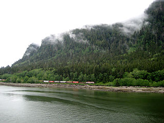
Skidegate Channel is a strait located in the Haida Gwaii archipelago of British Columbia, Canada. It divides the archipelago's two main islands, Graham Island to the north and Moresby Island to the south.
The Yakoun River is the largest river of Haida Gwaii, in the province of British Columbia, Canada. Located on Graham Island it flows about 58 km (36 mi) from Yakoun Lake north to Masset Inlet, a large saltwater bay located in the heart of the Graham Island and connected to the Pacific Ocean at Dixon Entrance via a long narrow inlet called Masset Sound.

New Clew, also Clue, Kloo, Kliew, Klue, Clew Indian Reserve, is a locality and First Nations reserve of the Haida people, located on the north shore of Louise Island, which is located in Cumshewa Inlet on Haida Gwaii, formerly known as the Queen Charlotte Islands, of the North Coast of British Columbia, Canada.

Cumshewa is a former village of the Haida people located on the north flank of Cumshewa Inlet in the Haida Gwaii of the North Coast of British Columbia, Canada. It is named for Cumshewa, an important Haida chief during the era of the Maritime Fur Trade, as is Cumshewa Head, an important headland and point on the north side of the opening of Cumshewa Inlet, which pierces Moresby Island from the east and was the location of several historical Haida villages.
Cumshewa Inlet, also recorded or referred to in exploration logs as Cumchewas Harbour and Tooscondolth Sound, is a large inlet on the east coast of Moresby Island in the Haida Gwaii islands of the North Coast of British Columbia. The inlet was the site of various Haida villages, including Cumshewa, Tanu and Djí-gua. The name for the inlet was conferred in the days of the Maritime Fur Trade following a custom whereby captains named locations for the most important local chief, in this case Cumshewa, who figures in maritime fur trade vessel logs from 1787 onwards. In 1794 Cumshewa and his followers massacred the crew of the American trading vessel Resolution in Cumshewa Inlet.

Louise Island is a 275-square-kilometre (106 sq mi) island in Haida Gwaii, in British Columbia, Canada, off the east coast of Moresby Island and just north of Laskeek Bay. It was named for Princess Louise, Duchess of Argyll, fourth daughter of Queen Victoria. Louise Island is located east of Moresby Island and Carmichael Passage, and south of Cumshewa Inlet.
Smith Sound is a sound on the Central Coast of British Columbia, Canada, located to the south of Rivers Inlet and between the Queen Charlotte Strait region (S) and Fitz Hugh Sound (N).
Old Massett Village Council is a band government of the Haida people, located in Old Massett, on Haida Gwaii. Old Massett Village Council is one of two Canadian band governments for the Haida Nation, the other is the Skidegate Band Council. The main governing body of the Haida people is the Council of the Haida Nation.
The Gitga'at First Nation is a Canadian First Nation, also known as the Hartley Bay First Nation. The members of the Gitga'at First Nation are often referred to as Gitka'a'ata. The population of Gitk’a’ata peoples living in Hartley Bay is approximately 140 as of November, 2024. There are also about 400-500 Gitk’a’ata peoples living in Prince Rupert, British Columbia, Canada, a neighboring territory. The Gitk’a’ata people have lived in Hartley Bay for hundreds of years, or longer. During the COVID-19 pandemic there were requirements for visiting Hartley Bay, such as vaccination status and British Columbian passport.
The Kitasoo/Xaixais First Nation, also known as the Kitasoo/Xaixais Nation, is the band government of the First Nations people of Klemtu, British Columbia, Canada. The band comprises two ethnic groups who share an ancient alliance, the Kitasoo, a Tsimshian group, and the Xai'xais, a north-wakashan speaking group. The government is a member of the Oweekeno-Kitasoo-Nuxalk Tribal Council and a member of the Tsimshian First Nations treaty council.

Skidegate Inlet is a broad inlet on the east coast of the Haida Gwaii archipelago of the North Coast of British Columbia, Canada. It is the easternmost of a series of waterways separating Graham Island to the north from Moresby Island to the south.

Tanu is a traditional Haida village site located on Tanu Island, Haida Gwaii, opposite of Kung'a Island in Laskeek Bay, within the Gwaii Haanas National Park Reserve and Haida Heritage Site.

Various Imperial and colonial actions against Haida Gwaii Authorities have been undertaken since the 19th century. The indigenous peoples of Haida Gwaii often reacted violently to European and American ships which trespassed in their waters and lands. From the 18th to 19th centuries, various skirmishes took place between Haida authorities and European and American merchantmen and warships. Canadian settlers did not arrive on Haida Gwaii islands until 1900, and many Canadian colonial police actions attempted to assault the Haida Gwaii authorities and citizens. The indigenous Haida population was decimated by diseases such as smallpox which were introduced accidentally by way of Fort Victoria. The presence of foreign diseases, to which the Haida had no immunity, along with some colonial hostility, meant that the numbers of Haida citizens was reduced from tens of thousands to 588 by 1915. This erosion of Haida cultural institutions was essential to open the way for subsequent British and Canadian incursions and jurisdictional claims.