Slunj

Last updated
Slunj
Grad Slunj
Town of Slunj
Trg Zrinskih panorama.jpg
Zrinski Square in Slunj
Slunj
Croatia location map.svg
Red pog.svg
Slunj
Location of Slunj in Croatia
Coordinates: 45°06′56″N15°35′05″E / 45.11556°N 15.58472°E / 45.11556; 15.58472
Country Flag of Croatia.svg  Croatia
County Flag of Karlovac county.svg  Karlovac County
Government
  MayorMirjana Puškarić (HDZ)
Area
[1]
   Town 393.4 km2 (151.9 sq mi)
  Urban
5.1 km2 (2.0 sq mi)
Elevation
258 m (846 ft)
Population
 (2021) [2]
   Town 4,224
  Density11/km2 (28/sq mi)
   Urban
1,576
  Urban density310/km2 (800/sq mi)
Time zone UTC+1 (CET)
  Summer (DST) UTC+2 (CEST)
Area code 047
Website slunj.hr
Franjo Tudman Square in the town center Slunj, Trg Dr. Franje Tudmana.jpg
Franjo Tuđman Square in the town center

Slunj (Hungarian Szluin, old German Sluin, Latin Slovin, archaic Croatian Slovin grad) is a town in the mountainous part of Central Croatia, located along the important North-South route to the Adriatic Sea between Karlovac and Plitvice Lakes National Park, on the meeting of the rivers Korana and Slunjčica. Slunj has a population of 1,674, with a total of 5,076 people in the municipality (2011) [3] and is the cultural and social center of the region of Kordun in the vicinity to Bosnia and Herzegovina. Administratively, the town is part of Karlovac County. Slunj is an underdeveloped municipality which is statistically classified as part of the First Category Area of Special State Concern by the Government of Croatia. [4]

Contents

History

An old fortification of the Frankopans, built during the wars against the Turks, Slovin was first mentioned in the 12th century. The old fort was property of the Frankopan (Hungarian Frangepán) family since the 15th century, joined by an old Franciscan monastery from the same period. Later, this town has been called Slunj. In the 16th century the town was ravaged by the Ottoman wars and turned into a military outpost of the Croatian Military Frontier, but by the end of the 17th century the settlement was rebuilt into the Slunj as it exists today. The castle has been developed to a fortress and served as headquarters for the commanding general of this area (see Stari grad Slunj). After the Treaty of Sistova in 1791 people increasingly began to re-settle in this area.

During the short French governance period from 1809 until 1813, Slunj encountered an economic boom as streets, storage facilities and mills were built and as vineyards and mulberry trees were planted. At this point of time, the Croatian language has become official language of the country. The residence of the former governor general of the French Illyrian Provinces, marshal Auguste de Marmont, still exists.

The town of Slunj was first mentioned in a written document by the chronicler Johann Weikhard von Valvasor who reported about the fortified town of Slunj, a bridge and a mill in 1689. The first illustration of the mills of Rastoke dates back from 1789. It was a copper engraving that has been added to a description by Belsazar Hacquet. At the end of the 19th century, Stjepan Širola wrote the following about this place: "The surroundings of Slunj are downright romantic […]. They are crowned by the magnificent waterfalls of the Slunjčica river by which even not outspoken nature lovers will be captivated. Indeed, Slunj with its romantic surroundings and the silver waterfalls of the Slunjčica represent a true nature gem astonishing even to foreigners."

Until 1918, Slunj (named SZLUIN [5] ) was part of the Austrian monarchy (Kingdom of Croatia-Slavonia, Modruš-Rijeka County, after the compromise of 1867), in the Croatian Military Frontier. [6] It was administered by the SZLUINER Grenz-Infanterie-Regiment N°IV before 1881. Slunj became a district capital in the Modruš-Rijeka County in the Kingdom.

The Cazin uprising of 1950, an armed anti-state rebellion of peasants, which mostly affected the Bosnian towns Cazin and Velika Kladuša, also affected Slunj to a lesser extent. All of the cities were a part of Communist Yugoslavia at the time. [7] Peasants revolted against the forced collectivization and collective farms by the Yugoslav government on the farmers of its country. Following a drought in 1949, the peasants of Yugoslavia were unable to meet unrealistic quotas set by their government and were punished. The revolt that followed the drought resulted in the killings and persecution of those who organized the uprising, but also many innocent civilians. [8] [9] It was the only peasant rebellion in the history of Cold War Europe. [10]

Rastoke waterfall Rastoke, Slunj, Croatia, waterfall.JPG
Rastoke waterfall

In 1963, the Austrian writer Heimito von Doderer published the novel The Waterfalls of Slunj (German : Die Wasserfälle von Slunj) which features a climactic sequence set in this locality. [11] During the 20th century scientific research studies were carried out in the Slunj area and particularly its Rastoke district. During the 19th century and at the beginning of the 20th century Rastoke has been the center of social life in this region. With the development of the electric mill and massive emigration after the Second World War the economic significance of the mills in Rastoke has declined drastically.

Places of interest

Slunj is famous for its little waterfalls and the well-preserved corn mills (dating back to the 18th century) in the picturesque lower part of the town, called Rastoke (referring to the branching of the rivers). At Slunj, the Slunjčica river (also called “Slušnica“ by local people) flows over several waterfalls and cascades into the Korana river. Here is also the location of the 22 water mills of Rastoke.

Population

As of 2011, most of Slunj's population is Croatian (87.9%) followed by Serbs (10.5%) and a small number of other ethnic groups. [12]

Town of Slunj: Population trends 1857–2021
population
19430
19412
18110
20498
20724
21035
18749
21256
17004
16518
15798
13629
11799
10096
6096
5076
4224
18571869188018901900191019211931194819531961197119811991200120112021

Settlements

The settlements in the Town of Slunj is: [3]

Sport

Football

Although Slunj is very small, it has many sport clubs. Most famous are the football club NK Slunj and MNK Drenak. There are two football fields in Slunj. One is situated in the center of Slunj and popularly called Gradsko igralište (Town field) and the other is Zubac, which is the official turf of NK Slunj.

Koranski susreti

On the last day of "Dani grada Slunja" (festivity called Days of the city of Slunj), which usually takes place at the beginning of August, games are organized on main swimming area on the river Korana. Participating teams compete in many games like swimming and snorkeling and many other.

Notable people

Acknowledgements

Twin towns

Mississauga, Canada

Related Research Articles

<span class="mw-page-title-main">Karlovac</span> City in Karlovac County, Croatia

Karlovac is a city in central Croatia. In the 2021 census, its population was 49,377.
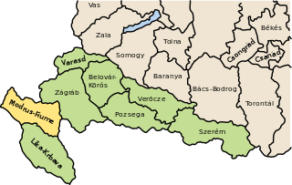
<span class="mw-page-title-main">Modruš-Rijeka County</span> Historic county of the Kingdom of Croatia-Slavonia

The Modruš-Rijeka County was a historic administrative subdivision of the Kingdom of Croatia-Slavonia. Croatia-Slavonia was an autonomous kingdom within the Lands of the Crown of Saint Stephen (Transleithania), the Hungarian part of the dual Austro-Hungarian Empire. Its territory is now in western Croatia. Modruš is a small town near Ogulin; Rijeka is a large city on the Adriatic coast. However, Rijeka was not part of the Modruš-Rijeka County, but under the direct administration of Hungary. The capital of the county was Ogulin.
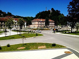
<span class="mw-page-title-main">Cazin</span> City in Federation of Bosnia and Herzegovina, Bosnia and Herzegovina

Cazin is a city located in Una-Sana Canton of the Federation of Bosnia and Herzegovina, an entity of Bosnia and Herzegovina. It is situated in northwest Bosnia and Herzegovina in the Bosanska Krajina region, near the border with Croatia. As of 2013, it has a population of 66,149 inhabitants. The municipality is often also called Cazinska Krajina. The town of Cazin is located on the main road which connects Bihać and Velika Kladuša.

<span class="mw-page-title-main">Cetingrad</span> Municipality in Karlovac County, Croatia

Cetingrad is a municipality in Karlovac County, Croatia near Croatia's border with Bosnia. The population of the village itself is 319, while the total municipality population is 2,027 (2011). The municipality is part of Kordun. Cetingrad is underdeveloped municipality which is statistically classified as the First Category Area of Special State Concern by the Government of Croatia.

<span class="mw-page-title-main">Velika Kladuša</span> Town and municipality in Federation of Bosnia and Herzegovina, Bosnia and Herzegovina

Velika Kladuša is a town and municipality located in the Una-Sana Canton of the Federation of Bosnia and Herzegovina, an entity of Bosnia and Herzegovina. It is situated in the far northwest of Bosnia and Herzegovina, located near the border with Croatia. As of 2013, it has a population of 40,419 inhabitants.

<span class="mw-page-title-main">Korana</span> River in Croatia, Bosnia and Herzegovina

The Korana is a river in central Croatia and west Bosnia and Herzegovina. The river has a total length of 138.6 km (86.1 mi) and watershed area of 2,301.5 km2 (888.6 sq mi).

<span class="mw-page-title-main">Delnice</span> Town in Primorje-Gorski Kotar, Croatia

Delnice is a town in western Croatia, the largest settlement in the mountainous region of Gorski Kotar, in the Primorje-Gorski Kotar County. The town has a population of 4,379, and total municipality population is 5,952 (2011). Delnice is Gorski Kotar's main town.
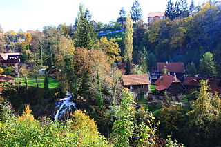
<span class="mw-page-title-main">Rastoke</span> Settlement in Karlovac County, Croatia

Rastoke is a village, located in the Town of Slunj, known for the Slunjčica River, which flows into the Korana River at Rastoke.
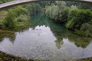
<span class="mw-page-title-main">Slunjčica</span> River in Croatia

The Slunjčica is a river, which flows through the Kordun region in central Croatia. It partly flows underground through porous karst and surfaces in the vicinity of the city of Slunj. At Rastoke the Slunjčica leads into the river Korana, which reaches this point after passing the Plitvice Lakes National Park. The city of Slunj bears its name from this river. Due to its underground course the Slunjčica river has a quite cold temperature even during summer and the nearby situated towns use it as drinking water.

<span class="mw-page-title-main">Plitvička Jezera</span> Municipality in Lika-Senj, Croatia

Plitvička Jezera is a municipality (općina) in central Croatia, in the eastern part of the Lika-Senj county, that lies in and near the eponymous Plitvice Lakes National Park, bisected by the D1 main road (Zagreb–Split). Its total area is 539.08 km2 The main town and seat of the municipality is Korenica. Smaller towns and villages are Bjelopolje, Jezerce, and Ličko Petrovo Selo.

<span class="mw-page-title-main">Glina, Croatia</span> Town in Continental Croatia, Croatia

Glina is a town in central Croatia, located southwest of Petrinja and Sisak in the Sisak-Moslavina County. It lies on the eponymous river Glina.

<span class="mw-page-title-main">Krnjak</span> Municipality in Karlovac County, Croatia

Krnjak is a village and a municipality in Karlovac County, Croatia.

<span class="mw-page-title-main">Brod Moravice</span> Municipality in Gorski Kotar, Croatia

Brod Moravice is a municipality in the Primorje-Gorski Kotar County in western Croatia.
<span class="mw-page-title-main">Čabar</span> Town in Primorje-Gorski Kotar, Croatia

Čabar is a town in Primorje-Gorski Kotar County in western Croatia. There are 3,770 inhabitants, in the following settlements:
<span class="mw-page-title-main">Barilović</span> Village in Karlovac County, Croatia

Barilović is a village and a municipality in central Croatia, in the Karlovac County.

The Battle of Logorište was fought east of Duga Resa and south of Karlovac, Croatia, from 4–6 November 1991 during the Croatian War of Independence, between the Croatian National Guard and the Yugoslav People's Army. The ZNG placed the JNA-held Logorište barracks under a blockade as part of the countrywide Battle of the Barracks, which aimed to pin down JNA units isolated in their bases and force them to surrender weapons and ammunition to the ZNG. However, the JNA garrison broke out from the besieged barracks with part of its stored equipment before the ZNG claimed the vacant base. The breakout was supported by JNA units and SAO Krajina units deployed to lift the blockade of the barracks and other JNA garrisons in Karlovac. A battle ensued as the ZNG attempted to contain advancing JNA units, ending with a ceasefire signed in The Hague.

The Cazin rebellion was an armed anti-state rebellion of peasants that occurred in May 1950 in the towns of Cazin and Velika Kladuša in the Bosanska Krajina region, as well as Slunj in Croatia, at that time part of Communist Yugoslavia. The peasants revolted against the forced collectivization and collective farms set up by the Yugoslav government following a drought in 1949, after which they had been punished due to their inability to meet the quotas. The ringleaders were persecuted and some killed, including many innocent civilians.

<span class="mw-page-title-main">Budački castle</span>

Budački or Gorica is a ruined castle on the left bank of the river Rijeka, which flows into the Radonja, a tributary of the Korana. It had a rectangular floorplan, and every corner had its own tower, making it one of the stronger fortifications of the region.

References

  1. Register of spatial units of the State Geodetic Administration of the Republic of Croatia. Wikidata   Q119585703.
  2. "Population by Age and Sex, by Settlements" (xlsx). Census of Population, Households and Dwellings in 2021. Zagreb: Croatian Bureau of Statistics. 2022.
  3. 1 2 "Population by Age and Sex, by Settlements, 2011 Census: Slunj". Census of Population, Households and Dwellings 2011. Zagreb: Croatian Bureau of Statistics. December 2012.
  4. Lovrinčević, Željko; Davor, Mikulić; Budak, Jelena (June 2004). "AREAS OF SPECIAL STATE CONCERN IN CROATIA- REGIONAL DEVELOPMENT DIFFERENCES AND THE DEMOGRAPHIC AND EDUCATIONAL CHARACTERISTICS". Ekonomski pregled, Vol.55 No.5-6. Retrieved 25 August 2018.
  5. Name of the Austrian post-office opened in 1864.
  6. Handbook of Austria and Lombardy-Venetia Cancellations on the Postage Stamp Issues 1850-1864, by Edwin MUELLER, 1961.
  7. "CAZINSKA BUNA 1950: Danas se navršavaju 62 godine od ustanka u Krajini". Cazin. 6 May 2012. Archived from the original on 9 June 2012. Retrieved 11 February 2014.
  8. "Klanjana kolektivna dženaza žrtvama Cazinske bune iz 1950. godine". Haber. 11 May 2012. Archived from the original on 22 February 2014. Retrieved 11 February 2014.
  9. "Vera Kržišnik Bukić i Cazinska buna". Radio Sarajevo. 4 May 2012. Archived from the original on 22 February 2014. Retrieved 11 February 2014.
  10. Mueller, Andrew (2010). Rock and Hard Places: Travels to Backstages, Frontlines and Assorted Sideshows. ISBN   9781593763794 . Retrieved 11 February 2014.[ permanent dead link ]
  11. Doderer Gesellschaft. Heimito von Doderer. Die Wasserfälle von Slunj.
  12. "Population by Ethnicity, by Towns/Municipalities, 2011 Census: County of Karlovac". Census of Population, Households and Dwellings 2011. Zagreb: Croatian Bureau of Statistics. December 2012.
  13. "World recognition for the Croatian town of Slunj". croatiaweek.com. Croatia Week. 23 October 2023. Retrieved 23 October 2023.