Smithville Flats, New York | |
|---|---|
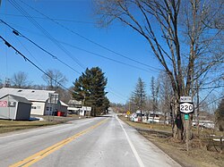
| New York State Route 220 northbound in Smithville Flats, New York. | |
| Coordinates: 42°23′42″N75°48′29″W / 42.39500°N 75.80806°W | |
| Country | United States |
| State | New York |
| County | Chenango |
| Town | Smithville |
| Area | |
• Total | 1.42 sq mi (3.68 km2) |
| • Land | 1.42 sq mi (3.68 km2) |
| • Water | 0.00 sq mi (0.00 km2) |
| Elevation | 1,024 ft (312 m) |
| Population (2020) | |
• Total | 303 |
| • Density | 213.08/sq mi (82.27/km2) |
| Time zone | UTC-5 (Eastern (EST)) |
| • Summer (DST) | UTC-4 (EDT) |
| ZIP code | 13841 |
| Area code | 607 |
| GNIS feature ID | 965536 [2] |
Smithville Flats is a census-designated place and hamlet in the town of Smithville, Chenango County, New York, United States. [2] The zipcode is 13841. [3] Its population was 351 as of the 2010 census. [4]
In the 2020 census, Smithville Flats had 303 people, 164 households, and 158 housing units. The racial demographics were 92.7% White, 1.3% African American, 0.6% Asian, 0.6% from some other race, and 4.6% from two or more races. The median age was 38.4 years old. 11.9% of the population were 65 or older, 9.3% of the population were between the ages of 65 and 74, 2.0% between the ages of 75 and 84, and 0.6% were 85 or older. [5]
The median income of Smithville Flats was $55,938. Families had a median income of $69,063 and non-families had a median income of $29,135. The CDP had a poverty rate of 11.9%. Children had a poverty rate of 20%, adults had a poverty rate of 9.1%, and seniors had a poverty rate of 7.3%. [5]
The ancestry of the CDP was 26.2% Irish, 13.4% American, 11.9% Welsh, 7.6% English, 6.7% German, 3.8% Dutch, 3.5% Italian, and 2.3% West Indian. [6]
| Census | Pop. | Note | %± |
|---|---|---|---|
| 2020 | 303 | — | |
| U.S. Decennial Census [7] | |||