Coventry, New York | |
---|---|
Coordinates: 42°17′51″N75°37′41″W / 42.29750°N 75.62806°W | |
Country | United States |
State | New York |
County | Chenango |
Government | |
• Type | Town Council |
• Town Supervisor | John M. Phelan, Sr. (R) |
• Town Council | Members' List |
Area | |
• Total | 48.68 sq mi (126.09 km2) |
• Land | 48.52 sq mi (125.65 km2) |
• Water | 0.17 sq mi (0.43 km2) |
Elevation | 1,578 ft (481 m) |
Population (2010) | |
• Total | 1,655 |
• Estimate (2016) [2] | 1,596 |
• Density | 32.90/sq mi (12.70/km2) |
Time zone | UTC-5 (Eastern (EST)) |
• Summer (DST) | UTC-4 (EDT) |
ZIP code | 13778 |
Area code | 607 |
FIPS code | 36-017-18619 |
GNIS feature ID | 0978873 |
Website | townofcoventryny |
Coventry is a town in Chenango County, New York, United States. The population was 1,655 at the 2010 census. [3] The town is named after Coventry, Connecticut, by settlers from New England. Coventry is in the southern part of Chenango County and is northeast of Binghamton.
The first settlement took place circa 1785 near the current Coventry village. Coventry was formed from the town of Greene in 1806. In 1843, the area of the town was increased from parts of Greene and the town of Oxford.
Due to poor soil conditions, dairy herding was prominent from the pioneer days, leading to five butter and cheese factories in the town at one time in the past.
District School 4 was listed on the National Register of Historic Places in 2004. [4]
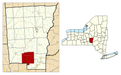
According to the United States Census Bureau, the town has a total area of 48.9 square miles (126.6 km2), of which 48.7 square miles (126.1 km2) is land and 0.15 square miles (0.4 km2), or 0.34%, is water. [3]
Part of the southern town line is the border of Broome County.
Conjoined New York State Route 41 and New York State Route 206 intersect New York State Route 235, a north–south highway, at Coventry village.
Census | Pop. | Note | %± |
---|---|---|---|
1820 | 1,431 | — | |
1830 | 1,576 | 10.1% | |
1840 | 1,681 | 6.7% | |
1850 | 1,677 | −0.2% | |
1860 | 1,671 | −0.4% | |
1870 | 1,490 | −10.8% | |
1880 | 1,317 | −11.6% | |
1890 | 1,166 | −11.5% | |
1900 | 987 | −15.4% | |
1910 | 764 | −22.6% | |
1920 | 733 | −4.1% | |
1930 | 780 | 6.4% | |
1940 | 722 | −7.4% | |
1950 | 796 | 10.2% | |
1960 | 859 | 7.9% | |
1970 | 974 | 13.4% | |
1980 | 1,271 | 30.5% | |
1990 | 1,517 | 19.4% | |
2000 | 1,589 | 4.7% | |
2010 | 1,655 | 4.2% | |
2016 (est.) | 1,596 | [2] | −3.6% |
U.S. Decennial Census [5] |
As of the census [6] of 2000, there were 1,589 people, 577 households, and 428 families residing in the town. The population density was 32.6 inhabitants per square mile (12.6/km2). There were 757 housing units at an average density of 15.5 per square mile (6.0/km2). The racial makeup of the town was 99.06% White, 0.25% African American, 0.19% Native American, 0.06% Asian, and 0.44% from two or more races. Hispanic or Latino of any race were 0.94% of the population.
There were 577 households, out of which 36.7% had children under the age of 18 living with them, 62.0% were married couples living together, 5.4% had a female householder with no husband present, and 25.8% were non-families. 19.8% of all households were made up of individuals, and 5.9% had someone living alone who was 65 years of age or older. The average household size was 2.75 and the average family size was 3.14.
In the town, the population was spread out, with 28.8% under the age of 18, 6.5% from 18 to 24, 30.9% from 25 to 44, 24.4% from 45 to 64, and 9.5% who were 65 years of age or older. The median age was 36 years. For every 100 females, there were 105.0 males. For every 100 females age 18 and over, there were 104.3 males.
The median income for a household in the town was $35,769, and the median income for a family was $38,906. Males had a median income of $30,272 versus $19,946 for females. The per capita income for the town was $14,807. About 10.7% of families and 14.9% of the population were below the poverty line, including 18.4% of those under age 18 and 10.0% of those age 65 or over.
Coventry is twinned with:
Barker is a town in Broome County, New York, United States. The population was 2,516 at the 2020 census. The town is named after John Barker, an early settler. The town is in the northern part of Broome County and is north of Binghamton.
Chenango is a town in Broome County, New York, United States. The population was 10,983 at the 2020 census.
Colesville is a town in Broome County, New York, United States. The population was 4,877 at the 2020 census.
Fenton is a town in Broome County, New York, United States. The population was 6,441 at the 2020 census. The town was named after Reuben Fenton, a governor of New York.
Triangle is a town in Broome County, New York, United States. The population was 2,946 at the 2010 census. The town's primary settlement is the village of Whitney Point.
Columbus is a town in Chenango County, New York, United States. The population was 975 at the 2010 census. Columbus is in the northeastern corner of the county and is northeast of Norwich.
Lincklaen is a town in Chenango County, New York, United States. The population was 396 at the 2010 census. The town was named after Colonel John Lincklaen, an agent of the Holland Land Company and a land owner. The town is in the northwestern corner of the county, northwest of the city Norwich and northeast of Cortland.
McDonough is a town in Chenango County, New York, United States. The population was 886 at the 2010 census. The town is named after Thomas Macdonough, a naval officer who served on Lake Champlain and other locations. McDonough is located in the western part of Chenango County, west of Norwich.
North Norwich is a town in Chenango County, New York, United States. The population was 1,783 at the 2010 census. The town is directly north of the City of Norwich in the eastern half of the county.
Pharsalia is a town in Chenango County, New York, United States. The population was 593 at the 2010 census. The town was named after Pharsalia, which is a commonly accepted name of the decisive battle in the Great Roman Civil War, where Julius Caesar defeated Pompey in 48 BCE.
Pitcher is a town in Chenango County, New York, United States. The population was 803 at the 2010 census. The town is named after Nathaniel Pitcher, the eighth governor of New York. The town is on the western border of Chenango County, west of the city of Norwich.
Plymouth is a town in Chenango County, New York, United States. The population was 1,804 at the 2010 census. It is an interior town in the northern part of the county. The town is northwest of the city of Norwich. Plymouth was also known as Plymouth Rock.
Preston is a town in Chenango County, New York, United States. The population was 1,044 at the 2010 census. Preston is an interior town of Chenango County and is west of the city of Norwich.
Smithville is a town in Chenango County, New York, United States. The population was 1,330 at the 2010 census. The town is at the western border of Chenango County, west of the city of Norwich.
Willet is a town in Cortland County, New York, United States. The population was 1,043 at the 2010 census. The town is named after Colonel Marinus Willet. It is in the southeast corner of the county, southeast of the City of Cortland.
West Union is a town in Steuben County, New York, United States. The population was 343 as of the 2020 decennial census.
Greene is a town in Chenango County, New York, United States. The population was 5,604 at the 2010 census. The town is named after General Nathanael Greene. It is located in the southwestern corner of the county and contains a village, also named Greene. The town and village are northeast of Binghamton. Greene was founded in 1792, but commenced in 1798.
New Berlin is a town in Chenango County in central New York, United States. The population was 2,682 at the 2010 census. The town contains the village of New Berlin. The town is at the eastern border of the county and is northeast of Norwich.
Oxford is a town in Chenango County, New York, United States. The town contains a village also named Oxford. Oxford is an interior town in the south-central part of the county, southwest of the city of Norwich. At the 2010 census the town population was 3,901. The name derives from that of the native town of an early landowner from New England.
Smyrna is a village in Chenango County, New York, United States. The population was 213 at the 2010 census. The village is located in the town of Smyrna and is near the northern border of Chenango County.