Southampton, Pennsylvania

Last updated

Southampton
Southampton, PA.jpg
Approaching PA 132 from PA 232 southbound
USA Pennsylvania location map.svg
Red pog.svg
Southampton
Location of Southampton in Pennsylvania
Coordinates: 40°10′27″N75°02′38″W / 40.17417°N 75.04389°W / 40.17417; -75.04389
CountryUnited States
StatePennsylvania
County Bucks
Township Upper Southampton
Elevation
256 ft (78 m)
Time zone UTC-5 (EST)
  Summer (DST) UTC-4 (EDT)
ZIP code
18966
Area code(s) 215, 267 and 445

Southampton is an unincorporated community located in Upper Southampton Township, Bucks County, Pennsylvania.

Contents

Geography

Southampton is 18 miles north, from the center of Philadelphia. Its ZIP Code is 18966. Portions of this ZIP Code can also be addressed as Churchville or Holland.

The town is located in the west central part of Bucks County, Pennsylvania, and is directly bordered by Montgomery County to the west. It lies within the Townships of Upper Southampton and Northampton.

Upper Southampton Township is part of the Centennial School District, and is served by William Tennent High School, located in nearby Warminster. Northampton Township is part of the Council Rock School District. Most of Northampton Township is served by Council Rock High School South, located within Southampton (addressed as Holland), while some students are zoned to Council Rock High School North in nearby Newtown Township. Students in both districts may also attend Middle Bucks Institute of Technology, a part time vocational school in nearby Jamison.

History

Southampton, Pennsylvania is a namesake of Southampton, England, from where the followers of William Penn set sail to the Province of Pennsylvania. By 1685, Southampton was recognized by the Provincial Council as a township, and the lands within its borders had been allocated to thirteen original purchasers: John Luff, John Martin, Robert Pressmore, Richard Wood, John Jones, Mark Betres, John Swift, Enoch Flowers, Joseph Jones, Thomas Groom, Robert Marsh, Thomas Hould and John Gilbert, whose tracts were delineated on a Map of the Improved Part of the Province of Pennsylvania, drafted by Thomas Holme, Pennsylvania's Surveyor General.

Southampton's boundaries at that time extended eastward to Bensalem, and it was not until 1929 that the township was divided into "Upper Southampton" and "Lower Southampton". Its immediate bordering towns are now Feasterville, Huntingdon Valley, Warminster, and Churchville.

In order to ensure peaceful coexistence with the Indians residing in this region, Penn purchased the land with wampum and other valuable commodities including items of clothing, fish hooks, axes, knives and other useful tools. The area between the Pennypack and Neshaminy Creeks, encompassing Southampton Township, was conveyed by the Lenni-Lenape Chief Tamanend to William Penn by Deed dated June 23, 1683.

Many of the first English settlers were Quakers who fled religious persecution, and it was a group of dissident Quakers who joined with members of the Pennepek Baptist Church (a.k.a. Lower Dublin) to form the Southampton Baptist Church, which was constituted in 1746. Dutch colonists arrived in Southampton in the 18th century – the Vandikes, Vansandts, Vanartsdalens, Cornells, Krewsons and Hogelands – who migrated south from Long Island, New York and settled in Smoketown, later to be called Churchville after the North and Southampton Reformed Church erected on Bristol Road. The churchyards adjacent to the Southampton Baptist and North and Southampton Reformed Churches contain graves of patriots who fought in the Revolutionary War.

Farming was the way of life for most Southampton residents throughout the 18th and 19th Centuries, and roads were constructed from farm to mill, to market and to church. Second Street Pike was the thoroughfare used to carry produce by horse and wagon to the markets in Philadelphia. In the mid-19th century the villages of Davisville, Churchville, and Southamptonville (formerly "Fetter's Corner") sprouted at the various crossroads in the township, and Second Street Pike became a toll road.

In 1785 inventor John Fitch was living in Warminster and tested a 23" model of a steamboat in a small stream on his friend Joseph Longstreth’s property, behind the current General Davis House on Street Road, on the western end of what is now Upper Southampton Township. [1] [2] [3] The steamboat is memorialized on Upper Southampton Township's seal. [4]

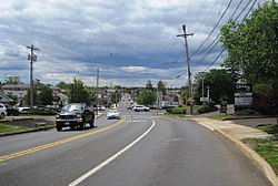
The railroad arrived in the 1870s and brought with it many changes. "Southamptonville" was shortened to Southampton, and farmers now had a faster and more efficient way to market their milk and produce. Tradesmen and craftsmen opened shops along Second Street Pike, and residents began commuting into Philadelphia.

Changes continued through the 20th Century. Electricity and telephone lines were installed, and Street Road has been widened (1969–1970) and a railroad overpass constructed, necessitating the removal and/or demolition of the toll house, several shops and residences.

Public education began in the mid-19th Century and one-room schoolhouses once stood at Street Road and Gravel Hill, and on County Line Road just west of Buck Road. Southamptonville's former one-room schoolhouse has been enlarged to such an extent that it is no longer recognizable as such, but stands in its original location on the south side of Street Road near the railroad overpass. The Original "Southampton High School" was later converted and expanded into Shelmire Elementary School (now First Children Academy) when the new Centennial School District's William Tennent High School was built in 1953.

The first public school in the village of Davisville, known as the Davisville Seminary, remains on its original site on the South Side of Street Road – next to the Dairy Queen. The Seminary was used in more recent times as an overflow classroom for the "stone school" (C.H.I. Institute).

Upper Southampton Township has embraced industry and development, but retains a certain small-town feeling despite rapid growth in the post-war years, and again in the 1980s and 1990s.

Related Research Articles

<span class="mw-page-title-main">Bucks County, Pennsylvania</span> County in Pennsylvania, United States

Bucks County is a county in the Commonwealth of Pennsylvania. As of the 2020 census, the population was 646,538, making it the fourth-most populous county in Pennsylvania. Its county seat is Doylestown. The county is named after the English county of Buckinghamshire.

<span class="mw-page-title-main">Lower Southampton Township, Pennsylvania</span> Township in Pennsylvania, United States

Lower Southampton Township is a township in Bucks County, Pennsylvania, United States. The population was 20,599 at the 2020 census.

<span class="mw-page-title-main">Northampton Township, Bucks County, Pennsylvania</span> Township in Pennsylvania, United States

Northampton Township is a township in Bucks County, Pennsylvania, United States. The township is located approximately 12 miles northeast of Philadelphia. The population was 39,915 at the 2020 census.

<span class="mw-page-title-main">Upper Southampton Township, Pennsylvania</span> Township in Pennsylvania, United States

Upper Southampton Township is a township in Bucks County, Pennsylvania, United States. The population was 15,152 at the 2010 census.

<span class="mw-page-title-main">Warminster Township, Pennsylvania</span> Township in Pennsylvania, United States

Warminster Township, also referred to as Warminster, is located in Bucks County, Pennsylvania, United States. It was formally established in 1711. The township is 13.7 miles north of Philadelphia and had a population of 33,603 according to the 2020 U.S. census.

<span class="mw-page-title-main">Upper Saucon Township, Pennsylvania</span> Township in Pennsylvania, United States

Upper Saucon Township is a township in Lehigh County, Pennsylvania. It is part of the Lehigh Valley metropolitan area, which had a population of 861,899 and was the 68th-most populous metropolitan area in the U.S. as of the 2020 census. The township had a population of 16,973 as of the 2020 census.

<span class="mw-page-title-main">Upper Moreland Township, Pennsylvania</span> Township in Pennsylvania, United States

Upper Moreland Township is a township in Montgomery County, Pennsylvania. The population was 24,015 at the 2010 census. Upper Moreland Township is primarily a residential community with distinctive neighborhoods that are complemented by several thriving business, industrial, and commercial districts.

<span class="mw-page-title-main">Pennsylvania Route 132</span> State highway in Bucks County, Pennsylvania, US

Pennsylvania Route 132 (PA 132) is a state highway in southeast Pennsylvania. The route, which is signed east–west, runs northwest to southeast through Bucks County in suburban Philadelphia from PA 611 in Warrington southeast to Interstate 95 (I-95) in Bensalem. PA 132 is a commercial route lined with shopping centers throughout much of its 15-mile (24 km) length. It is named Street Road and is five lanes wide for much of its length. The route was also designated as the Armed Forces and Veterans Memorial Highway in 2005. From west to east, PA 132 intersects PA 263 and PA 332 in Warminster; PA 232 in Southampton; PA 532 in Feasterville; and U.S. Route 1 (US 1), the Pennsylvania Turnpike (I-276), PA 513, and US 13 in Bensalem. Street Road was included in William Penn's survey plans and completed by 1737. The road was paved by 1911 and received the PA 132 designation between US 611 and US 13 by 1927. The route was widened into a multilane highway and extended east from US 13 to I-95 by 1970. An interchange with the eastbound direction of the Pennsylvania Turnpike opened in 2010.

North Pennsylvania Railroad was a railroad company which served Philadelphia, Montgomery County, Bucks County and Northampton County in Pennsylvania. It was formed in 1852, and began operation in 1855. The Philadelphia and Reading Railway, predecessor to the Reading Company, leased the North Pennsylvania in 1879. Its tracks were transferred to Conrail and the Southeastern Pennsylvania Transportation Authority (SEPTA) in 1976.

The North Penn Valley is a region of Philadelphia suburbs and exurbs in Montgomery County, Pennsylvania. It is somewhat congruent with the North Penn School District. It contains the boroughs of North Wales, Lansdale, and Hatfield, as well as the surrounding townships. The area to its west has traditionally been more rural, while the suburbs to its south and east are, on the whole, more affluent and densely populated.

<span class="mw-page-title-main">William Tennent</span> Religious leader and educator in early America

William Tennent was an early Scottish American Presbyterian minister and educator in British North America.

<span class="mw-page-title-main">William Tennent High School</span> Public school in Warminster, Pennsylvania, United States

William Tennent High School is a public high school serving grades 9 through 12, located in Warminster, Pennsylvania, US.

<span class="mw-page-title-main">Centennial School District (Pennsylvania)</span> School district in Pennsylvania

The Centennial School District is a public school district serving the Borough of Ivyland, Upper Southampton Township, and Warminster Township in Bucks County, Pennsylvania. The district operates one High School, two Middle Schools, three Elementary Schools and one Alternative School.

<span class="mw-page-title-main">Pennsylvania Route 63</span> 37.4-mile-long (60.2 km) state highway located in Pennsylvania

Pennsylvania Route 63 (PA 63) is a 37.4-mile-long (60.2 km) state highway located in the Philadelphia, Pennsylvania, area. The western terminus of the route is at PA 29 in Green Lane, Montgomery County. The eastern terminus is at Interstate 95 (I-95) in Bensalem Township, Bucks County. PA 63 runs northwest to southeast for most of its length. The route heads through a mix of suburban and rural areas of northern Montgomery County as a two-lane road, passing through Harleysville, before coming to an interchange with I-476 in Kulpsville. From this point, PA 63 continues through predominantly suburban areas of eastern Montgomery County as a two- to four-lane road, passing through Lansdale, Maple Glen, Willow Grove, and Huntingdon Valley. Upon entering Northeast Philadelphia, the route follows Red Lion Road and U.S. Route 1 (US 1) before heading southeast on a freeway called Woodhaven Road to I-95.

<span class="mw-page-title-main">Pennsylvania Route 232</span> State highway in Pennsylvania, US

Pennsylvania Route 232 (PA 232) is a 25.2-mile-long (40.6 km) state highway located in southeastern Pennsylvania. The southern terminus of the route is at U.S. Route 1 (US 1)/US 13 at the Oxford Circle in Philadelphia. The northern terminus is at PA 32 in the borough of New Hope, Bucks County, on the banks of the Delaware River. The route passes through the urban areas of Northeast Philadelphia as Oxford Avenue, serving the Lawncrest, Burholme, and Fox Chase neighborhoods. Upon entering Montgomery County, PA 232 becomes Huntingdon Pike and through suburban areas, serving the communities of Rockledge, Huntingdon Valley, and Bryn Athyn. The route passes through more suburban development in Bucks County as Second Street Pike, running through Southampton and Richboro. In Wrightstown Township, PA 232 enters rural areas and becomes Windy Bush Road as it heads north to New Hope.

<span class="mw-page-title-main">Pennsylvania Route 152</span> State highway in Pennsylvania, US

Pennsylvania Route 152 (PA 152) is a 25.3-mile-long (40.7 km) state highway located in the U.S. state of Pennsylvania. The route travels north–south from an interchange with PA 309 located in the Cedarbrook neighborhood of Cheltenham Township in Montgomery County north to another interchange with PA 309 located northeast of Telford in Bucks County. PA 152 is known as Limekiln Pike for most of its length. From the southern terminus, the route passes through suburban areas to the north of Philadelphia, serving Dresher, Maple Glen, and Chalfont. North of Chalfont, PA 152 runs through rural suburbs of Philadelphia before reaching Silverdale. Past here, the road continues northwest through Perkasie, where it turns southwest and passes through Sellersville before reaching its northern terminus.

Old York Road is a roadway that was built during the 18th century to connect Philadelphia with New York City. Through New Jersey it was built along the Raritan "Naraticong Trail", also known as the Tuckaraming Trail. A memorial plaque to the friendship of the Naraticong tribe, who permitted the road to be built over their trail, is at the intersection of Old York Road and Canal in Raritan, NJ. The Swift Sure Stage Coach Line completed the journey between the two cities in two days and cost a few dollars.

<span class="mw-page-title-main">Craven Hall</span> Historic house in Pennsylvania, United States

Craven Hall is a historic building located in Warminster Township, Pennsylvania, at the corner of Newtown Road and East Street Road, a five-lane arterial road which runs through the central commercial district. The house was originally built in 1780, with subsequent work in 1823 and a single story addition in the 20th century.

Locust Valley was a village located in the southeastern corner of Lehigh County, Pennsylvania, United States. The village is located at the southern end of Upper Saucon Township. It is part of the Lehigh Valley, which has a population of 861,899 and is the 68th-most populous metropolitan area in the U.S. as of the 2020 census.

<span class="mw-page-title-main">Churchville Historic District</span> Historic district in Pennsylvania, United States

Churchville Historic District is a national historic district located in Churchville, Northampton Township and Upper Southampton Township in Bucks County, Pennsylvania, USA. The district includes 140 contributing buildings, seven contributing structures and one contributing object in the crossroads village of Churchville. They include a variety of residential, commercial and institutional buildings and notable examples of Gothic Revival and Bungalow/craftsman architecture. Notable buildings include the John Hillings House, North and Southampton Dutch Reformed Church (1816), Churchville Train Station (1891), general store (1883), Studebaker and Willys car dealership (1920s), and Churchville Telephone Exchange (1900).

References

  1. "The Legacy of John Fitch". Craven Hall Historic Site. Retrieved August 21, 2022.
  2. "More History". Upper Southampton Township. Retrieved August 21, 2022.
  3. Westcott, Thompson (1857). "The life of John Fitch, The Inventor of the Steamboat". Illinois State Museum. J.B. Lippincott & Co. Retrieved August 21, 2022.
  4. "Patch Call". FBI Law Enforcement Bulletin. Retrieved August 21, 2022.