Southease railway station

Last updated

12 mile (800 m) east of the village of Southease in East Sussex, England. It is on the Seaford branch of the East Coastway Line, 53 miles 40 chains (86.1 km) measured from London Bridge via Redhill. [1] The station is surrounded by agricultural land. The South Downs Way crosses the Seaford Branch here.

Contents

History

The London, Brighton and South Coast Railway opened the station on 1 September 1906 as Southease and Rodmell Halt, to serve two villages in the Ouse Valley; Southease, 12 mile (800 m) to the west, and the slightly larger Rodmell, more than 1 mile (1.6 km) away. [2] The station was renamed Southease on 12 May 1980. [3]

There was a racecourse between the railway line and the River Ouse from the late 1920s to the early 1940s. [4]

Infrastructure

The station is unstaffed and has two platforms, each with a PERTIS machine. A self-service ticket machine was also installed in 2016. There is a level crossing immediately north of the station leading to Itford Farm and the A26 road. The crossing is a user-controlled crossing with barriers which can be raised or lowered by road users. There is a pedestrian gate for walkers and cyclists. There is also a footbridge over the line.

Services

All services at Southease are operated by Southern using Class 377 EMUs.

The typical off-peak service in trains per hour is: [5]

Connections with services to Gatwick Airport and London Victoria can be made by changing at Lewes.

Southease
National Rail logo.svg
Southease.jpg
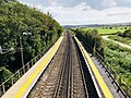
The platforms at Southease, looking north
General information
Location Southease, Lewes
England
Grid reference TQ430054
Managed by Southern
Platforms2
Other information
Station codeSEE
Classification DfT category F2
History
Pre-grouping LB&SCR
Post-grouping Southern Railway
Key dates
1 September 1906Opened as Southease and Rodmell Halt
12 May 1980Renamed Southease
Passengers
2019/20Increase2.svg 22,052
Preceding station National Rail logo.svg National Rail Following station
Southern

References

  1. Yonge, John (November 2008) [1994]. Jacobs, Gerald (ed.). Railway Track Diagrams 5: Southern & TfL (3rd ed.). Bradford on Avon: Trackmaps. map 17A. ISBN   978-0-9549866-4-3.
  2. Mitchell, Vic; Smith, Keith (1986). Southern Main Lines – Haywards Heath to Seaford. Middleton Press. p. not cited. ISBN   0-906520-28-2.
  3. Butt, R.V.J. (1995). The Directory of Railway Stations. Yeovil: Patrick Stephens Ltd. p. 215. ISBN   1-85260-508-1. R508.
  4. "A history of Southease" (PDF). Southease Parish Newsletter. October 2006. Archived from the original on 10 May 2008.
  5. Table 189 National Rail timetable, December 2022

50°49′50″N0°1′50″E / 50.83056°N 0.03056°E / 50.83056; 0.03056