Southern Shops, South Carolina

Last updated

Southern Shops, South Carolina
CDP
USA South Carolina location map.svg
Red pog.svg
Southern Shops, South Carolina
Location within the state of South Carolina
Coordinates: 34°59′23″N81°59′15″W / 34.98972°N 81.98750°W / 34.98972; -81.98750
Country United States
State South Carolina
County Spartanburg
Area
[1]
  Total3.58 sq mi (9.26 km2)
  Land3.56 sq mi (9.23 km2)
  Water0.01 sq mi (0.03 km2)
Elevation
[2]
876 ft (267 m)
Population
 (2020) [3]
  Total3,663
  Density1,027.78/sq mi (396.83/km2)
Time zone UTC-5 (Eastern (EST))
  Summer (DST) UTC-4 (EDT)
FIPS code 45-67750 [4]
GNIS feature ID1867531 [2]

Southern Shops is a census-designated place (CDP) in Spartanburg County, South Carolina, United States. The population was 3,663 at the 2020 census. [5]

Contents

Geography

Southern Shops is located at 34°59′23″N81°59′15″W / 34.98972°N 81.98750°W / 34.98972; -81.98750 (34.989699, -81.987468). [6]

According to the United States Census Bureau, the CDP has a total area of 3.5 square miles (9.2 km2), all land.

Demographics

Historical population
CensusPop.Note
2000 3,707
2010 3,7671.6%
2020 3,663−2.8%
U.S. Decennial Census [7]

2020 census

Southern Shops racial composition [8]
RaceNum.Perc.
White (non-Hispanic)1,15831.61%
Black or African American (non-Hispanic)59916.35%
Native American 50.14%
Asian 411.12%
Other/Mixed 992.7%
Hispanic or Latino 1,76148.08%

As of the 2020 United States census, there were 3,663 people, 949 households, and 663 families residing in the CDP.

2000 census

As of the census [4] of 2000, there were 3,707 people, 1,164 households, and 735 families residing in the CDP. The population density was 1,043.1 inhabitants per square mile (402.7/km2). There were 1,278 housing units at an average density of 359.6 per square mile (138.8/km2). The racial makeup of the CDP was 67.28% White, 14.76% African American, 0.81% Native American, 0.78% Asian, 12.73% from other races, and 3.64% from two or more races. Hispanic or Latino of any race were 25.09% of the population.

There were 1,164 households, out of which 29.5% had children under the age of 18 living with them, 41.8% were married couples living together, 14.2% had a female householder with no husband present, and 36.8% were non-families. 30.2% of all households were made up of individuals, and 11.3% had someone living alone who was 65 years of age or older. The average household size was 2.67 and the average family size was 3.30.

In the CDP, the population was spread out, with 21.6% under the age of 18, 14.2% from 18 to 24, 37.3% from 25 to 44, 17.4% from 45 to 64, and 9.5% who were 65 years of age or older. The median age was 32 years. For every 100 females, there were 147.3 males. For every 100 females age 18 and over, there were 154.8 males.

The median income for a household in the CDP was $25,268, and the median income for a family was $31,290. Males had a median income of $19,513 versus $17,991 for females. The per capita income for the CDP was $12,268. About 20.6% of families and 22.3% of the population were below the poverty line, including 30.1% of those under age 18 and 11.1% of those age 65 or over.

Education

Most of Southern Shops is in Spartanburg County School District 6, while a portion is in Spartanburg County School District 2. [9]

Related Research Articles

<span class="mw-page-title-main">Bayview-Montalvin, California</span> Former CDP in California, United States

Bayview-Montalvin is a former census-designated place (CDP) in Contra Costa County, California, United States. The population was 5,004 at the 2000 census.

<span class="mw-page-title-main">Watertown, Florida</span> CDP in Florida, United States

Watertown is a census-designated place (CDP) in Columbia County, Florida, United States. As of the 2010 census, it had a population of 2,829.

<span class="mw-page-title-main">Fairview Shores, Florida</span> Census-designated place in Florida, United States

Fairview Shores is a census-designated place and an unincorporated area in Orange County, Florida, United States. The population was 10,239 at the 2010 census. It is part of the Orlando–Kissimmee–Sanford, Florida Metropolitan Statistical Area.

<span class="mw-page-title-main">Lockhart, Florida</span> Census-designated place in Florida, United States

Lockhart is a census-designated place in Orange County, Florida, United States. The population was 13,060 at the 2010 census. It is part of the Orlando–Kissimmee–Sanford, Florida Metropolitan Statistical Area. The community is named for David Lockhart.

<span class="mw-page-title-main">Sky Lake, Florida</span> Census-designated place in Florida, United States

Sky Lake is a census-designated place (CDP) and an unincorporated area in Orange County, Florida, United States. The population was 6,153 at the 2010 census. It is part of the Orlando-Kissimmee, Florida Metropolitan Statistical Area.

Long Lake is an unincorporated community and census-designated place (CDP) in Lake County, Illinois, United States. Per the 2020 census, the population was 3,663.

<span class="mw-page-title-main">West Chatham, Massachusetts</span> Census-designated place in Massachusetts, United States

West Chatham is a census-designated place (CDP) in the town of Chatham in Barnstable County, Massachusetts, United States. The population was 1,410 at the 2010 census.

<span class="mw-page-title-main">Dulce, New Mexico</span> Census-designated place in New Mexico, United States

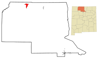
Dulce is a census-designated place (CDP) in Rio Arriba County, New Mexico, United States. The population was 2,743 at the 2010 census, almost entirely Native American. It is the largest community and tribal headquarters of the Jicarilla Apache Reservation.

<span class="mw-page-title-main">East Flat Rock, North Carolina</span> Census-designated place in North Carolina, United States

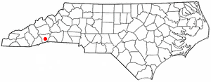
East Flat Rock is an unincorporated area and census-designated place (CDP) in Henderson County, North Carolina, United States. The population was 4,995 at the 2010 census, up from 4,151 at the 2000 census. It is part of the Asheville Metropolitan Statistical Area.

<span class="mw-page-title-main">Gayle Mill, South Carolina</span> Census-designated place in South Carolina, United States

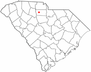
Gayle Mill is a census-designated place (CDP) in Chester County, South Carolina, United States. The population was 913 at the 2010 census, down from 1,094 at the 2000 census.

<span class="mw-page-title-main">Gantt, South Carolina</span> Census-designated place in South Carolina, United States

Gantt is a census-designated place (CDP) in Greenville County, South Carolina, United States. The population was 14,229 at the 2010 census. It is part of the Greenville–Mauldin–Easley Metropolitan Statistical Area and a suburb of the city of Greenville.

<span class="mw-page-title-main">Socastee, South Carolina</span> CDP in South Carolina, United States

Socastee is a census-designated place (CDP) in Horry County, South Carolina, United States. The population was 19,952 at the 2010 census.

<span class="mw-page-title-main">Watts Mills, South Carolina</span> Census-designated place in South Carolina, United States

Wattsville is an unincorporated community in Laurens County, South Carolina, United States. The town name is derived from Watts Mill, a textile mill in the center of town. The area is listed as the Wattsville census-designated place (CDP) for statistical purposes. The population of the CDP was 1,635 at the 2010 census. It is part of the Greenville–Mauldin–Easley Metropolitan Statistical Area.

Seven Oaks is a census-designated place (CDP) in Lexington County, South Carolina, United States, 8 miles (13 km) northwest of downtown Columbia, the state capital. The population of the CDP was 15,144 at the 2010 census. It is part of the Columbia Metropolitan Statistical Area.

<span class="mw-page-title-main">Boiling Springs, South Carolina</span> CDP in South Carolina, United States

Boiling Springs is a census-designated place (CDP) in Spartanburg County, South Carolina, United States. The population was 8,219 at the 2010 census.

<span class="mw-page-title-main">Mayo, South Carolina</span> CDP in South Carolina, United States

Mayo is a census-designated place (CDP) in Spartanburg County, South Carolina, United States. The population was 1,592 at the 2010 census.

<span class="mw-page-title-main">Roebuck, South Carolina</span> CDP in South Carolina, United States

Roebuck is a census-designated place (CDP) in Spartanburg County, South Carolina, United States. The population was 2,200 at the 2010 census.

<span class="mw-page-title-main">Saxon, South Carolina</span> CDP in South Carolina, United States

Saxon is a census-designated place (CDP) in Spartanburg County, South Carolina, United States. The population was 3,424 at the 2010 census.

<span class="mw-page-title-main">Startex, South Carolina</span> CDP in South Carolina, United States

Startex is a census-designated place (CDP) in Spartanburg County, South Carolina, United States. The population was 859 at the 2010 census. The area was originally known as Tucapau, named after the mill that was built there in 1896. In 1936, Walter Montgomery Sr. bought the mill and changed its name to Startex—the brand name of household textiles produced at the plant. The mill ceased operations in 1998 and was mostly dismantled in 1999.

<span class="mw-page-title-main">Valley Falls, South Carolina</span> CDP in South Carolina, United States

Valley Falls is a census-designated place (CDP) in Spartanburg County, South Carolina, United States. The population was 6,299 at the 2010 census.

References

  1. "ArcGIS REST Services Directory". United States Census Bureau. Retrieved October 15, 2022.
  2. 1 2 U.S. Geological Survey Geographic Names Information System: Southern Shops, South Carolina
  3. "Census Population API". United States Census Bureau. Retrieved October 15, 2022.
  4. 1 2 "U.S. Census website". United States Census Bureau . Retrieved January 31, 2008.
  5. "Race, Hispanic or Latino, Age, and Housing Occupancy: 2010 Census Redistricting Data (Public Law 94-171) Summary File (QT-PL), Southern Shops CDP, South Carolina". United States Census Bureau . Retrieved August 16, 2011.
  6. "US Gazetteer files: 2010, 2000, and 1990". United States Census Bureau. February 12, 2011. Retrieved April 23, 2011.
  7. "Census of Population and Housing". Census.gov. Retrieved June 4, 2016.
  8. "Explore Census Data". data.census.gov. Retrieved December 10, 2021.
  9. "2020 CENSUS - SCHOOL DISTRICT REFERENCE MAP: Spartanburg County, SC" (PDF). U.S. Census Bureau . Retrieved July 5, 2021.