Vincent is a census-designated place (CDP) in the central San Gabriel Valley, in Los Angeles County, California, United States. The city name and zipcode for addresses south of Arrow Highway is Covina and 91722, respectively, and Azusa and 91702 for addresses north of Arrow Highway. The population was 15,922 at the 2010 census, up from 15,097 at the 2000 census. Vincent is named after Vincent Avenue, which passes through the community. It should not be confused with another unincorporated community called Vincent, also within Los Angeles County, that is located at the summit of Soledad Pass near the junction of SR 14 and Angeles Forest Highway.
Broadview Park is a census-designated place (CDP) in Broward County, Florida, United States. The population was 7,670 at the 2020 census.

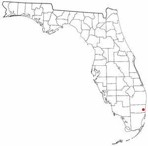
Weeki Wachee Gardens is a census-designated place (CDP) in Hernando County, Florida, United States. The population was 1,146 at the 2010 census.
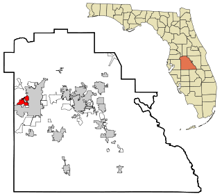
Winston is a former census-designated place (CDP) in Polk County, Florida, United States. The population was 9,024 at the 2000 census. Most of the community's core is now part of neighboring Lakeland. It is part of the Lakeland–Winter Haven Metropolitan Statistical Area.

Wildwood is a city in Sumter County, Florida, United States. The population was 15,730 at the 2020 census.
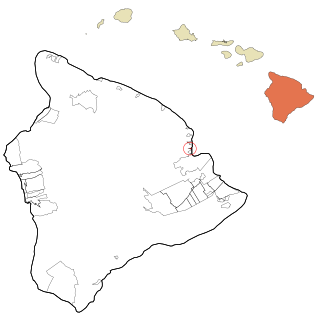
Paukaʻa is a census-designated place (CDP) in Hawaii County, Hawaii, United States. The population was 425 at the 2010 census, down from 495 at the 2000 census. The ZIP code is 96720.
Hawkeye is a city in Fayette County, Iowa, United States. The population was 438 at the time of the 2020 census.

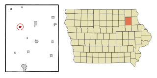
Redding is a city in southwest Ringgold County, Iowa, United States. The population was 63 at the time of the 2020 census.

Belpre is a city in Edwards County, Kansas, United States. As of the 2020 census, the population of the city was 97. It is located along Highway 50.

Lewisburg is a home rule-class city in Logan County, Kentucky, in the United States. The population was 810 at the 2010 census, down from 903 at the 2000 census.
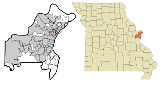
Flordell Hills is a city in St. Louis County, Missouri, United States. The population was 822 at the 2010 census.

Middlesex is a town in Nash County, North Carolina, United States. It is part of the Rocky Mount, North Carolina Metropolitan Statistical Area. Middlesex is about 25 miles east of Raleigh. The population was 822 at the 2010 census.

Springdale is a city in Hamilton County, Ohio, United States. It is a suburb of Cincinnati. The population was 11,007 at the 2020 census.

Platea is a borough in Erie County, Pennsylvania, United States. The population was 443 at the 2020 census.

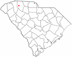
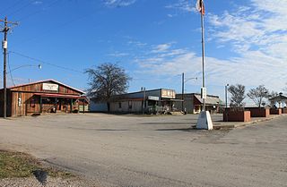
Startex is a census-designated place (CDP) in Spartanburg County, South Carolina, United States. The population was 859 at the 2010 census. The area was originally known as Tucapau, named after the mill that was built there in 1896. In 1936, Walter Montgomery Sr. bought the mill and changed its name to Startex—the brand name of household textiles produced at the plant. The mill ceased operations in 1998 and was mostly dismantled in 1999.

Yorkville is a city in Gibson County, Tennessee. The population was 286 at the 2010 census.
Blue Ridge is a city at the intersection of state highway 78, FM 981, and FM 545 in Collin County, Texas, United States. The population was 822 at the 2010 census, and 1,180 in 2020.

Morgan is a city in the U.S. state of Utah and the county seat of Morgan County. It is part of the Ogden-Clearfield metropolitan area. It is named after Jedediah Morgan Grant, a leader in the Church of Jesus Christ of Latter-day Saints who served as an apostle and as a member of the LDS First Presidency under Brigham Young in the mid-1850s. As of the 2020 census, the city population was 4,071 people. Morgan is also a location where some of the movie Troll 2 was filmed in 1989.
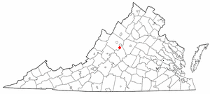
Sherando is a census-designated place (CDP) in Augusta County, Virginia, United States. The population was 688 at the 2010 census. It is part of the Staunton–Waynesboro Micropolitan Statistical Area.
Evergreen Township is a civil township of Montcalm County in the U.S. state of Michigan. The population was 2,941 at the 2020 census.