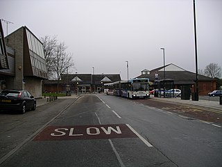
Hampstead Norreys is a village and civil parish in Berkshire, England. It is centred on the River Pang, north of Newbury. As well as the nucleus of Hampstead Norreys, the parish includes the hamlets of Bothampstead, Eling and Wyld Court. The village was recorded in the Domesday Book of 1086 as Hanstede.

Bardney is a village and civil parish in the West Lindsey district of Lincolnshire, England. The population of the civil parish was 1,643 at the 2001 census increasing to 1,848 at the 2011 census. The village sits on the east bank of the River Witham and 9 miles (14 km) east of Lincoln.

Hatton is a small village and civil parish in the East Lindsey district of Lincolnshire, England. It is situated 3 miles (5 km) east of the town of Wragby, 6 miles (10 km) north-west of the town of Horncastle, and just north of the A158 road.

Long Sutton is a market town and civil parish in the South Holland district of Lincolnshire, England. It lies in The Fens, close to the Wash, 13 miles (21 km) east of Spalding. In 2011 the parish had a population of 4,821.

Crigglestone is a village and civil parish in the City of Wakefield in West Yorkshire, England. It is recorded as "Crigeston" in the Domesday Book. The civil parish had a population of 9,271 at the 2011 Census. On 29 July 1941, an explosion occurred at the Crigglestone Colliery, killing 21 men. Since the 1970s, the site of the colliery has become an industrial estate on the western side, giving way to residential housing on the eastern side and a public amenity to the south.

Willenhall is a suburb of Coventry, in the county of the West Midlands, England.

Wragby is a historic market town and civil parish in the East Lindsey district of Lincolnshire, England. It is situated at the junction of the A157 and A158 roads, and approximately 10 miles (16 km) north-west from Horncastle and about 11 miles (18 km) north-east of Lincoln.

Felbridge is a village and civil parish in the Tandridge district of Surrey with a playing field within its focal area, narrowly in West Sussex. Felbridge village forms a contiguous settlement with East Grinstead and had 829 homes and households at the time of the 2011 census. Domewood is part of Felbridge civil parish, which was created in 1953.

The A158 road is a major route that heads from Lincoln in the west to Skegness on the east coast. The road is located entirely in the county of Lincolnshire and is single carriageway for almost its entirety. The road is approximately 40 miles (64 km) long. The road gets quite congested with holiday traffic during the summer.

Skendleby is a small village and civil parish in the East Lindsey district of Lincolnshire, England. It is situated near to the A158 and lies 35 miles (56 km) east from the county town Lincoln, and about 4 miles (6 km) north-east from the town of Spilsby. The village stands near the south-eastern edge of the Lincolnshire Wolds.

Friskney is a village and civil parish within the East Lindsey district of Lincolnshire, England.

Potterhanworth is a village and civil parish in the North Kesteven district of Lincolnshire, England. The population of the civil parish at the 2011 census was 839. It is situated 6 miles (10 km) south-east from Lincoln.

Woodhall Spa railway station was a station in Woodhall Spa, Lincolnshire on a small branch line running north from Woodhall Junction to Horncastle. Both the station and the line are now closed.

The Lincolnshire loop line was a railway built by the Great Northern Railway, that linked Peterborough to Gainsborough via Spalding, Boston and Lincoln. It ran through the counties of Lincolnshire and Northamptonshire

Stixwould is a small village in the civil parish of Stixwould and Woodhall, in the East Lindsey district of Lincolnshire, England.

Tumby is a village and civil parish in the East Lindsey district of Lincolnshire, England. It is situated approximately 2 miles (3.2 km) north from Coningsby and 6.5 miles (10.5 km) south from Horncastle. In 2011 the parish had a population of 203.

Southrey Wood is reserve near Bardney in the county of Lincolnshire, England. Butterfly Conservation manages this reserve. It is 22 acres (8.9 ha) in extent.

The Bardney Limewoods, part of the Lincolnshire Limewoods National Nature Reserve is a collection of small woodlands near Bardney in Lincolnshire. The reserve includes about half the Limewoods in the area. Cocklode Wood, part of the Bardney Limewoods, is the best surviving spread of medieval limes in England.

Sots Hole is a hamlet in the civil parish of Metheringham in North Kesteven, Lincolnshire, England. It is located to the northeast of Metheringham, east of Dunston and southwest of Southrey.


