
Merrill C. Meigs Field Airport was a single-runway airport in Chicago that was in operation from 1948 to 2003, when it was bulldozed overnight by then-mayor Richard M. Daley. The airport was located on Northerly Island, an artificial peninsula on Lake Michigan adjacent to downtown Chicago, the second-largest business district in the Western Hemisphere. By 1955, Meigs Field had become the busiest single-strip airport in the United States. The airport was a familiar sight on the downtown lakefront. The latest air traffic tower was built in 1952, and the terminal was dedicated in 1961. The airfield was named for Merrill C. Meigs.

Agawam is a city in Hampden County, Massachusetts, United States. The population was 28,692 at the 2020 census. Agawam sits on the western side of the Connecticut River, directly across from Springfield. It is considered part of the Springfield Metropolitan Statistical Area, which is contiguous with the Knowledge Corridor area, the second-largest metropolitan area in New England. Agawam contains a subsection, Feeding Hills. The Six Flags New England amusement park is located in Agawam, on the banks of the Connecticut River.

An airbase, sometimes referred to as a military airbase, military airfield, military airport, air station, naval air station, air force station, or air force base, is an aerodrome or airport used as a military base by a military force for the operation of military aircraft.

Nagoya Airfield, also known as Komaki Airport or Nagoya Airport, is an airport which lies within the local government areas of Toyoyama, Komaki, Kasugai and Nagoya in Aichi Prefecture, Japan. Prior to 2005, it was once an international airport, but is now a domestic secondary airport serving Nagoya while the current primary civil airport for Nagoya is Chūbu Centrair International Airport in Tokoname.

An aerodrome or airfield is a location from which aircraft flight operations take place, regardless of whether they involve air cargo, passengers, or neither, and regardless of whether it is for public or private use. Aerodromes include small general aviation airfields, large commercial airports, and military air bases.

Eppley Airfield, also known as Omaha Airport, is an airport in the midwestern United States, located three miles (5 km) northeast of downtown Omaha, Nebraska. On the west bank of the Missouri River in Douglas County, it is the largest airport in Nebraska, with more arrivals and departures than all other airports in the state combined. It is classified as a medium hub airport by the Federal Aviation Administration (FAA). It is owned and operated by the Omaha Airport Authority (OAA).

Port Moresby International Airport, also known as Jacksons International Airport, is an international airport located eight kilometres outside Port Moresby in Papua New Guinea. It is the largest and busiest airport in Papua New Guinea, with an estimated 1.4 million passengers using the airport in 2015, and is the main hub for Air Niugini, the national airline of Papua New Guinea. The airport serves as the main hub for PNG Air and Travel Air. It replaced the original Port Moresby airport, in what is now the suburb of Waigani, whose airstrip remained until the 1990s but no trace of which remains, having been built over.
Lumbia Airfield, formerly known as Lumbia Airport and Cagayan de Oro Airport, is an air base and was the main civilian airport that served the general areas of Cagayan de Oro and Northern Mindanao, in the province of Misamis Oriental in the Philippines. It was the second busiest airport in Mindanao, after Francisco Bangoy International Airport in Davao City before the opening of Laguindingan Airport.

St. Louis Downtown Airport is a public-use airport located in Greater St. Louis, one mile (2 km) east of the central business district of Cahokia Heights, in St. Clair County, Illinois, United States. It is owned by the Bi-State Development Agency. The airport is located less than 3 miles from the Gateway Arch riverfront in St. Louis and is used by many business aircraft visiting the St. Louis region. Airport services include one full-service 24-hour fixed-base operator, an instrument landing system, an FAA air traffic control tower, and its own dedicated Index B aircraft rescue and firefighting (ARFF) service. It is utilized mainly by Saint Louis University's Parks College of Engineering, Aviation and Technology for training purposes, as well as the St. Louis Cardinals for charter flights to away games.
Hanzhong Xiguan Airport is the airport formerly serving the city of Hanzhong in Shaanxi Province, China. It is located only 2 kilometers from the city center, which severely limits its expansion possibilities. As a result, Hanzhong Chenggu Airport, a military air base located in Chenggu County northeast of the city, was converted to a dual-use airport, and replaced Xiguan Airport when it was opened on 13 August 2014.

Frans Kaisiepo Airport is an airport on Biak island, in Papua, Indonesia. It is also known as Mokmer Airport. The airport is named after Frans Kaisiepo (1921–1979), the fourth Governor of Papua. The airport has seven aircraft parking slots, of which two are capable of handling wide-body aircraft, and a small terminal without jet bridges. The airport's only runway is 3,571m long, designated as 11/29.
Bezymyanka Airport is an experimental aerodrome in the Aviakor aviation plant in the city of Samara, Russia. It is located 4 kilometres (2.5 mi) east of the Bezymyanka railroad station in the Kirov district of Samara, 12 kilometres (7.5 mi) east of the city center.
Walt Disney World Airport, also known as Lake Buena Vista Airport and Lake Buena Vista STOLport, is a former small airfield owned by The Walt Disney Company, located within Walt Disney World, just across World Drive from the Transportation and Ticket Center, in Bay Lake in Orange County, Florida, United States. When it was active, it accommodated smaller commuter airliners such as the de Havilland Canada DHC-6 Twin Otter turboprop, which had STOL capabilities and could operate from airfields with short runways. It is no longer registered as an active airport by the FAA, ICAO, and IATA, and as of December 2017 serves Walt Disney World as a storage lot.

RAF Stansted Mountfitchet is a former Royal Air Force station during the Second World War located near the village of Stansted Mountfitchet in the District of Uttlesford in Essex, 48 km (30 mi) north-east of central London. The airfield is now London Stansted Airport.
Carrabelle–Thompson Airport is a public use airport located three nautical miles (6 km) west of the central business district of Carrabelle, a city in Franklin County, Florida, United States. It is owned by the Carrabelle Port and Airport Authority.

Dothan Municipal Airport is a closed airport located 3 miles (5 km) west-northwest of Dothan, Alabama, United States.
Suzhou Guangfu Airport, also known as Suzhou West Airfield, is a People's Liberation Army Air Force Base in the city of Suzhou in East China's Jiangsu province, located 22 kilometers southwest of Suzhou City. From February 1994 until 29 October 2002 it briefly served civil flights for Suzhou, but is now exclusively used by the military. Suzhou is now mainly served by Sunan Shuofang International Airport, Shanghai Hongqiao International Airport, and Shanghai Pudong International Airport.
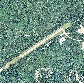
Bowles Agawam Airport was an airfield operational in the mid-20th century in Agawam, Massachusetts.
Derby Airport was an airport located at Burnaston, Derbyshire, England. Opened in 1938 as the commercial airport serving Derby, it was superseded by East Midlands Airport in the 1960s but continued as an airfield until the spring of 1990.
