Italy has a well developed transport infrastructure. The Italian rail network is extensive, especially in the north, and it includes a high-speed rail network that joins the major cities of Italy from Naples through northern cities such as Milan and Turin. The Florence–Rome high-speed railway was the first high-speed line opened in Europe when more than half of it opened in 1977. Italy has 2,507 people and 12.46 km2 per kilometer of rail track, giving Italy the world's 13th largest rail network. The Italian rail network is operated by state-owned Ferrovie dello Stato, while the rail tracks and infrastructure are managed by Rete Ferroviaria Italiana.
Alghero is a city of about 45,000 inhabitants in the Italian province of Sassari in the north west of the island of Sardinia, next to the Mediterranean Sea. The city's name comes from Aleguerium, which is a mediaeval Latin word meaning "stagnation of algae".

The Strada statale 131 is an Italian state highway 226.0 kilometres (140.4 mi) long in Italy. It is the major road in the region of Sardinia. It is a freeway that connects the towns of Porto Torres and Cagliari via Sassari, Macomer and Oristano. It is considered the "spinal cord" of Sardinia. It is a part of the E25 European route.

The Strada statale 131 Diramazione Centrale Nuorese is an Italian state highway 144.0 kilometres (89.5 mi) long in Italy located in the region of Sardinia. This freeway is connected to the Strada statale 131 Carlo Felice, it links Abbasanta with Olbia, via Nuoro, crossing the hinterland mountainous regions of the island.

The Strada statale 115 Sud Occidentale Sicula (SS115) is an Italian state highway 395.7 kilometres (245.9 mi) long in Italy located in the regions of Sicily. It is one of the major roads in Sicily. It is the major state highway running along the south coast and connects the towns of Trapani and Syracuse via Agrigento and Ragusa. It is a part of the European route E45 and European route E931.
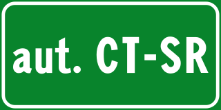
The Autostrada Catania-Siracusa is an autostrada 25.1 kilometres (15.6 mi) long in Italy in eastern Sicily that connects the cities of Catania and Syracuse. It is part of the E45 European route.
The Strade Statali, abbreviated SS, are the Italian national network of state highways. The total length of the network is about 25,000 km (16,000 mi).

The strada statale 235 "di Orzinuovi" was an Italian state highway 99.89 kilometres (62.07 mi) long in Italy in the region of Lombardy, created in 1959 and disestablished in 2000. It began in Pavia and ended in Brescia, going through the Po Valley.
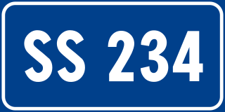
The strada statale 234 "Codognese" was an Italian state highway 73.6 kilometres (45.7 mi) long in Italy in the region of Lombardy, created in 1959 and disestablished in 2000. It began in Pavia and ended in Cremona, going through the Po Valley.

Autostrada A36, also called Pedemontana Lombarda, is an autostrada 22 kilometres (14 mi) long in Italy located in the region of Lombardy that aims to speed up travel in the north of Milan, creating a road outside the Metropolitan City of Milan to connect the province of Varese with that of Bergamo, as well as the Milan Malpensa Airport with the Orio al Serio International Airport.

Strada statale 148 Pontina , previously known as Strada regionale 148 Pontina , is an Italian state highway 109.2 kilometres (67.9 mi) long in Italy in the region of Lazio that connects Rome to Terracina, passing through Latina and through the localities of Pomezia, Ardea in the Metropolitan City of Rome and for Aprilia, Pontinia and Sabaudia in province of Latina.

Raccordo autostradale 4 or Raccordo autostradale di Reggio Calabria or Tangenziale di Reggio Calabria is an autostrada 5.5 kilometres (3.4 mi) long in Italy located in the region of Calabria that connects the Autostrada A2 with the Strada statale 106 Jonica through the city of Reggio Calabria. The motorway junction also constitutes the central section of the so-called "Reggio Calabria ring road". It is a part of the E90 European route.
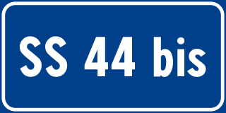
Strada statale 44 bis Passo del Rombo is an Italian state highway 29.51 kilometres (18.34 mi) long in Italy located in the region of Trentino-Alto Adige/Südtirol that connects Passiria with Austria.

Strada statale 44 del Passo di Giovo is an Italian state highway 57.829 kilometres (35.933 mi) long in Italy located in the region of Trentino-Alto Adige/Südtirol which connects Adige Valley with Isarco Valley passing through Passaria Valley.
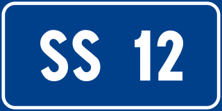
Strada statale 12 dell'Abetone e del Brennero is an Italian state highway 523.6 kilometres (325.3 mi) long in Italy located in the regions of Tuscany, Emilia-Romagna, Lombardy, Veneto and Trentino-Alto Adige/Südtirol that connects Pisa to the Austrian border at Brenner Pass.

Strada statale 38 dello Stelvio is an Italian state highway 224.29 kilometres (139.37 mi) long in Italy located in the regions of Lombardy and Trentino-Alto Adige/Südtirol that connects Valtellina with the South Tyrolean Vinschgau via the Stelvio Pass, to continue in Etschtal until it reaches Bolzano.
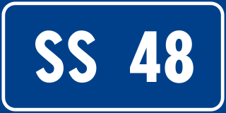
Strada statale 48 delle Dolomiti, also known as strada regionale 48 delle Dolomiti is an Italian state highway 182.1 kilometres (113.2 mi) long in Italy located in the regions of Trentino-Alto Adige/Südtirol and Veneto. It is a mountainous road that runs through the Dolomites area from South Tyrol, through Trentino to Cadore, crossing very suggestive mountain scenery.

Strada statale 72 di San Marino is an Italian state highway 10.7 kilometres (6.6 mi) long in Italy located in the regions of Emilia-Romagna that connects the province of Rimini and connects the provincial capital with the Republic of San Marino. The current road, built after the World War II, is 10,600 km long and has a typically flat layout. It consists of two lanes in each direction of travel and replaces the old state road 72. The road begins on the outskirts of Rimini and ends at the Dogana state border. In San Marino, it continues as the San Marino Highway.

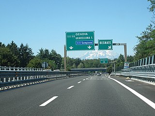
Strada statale 35 dei Giovi is an Italian state highway 172.8 kilometres (107.4 mi) long in Italy located in the regions of Liguria, Piedmont and Lombardy, which connects Genoa and the Italian Riviera with Como and the Canton of Ticino, passing through Pavia and Milan. The road begins in Genoa in the Sampierdarena district where it constitutes an important urban crossing artery with the Reti and Fillak streets, and then ends in Como more precisely at the Customs House in Ponte Chiasso on the border with Switzerland. Between Tortona and Casteggio the SS 35 is in common with the strada statale 10, while the Milan-Cermenate section is a Superstrada, built around the 1960s known as Superstrada Milano-Meda.

Strada statale 7 Via Appia is an Italian state highway 713.45 kilometres (443.32 mi) long in Italy located in the regions of Lazio, Campania, Basilicata and Apulia that follows the path of the ancient Appian Way, connecting Rome to Brindisi. In the stretch between Cisterna di Latina and Terracina, the SS 7 is called "fettuccia di Terracina" due to its straight line. It constitutes a section of the European route E90 from Taranto to Brindisi.


