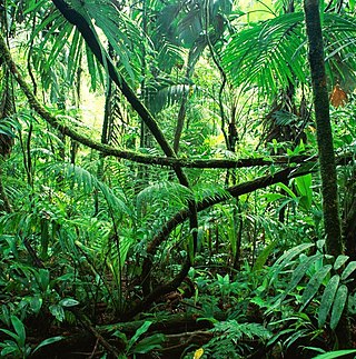
Rainforests are forests characterized by a closed and continuous tree canopy, moisture-dependent vegetation, the presence of epiphytes and lianas and the absence of wildfire. Rainforests can be generally classified as tropical rainforests or temperate rainforests, but other types have been described.
In forestry and ecology, understory, or understorey, also known as underbrush or undergrowth, includes plant life growing beneath the forest canopy without penetrating it to any great extent, but above the forest floor. Only a small percentage of light penetrates the canopy so understory vegetation is generally shade-tolerant. The understory typically consists of trees stunted through lack of light, other small trees with low light requirements, saplings, shrubs, vines and undergrowth. Small trees such as holly and dogwood are understory specialists.

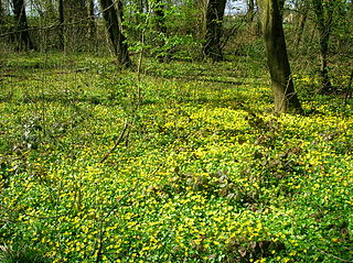
Groundcover or ground cover is any plant that grows over an area of ground. Groundcover provides protection of the topsoil from erosion and drought.

The Great Basin Desert is part of the Great Basin between the Sierra Nevada and the Wasatch Range. The desert is a geographical region that largely overlaps the Great Basin shrub steppe defined by the World Wildlife Fund, and the Central Basin and Range ecoregion defined by the U.S. Environmental Protection Agency and United States Geological Survey. It is a temperate desert with hot, dry summers and snowy winters. The desert spans large portions of Nevada and Utah, and extends into eastern California. The desert is one of the four biologically defined deserts in North America, in addition to the Mojave, Sonoran, and Chihuahuan Deserts.
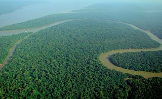
Tropical rainforests are rainforests that occur in areas of tropical rainforest climate in which there is no dry season – all months have an average precipitation of at least 60 mm – and may also be referred to as lowland equatorial evergreen rainforest. True rainforests are typically found between 10 degrees north and south of the equator ; they are a sub-set of the tropical forest biome that occurs roughly within the 28-degree latitudes. Within the World Wildlife Fund's biome classification, tropical rainforests are a type of tropical moist broadleaf forest that also includes the more extensive seasonal tropical forests.

An old-growth forest, sometimes synonymous with primary forest, virgin forest, late seral forest, primeval forest, first-growth forest, or mature forest—is a forest that has attained great age without significant disturbance, and thereby exhibits unique ecological features, and might be classified as a climax community. The Food and Agriculture Organization of the United Nations defines primary forests as naturally regenerated forests of native tree species where there are no clearly visible indications of human activity and the ecological processes are not significantly disturbed. More than one-third of the world's forests are primary forests. Old-growth features include diverse tree-related structures that provide diverse wildlife habitat that increases the biodiversity of the forested ecosystem. Virgin or first-growth forests are old-growth forests that have never been logged. The concept of diverse tree structure includes multi-layered canopies and canopy gaps, greatly varying tree heights and diameters, and diverse tree species and classes and sizes of woody debris.
Laurel forest, also called laurisilva or laurissilva, is a type of subtropical forest found in areas with high humidity and relatively stable, mild temperatures. The forest is characterized by broadleaf tree species with evergreen, glossy and elongated leaves, known as "laurophyll" or "lauroid". Plants from the laurel family (Lauraceae) may or may not be present, depending on the location.

Aspen parkland refers to a very large area of transitional biome between prairie and boreal forest in two sections, namely the Peace River Country of northwestern Alberta crossing the border into British Columbia, and a much larger area stretching from central Alberta, all across central Saskatchewan to south central Manitoba and continuing into small parts of the US states of Minnesota and North Dakota. Aspen parkland consists of groves of aspen, poplar and spruce, interspersed with areas of prairie grasslands, also intersected by large stream and river valleys lined with aspen-spruce forests and dense shrubbery. This is the largest boreal-grassland transition zone in the world and is a zone of constant competition and tension as prairie and woodlands struggle to overtake each other within the parkland.

Miconia calvescens, the velvet tree, miconia, or bush currant, is a species of flowering plant in the family Melastomataceae. It is native to Mexico and Central and South America and it has become one of the world's most invasive species.
Xerosere is a plant succession that is limited by water availability. It includes the different stages in a xerarch succession. Xerarch succession of ecological communities originated in extremely dry situation such as sand deserts, sand dunes, salt deserts, rock deserts etc. A xerosere may include lithoseres and psammoseres.

A treefall gap is a distinguishable hole in the canopy of a forest with vertical sides extending through all levels down to an average height of 2 m (6.6 ft) above ground. These holes occur as result of a fallen tree or large limb. The ecologist who developed this definition used two meters because he believed that "a regrowth height of 2 m was sufficient" for a gap to be considered closed, but not all scientists agree. For example, Runkle believed that regrowth should be 10–20 m (33–66 ft) above the ground. Alternatively, a treefall gap is "the smallest gap [that must] be readily distinguishable amid the complexity of forest structure."
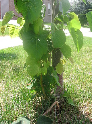
Basal shoots, root sprouts, adventitious shoots, and suckers are words for various kinds of shoots that grow from adventitious buds on the base of a tree or shrub, or from adventitious buds on its roots. Shoots that grow from buds on the base of a tree or shrub are called basal shoots; these are distinguished from shoots that grow from adventitious buds on the roots of a tree or shrub, which may be called root sprouts or suckers. A plant that produces root sprouts or runners is described as surculose. Water sprouts produced by adventitious buds may occur on the above-ground stem, branches or both of trees and shrubs. Suckers are shoots arising underground from the roots some distance from the base of a tree or shrub.

The New England-Acadian forests are a temperate broadleaf and mixed forest ecoregion in North America that includes a variety of habitats on the hills, mountains and plateaus of New England and New York State in the Northeastern United States, and Quebec and the Maritime Provinces of Eastern Canada.

The crown of a plant refers to the total of an individual plant's aboveground parts, including stems, leaves, and reproductive structures. A plant community canopy consists of one or more plant crowns growing in a given area.
Lowland heath is a Biodiversity Action Plan habitat as it is a type of ancient wild landscape. Natural England's Environmental Stewardship scheme describes lowland heath as containing dry heath, wet heath and valley mire communities, usually below 250 metres (820 ft) in altitude, on acidic soils and shallow peat, typically comprising heathers, gorses, fine grasses, wild flowers and lichens in a complex mosaic. Heathers and other dwarf shrubs usually account for at least 25% of the ground cover. By contrast, upland heath, which is above 300 metres (980 ft) in altitude, is called moorland, Dartmoor being an example.

The Cuban dry forests are a tropical dry forest ecoregion that occupies 65,800 km2 (25,400 sq mi) on Cuba and Isla de la Juventud. The ecoregion receives 1,000–2,000 mm (39–79 in) of rainfall annually. Cuban dry forests can be differentiated into evergreen forests, semi-deciduous forests, mogotes, and sclerophyllous low forests.

A plant community is a collection or association of plant species within a designated geographical unit, which forms a relatively uniform patch, distinguishable from neighboring patches of different vegetation types. The components of each plant community are influenced by soil type, topography, climate and human disturbance. In many cases there are several soil types present within a given plant community. This is because the soil type within an area is influenced by two factors, the rate at which water infiltrates or exits the soil, as well as the rate at which organic matter enters or decays from the soil. Plant communities are studied substantially by ecologists, due to providing information on the effects of dispersal, tolerance to environmental conditions, and response to disturbance of a variety of plant species, information valuable to the comprehension of various plant community dynamics.

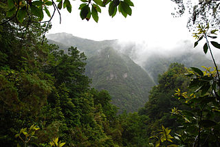
Montane ecosystems are found on the slopes of mountains. The alpine climate in these regions strongly affects the ecosystem because temperatures fall as elevation increases, causing the ecosystem to stratify. This stratification is a crucial factor in shaping plant community, biodiversity, metabolic processes and ecosystem dynamics for montane ecosystems. Dense montane forests are common at moderate elevations, due to moderate temperatures and high rainfall. At higher elevations, the climate is harsher, with lower temperatures and higher winds, preventing the growth of trees and causing the plant community to transition to montane grasslands, shrublands or alpine tundra. Due to the unique climate conditions of montane ecosystems, they contain increased numbers of endemic species. Montane ecosystems also exhibit variation in ecosystem services, which include carbon storage and water supply.
Tropical vegetation is any vegetation in tropical latitudes. Plant life that occurs in climates that are warm year-round is in general more biologically diverse that in other latitudes. Some tropical areas may receive abundant rain the whole year round, but others have long dry seasons which last several months and may vary in length and intensity with geographic location. These seasonal droughts have great impact on the vegetation, such as in the Madagascar spiny forests. Rainforest vegetation is categorized by five layers. The top layer being the upper tree layer. Here you will find the largest and widest trees in all the forest. These trees tend to have very large canopy's so they can be fully exposed to sunlight. A layer below that is the middle tree layer. Here you will find more compact trees and vegetation. These trees tend to be more skinny as they are trying to gain any sunlight they can. The third layer is the lower tree area. These trees tend to be around five to ten meters high and tightly compacted. The trees found in the third layer are young trees trying to grow into the larger canopy trees. The fourth layer is the shrub layer beneath the tree canopy. This layer is mainly populated by sapling trees, shrubs, and seedlings. The fifth and final layer is the herb layer which is the forest floor. The forest floor is mainly bare except for various plants, mosses, and ferns. The forest floor is much more dense than above because of little sunlight and air movement.

Dry sclerophyll forests occur throughout northern and eastern Tasmania. Characterised by the population of hard-leafed (sclerophyll) and often spiky, drought-adapted plants, dry sclerophyll forests are found in regions of where annual rainfall is below 1000mm.


