Stronghold, California

Last updated
Stronghold
Unincorporated community
California Locator Map with US.PNG
Red pog.svg
Stronghold
Location in California
Usa edcp location map.svg
Red pog.svg
Stronghold
Stronghold (the US)
Coordinates: 41°54′20″N121°24′35″W / 41.90556°N 121.40972°W / 41.90556; -121.40972 Coordinates: 41°54′20″N121°24′35″W / 41.90556°N 121.40972°W / 41.90556; -121.40972
Country United States
State California
County Modoc County
Elevation [1] 4,035 ft (1,230 m)

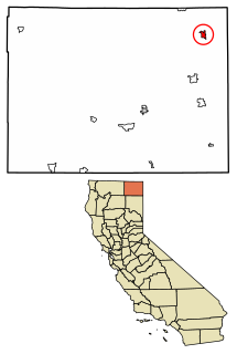
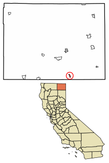
Stronghold is an unincorporated community in Modoc County, California. [1] It is located on the Southern Pacific Railroad, 3 miles (4.8 km) northwest of Newell, [2] at an elevation of 4035 feet (1230 m). [1]

Unincorporated area Region of land not governed by own local government

In law, an unincorporated area is a region of land that is not governed by a local municipal corporation; similarly an unincorporated community is a settlement that is not governed by its own local municipal corporation, but rather is administered as part of larger administrative divisions, such as a township, parish, borough, county, city, canton, state, province or country. Occasionally, municipalities dissolve or disincorporate, which may happen if they become fiscally insolvent, and services become the responsibility of a higher administration. Widespread unincorporated communities and areas are a distinguishing feature of the United States and Canada. In most other countries of the world, there are either no unincorporated areas at all, or these are very rare; typically remote, outlying, sparsely populated or uninhabited areas.

Modoc County, California County in California ----, United States

Modoc County is a county in the far northeast corner of the U.S. state of California. As of the 2010 census, the population was 9,686. making it the third-least populous county in California. The county seat and only incorporated city is Alturas. Previous county seats include Lake City and Centerville; the latter is now a ghost town. The county borders Nevada and Oregon.

California State of the United States of America

California is a state in the Pacific Region of the United States. With 39.6 million residents, California is the most populous U.S. state and the third-largest by area. The state capital is Sacramento. The Greater Los Angeles Area and the San Francisco Bay Area are the nation's second and fifth most populous urban regions, with 18.7 million and 8.8 million residents respectively. Los Angeles is California's most populous city, and the country's second most populous, after New York. California also has the nation's most populous county, Los Angeles County, and its largest county by area, San Bernardino County. The City and County of San Francisco is both the country's second-most densely populated major city after New York and the fifth-most densely populated county, behind only four of the five New York City boroughs.

Stronghold is located near the Oregon border. The ZIP Code is 96134. The community is inside area code 530.

Oregon State of the United States of America

Oregon is a state in the Pacific Northwest region on the West Coast of the United States. The Columbia River delineates much of Oregon's northern boundary with Washington, while the Snake River delineates much of its eastern boundary with Idaho. The parallel 42° north delineates the southern boundary with California and Nevada. Oregon is one of only three states of the contiguous United States to have a coastline on the Pacific Ocean.

Area code 530

Area code 530 is a California telephone area code in northeastern and Northern California.

Its coordinates are 41°54′20″N121°24′35″W / 41.90556°N 121.40972°W / 41.90556; -121.40972 at 4,035 feet (1,230 m) elevation. The place was named for Captain Jack's Stronghold held by the Modoc in 1872 and 1873 during the Modoc War, [2] at the nearby Lava Beds National Monument.

Captain Jacks Stronghold

Captain Jack's Stronghold, named for Modoc chief Captain Jack, is a part of Lava Beds National Monument. The stronghold can be accessed from the Perez turnoff, off Highway 139 between Tulelake and Canby, California. The Modoc people had long used this area for hunting and gathering as it was part of their traditional territory.

Modoc people ethnic group

The Modoc are a Native American people who originally lived in the area which is now northeastern California and central Southern Oregon. They are currently divided between Oregon and Oklahoma and are enrolled in either of two federally recognized tribes, the Klamath Tribes in Oregon and the Modoc Tribe of Oklahoma.

The Modoc War, or the Modoc Campaign, was an armed conflict between the Native American Modoc people and the United States Army in northeastern California and southeastern Oregon from 1872 to 1873. Eadweard Muybridge photographed the early part of the US Army's campaign.

Politics

In the state legislature, Stronghold is in the 1st Senate District, represented by Republican Dave Cox, and in the 2nd Assembly District, represented by Republican Jim Nielsen.

California State Legislature state legislature of the U.S. state of California

The California State Legislature is a bicameral legislature consisting of a lower house, the California State Assembly, with 80 members; and an upper house, the California State Senate, with 40 members. Both houses of the Legislature convene at the California State Capitol in Sacramento. The California State Legislature is one of just ten full-time state legislatures in the United States.

California State Senate upper house of the California State Legislature

The California State Senate is the upper house of the California State Legislature, the lower house being the California State Assembly. The State Senate convenes, along with the State Assembly, at the California State Capitol in Sacramento.

Republican Party (United States) political party in the United States

The Republican Party, also referred to as the GOP, is one of the two major political parties in the United States; the other is its historic rival, the Democratic Party.

Federally, Stronghold is in California's 1st congressional district , represented by Republican Doug LaMalfa. [3]

Californias 1st congressional district

California's 1st congressional district is a congressional district in the U.S. state of California.

Doug LaMalfa California U.S. House of Representative

Douglas Lee LaMalfa is an American politician. A Republican, he has been the U.S. Representative for California's 1st congressional district since 2013. The district, the second-largest in the state, covers nearly all of interior northern California including Chico, Redding, Susanville and Truckee.

Related Research Articles

Campo Seco, California Unincorporated community in California, United States

Campo Seco is an unincorporated community in Calaveras County, California. It sits at an elevation of 564 feet above sea level and is located at 38°13′38″N120°51′12″W. The community is in ZIP code 95226 and area code 209.

Milton, California Unincorporated community in California, United States

Milton is an unincorporated community in Calaveras County, California. It lies at an elevation of 394 feet and is located at 38°01′55″N120°51′08″W. The community is in ZIP code 95684 and area code 209.

Douglas Flat, California Unincorporated community in California, United States

Douglas Flat is an unincorporated community in Calaveras County, California. It lies at an elevation of 1965 feet and is located at 38°06′52″N120°27′18″W. The community is in ZIP code 95229 and area code 209.

Glencoe, California Unincorporated community in California, United States

Glencoe is an unincorporated community in Calaveras County, California. It lies at an elevation of 2749 feet and is located at 38°21′15″N120°35′06″W. The community is in ZIP code 95232 and area code 209.

The Shores of Poker Flat, California Unincorporated community in California, United States

The Shores of Poker Flat is an unincorporated community in Calaveras County, California. It lies at an elevation of 584 feet above sea level and is located at 37°54′11″N120°34′56″W, on the shore of the Tulloch Reservoir. The community is in ZIP code 95228 and area code 209.

Jesus Maria, California Unincorporated community in California, United States

Jesus Maria is an unincorporated community in Calaveras County, California. It lies at an elevation of 1043 feet and is located at 38°17′08″N120°38′51″W. The community is in ZIP code 95222 and area code 209.

Paloma, California Unincorporated community in California, United States

Paloma is an unincorporated community in Calaveras County, California. It lies at an elevation of 1362 feet and is located at 38°15′34″N120°45′48″W. The community is in ZIP code 95252 and area code 209.

Cave City, California Unincorporated community in California, United States

Cave City is an unincorporated community in Calaveras County, California. It lies at an elevation of 1,617 feet (493 m) and is located at 38°12′09″N120°30′31″W. The community is in ZIP code 95222 and area code 209.

Fort Bidwell, California census-designated place in California, United States

Fort Bidwell is a census-designated place in Modoc County, California. It is located 32 miles (51 km) northeast of Alturas, at an elevation of 4564 feet. The population was 173 at the 2010 census.

Ravendale, California Unincorporated community in California, United States

Ravendale is an unincorporated community in Lassen County, California. It is located 7 miles (11 km) southeast of Termo, at an elevation of 5305 feet. According to Rand McNally, it is 54 driving miles to the county seat, Susanville, the only city in the county, and about the same distance to Alturas.

Davis Creek, California Unincorporated community in California, United States

Davis Creek is an unincorporated community in Modoc County, California. It is located 19 miles (31 km) north-northeast of Alturas, at an elevation of 4846 feet. There is a post office, service station, and mini-mart housed in a single structure. The ZIP Code is 96108. The community is inside area code 530.

Tionesta, California Unincorporated community in California, United States

Tionesta is an unincorporated community in Modoc County, California. It is located on the former Great Northern Railway Bieber Line, 2 miles (3.2 km) northwest of Timber Mountain, at an elevation of 4278 feet.

El Dorado, California Unincorporated community in California, United States

El Dorado, not to be confused with the nearby El Dorado Hills, is an unincorporated community in El Dorado County, California. It is located 4 miles (6.4 km) southwest of Placerville, at an elevation of 1608 feet. The population was 4,096 at the 2000 census. The town is registered as California Historical Landmark #486. The ZIP code is 95623. The community is inside area code 530.

Glenn, California Unincorporated community in California, United States

Glenn is an unincorporated community in Glenn County, California. It lies at an elevation of 98 feet. The town is located on the Sacramento River, at the intersection of State Route 45 and State Route 162. It is about ten miles (16 km) east of Interstate 5 and Willows on the U.S. Geological Survey 7.5-minute quadrangle, Glenn, California. The U.S. Geological Survey, National Geographic Names Database, calls its existence official with a feature ID of 1658621 and lists the NAD27 coordinates of the community as 39°31′19″N122°00′50″W. The ZIP Code, shared with Ordbend and Bayliss, is 95943. The community is inside area code 530. This area is flagged as rural by the U.S. Census Bureau.

Newell, California census-designated place in California, United States

Newell is a census-designated place in Modoc County, California in the United States. It is located 50 miles (80 km) west-northwest of Alturas, at an elevation of 4,042 feet (1,232 m). The population was 449 at the 2010 census.

Panamint Springs, California Unincorporated community in California, United States

Panamint Springs is an unincorporated community in Inyo County, California. It lies at an elevation of 1926 feet.

East Biggs, California Unincorporated community in California, United States

East Biggs is a small unincorporated community in Butte County, California. Its zip code is 95917 and its area code is 530. It lies at an elevation of 121 feet.

Dayton, California Unincorporated community in California, United States

Dayton is a small unincorporated community in Butte County, California. Its zip code is 95928 and its area code is 530. It lies at an elevation of 141 feet.

Eagleville, Modoc County, California census-designated place in California, United States

Eagleville is a census-designated place in Modoc County, California. It is located 25 miles (40 km) east-southeast of Alturas, at an elevation of 4642 feet. The population was 59 at the 2010 census.

Likely, California census-designated place in California, United States

Likely is a census-designated place in Modoc County, California. It is located near the South Fork of the Pit River 18 miles (29 km) south of the county seat of Alturas, at an elevation of 4,449 feet (1,356 m). Located 6 miles (9.7 km) north-northwest of Likely Mountain, it is somewhat sheltered from prevailing southwesterly winds, and its microclimate is noticeably drier and less stormy than surrounding areas. The ZIP Code for the community is 96116. Likely has been noted for its unusual place name.

References

  1. 1 2 3 U.S. Geological Survey Geographic Names Information System: Stronghold, California
  2. 1 2 Durham, David L. (1998). California's Geographic Names: A Gazetteer of Historic and Modern Names of the State. Clovis, Calif.: Word Dancer Press. p. 422. ISBN   1-884995-14-4.
  3. "California's 1st Congressional District - Representatives & District Map". Civic Impulse, LLC. Retrieved March 3, 2013.