Sutton Four Oaks (ward)

Last updated

Sutton Four Oaks
Ward
West Midlands UK location map.svg
Red pog.svg
Sutton Four Oaks
Location within the West Midlands
Population24,025 (2011Ward) [1]
  Density 16.7 per ha
OS grid reference SP105995
Metropolitan borough
Metropolitan county
Region
Country England
Sovereign state United Kingdom
Post town SUTTON COLDFIELD
Postcode district B74
Dialling code 0121
Police West Midlands
Fire West Midlands
Ambulance West Midlands
EU Parliament West Midlands
UK Parliament
List of places
UK
England
West Midlands
52°35′17″N1°49′33″W / 52.5880°N 1.8258°W / 52.5880; -1.8258 Coordinates: 52°35′17″N1°49′33″W / 52.5880°N 1.8258°W / 52.5880; -1.8258

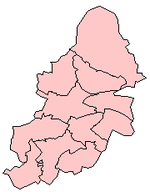
Sutton Four Oaks is one of the 40 electoral wards in Birmingham, England. [2]

Birmingham Major city in the English Midlands, 2nd highest population of UK cities

Birmingham is a major city in the West Midlands, England and is the second-largest city and metropolitan area in England and the United Kingdom, with roughly 1.3 million inhabitants within the city area and 4.3 million inhabitants within the metropolitan area according to Eurostat 2018 figures. This also makes Birmingham the 17th largest city and 8th largest metropolitan area in the European Union. Birmingham is commonly referred to as the nation's "second city".

England Country in north-west Europe, part of the United Kingdom

England is a country that is part of the United Kingdom. It shares land borders with Wales to the west and Scotland to the north. The Irish Sea lies west of England and the Celtic Sea to the southwest. England is separated from continental Europe by the North Sea to the east and the English Channel to the south. The country covers five-eighths of the island of Great Britain, which lies in the North Atlantic, and includes over 100 smaller islands, such as the Isles of Scilly and the Isle of Wight.

Contents

Sutton Four Oaks is one of the four wards that make up the Parliamentary Constituency and council constituency of Sutton Coldfield. The ward lies to the north of Sutton Coldfield town centre and covers Hill Hook, Hill Wood, Roughley, Doe Bank, Ley Hill, Four Oaks, Four Oaks Park and Mere Green. Mere Green is the main shopping area for the ward and also has the ward's only library.

Sutton Coldfield (UK Parliament constituency) Parliamentary constituency in the United Kingdom, 1945 onwards

Sutton Coldfield is a constituency represented in the House of Commons of the UK Parliament since 2001 by Andrew Mitchell, a Conservative.

Hill Hook is an area of Sutton Coldfield, Birmingham, England.

Roughley

Roughley is a housing estate part of Sutton Coldfield, which is in Birmingham in the West Midlands. It is north of Sutton Coldfield Town Centre, close to Mere Green and Four Oaks.

It covers an area of 19.61 square kilometres (7.57 sq mi).

Population

According to the 2001 Population Census there were 21,690 people living in 9,274 households in Sutton Four Oaks. 4.9% (1,068) of the ward's population consisted of ethnic minorities compared to 29.6% for Birmingham in general. The population had increased to 24,205 at the 2011 Census.

Census Acquiring and recording information about the members of a given population

A census is the procedure of systematically acquiring and recording information about the members of a given population. This term is used mostly in connection with national population and housing censuses; other common censuses include traditional culture, business, supplies, and traffic censuses. The United Nations defines the essential features of population and housing censuses as "individual enumeration, universality within a defined territory, simultaneity and defined periodicity", and recommends that population censuses be taken at least every ten years. United Nations recommendations also cover census topics to be collected, official definitions, classifications and other useful information to co-ordinate international practices.

Politics

Sutton Four Oaks is represented by Cllr Maureen Cornish on Birmingham City Council, and Cllrs Clare Horrocks and Simon Ward on Royal Sutton Coldfield Town Council.

Maureen, Clare and Simon all represent the Conservative Party.

Related Research Articles

Birmingham City Council Local government body for the English city

Birmingham City Council is the local government body responsible for the governance of the City of Birmingham in England, which has been a metropolitan district since 1974. It is the most populated local council in the United Kingdom with, following a reorganisation of boundaries in June 2004, 120 Birmingham City councillors representing over one million people, in 40 wards. This means that Birmingham is technically the largest city in the United Kingdom. The council headquarters are at the Council House in the city centre. The council is responsible for running nearly all local services, with the exception of those run by joint boards. The provision of certain services has in recent years been devolved to several council constituencies, which each have a constituency committee made up of councillors from that district.

Erdington Suburb of Birmingham, England.

Erdington is a suburb and ward of Birmingham that is historically part of Warwickshire. Its postcodes include B23, B24 and B72. It is 5 miles (8 km) northeast of central Birmingham, England and borders Sutton Coldfield. It was also a council constituency, managed by its own district committee. The former council district consisted of the ward of Erdington, and Tyburn,, Stockland Green and Kingstanding, although all of Kingstanding and most of both Tyburn and Stockland Green wards lie outside the historical boundaries of Erdington. Stockland Green was formerly part of Aston, Kingstanding part of Perry Barr and Tyburn partially split between Aston and Hodge Hill. Erdington was part of the Sutton Coldfield constituency before 1974.

Hodge Hill

Hodge Hill is an area 4 miles east of Birmingham City Centre, England. It is also a council constituency, managed by its own district committee.

Government of Birmingham

This article is about the government of Birmingham, England.

Sutton Trinity (ward) electoral ward of Birmingham City Council

Sutton Trinity is one of the 40 electoral wards in Birmingham, England. The ward is named after Holy Trinity Church, the town's parish church.

Mere Green is a small commercial centre in Four Oaks, Sutton Coldfield Birmingham, England.

Four Oaks is a residential area in Sutton Coldfield, West Midlands, lying along the north and east borders of Sutton Park. Four Oaks is situated approximately 7 12 miles (12.1 km) north of Birmingham City Centre, and is bordered by Sutton Park, Streetly, Mere Green, Little Aston and Roughley. Four Oaks has a population of 21,690 as of 2004, and is part of the Sutton Four Oaks electoral ward.

Gravelly Hill area of Birmingham, England

Gravelly Hill is an area of Birmingham, United Kingdom.

Streetly area in the West Midlands, England

Streetly is an area in the county of West Midlands, England which lies around 7 miles (11 km) to the north of Birmingham City Centre. It is uniquely located within the borders of Birmingham, Lichfield and Walsall district authorities, and is part of the West Midlands conurbation. It is adjacent to Sutton Coldfield, New Oscott, Great Barr, Four Oaks, Little Aston and Aldridge.

Walmley

Walmley is an area of Sutton Coldfield, Birmingham, England. It is in south Sutton Coldfield, near to Erdington, Minworth, Wylde Green, Pype Hayes and south of Thimble End. It is approximately 6 miles (9.7 km) northeast of Birmingham City Centre. It is the main focus of the Sutton New Hall Birmingham City Council ward.

Birmingham Erdington (UK Parliament constituency) Parliamentary constituency in the United Kingdom, 1974 onwards

Birmingham, Erdington is a constituency represented in the House of Commons of the UK Parliament since 2010 by Jack Dromey of the Labour Party.

Sutton Vesey (ward) electoral ward of Birmingham City Council

Sutton Vesey is one of the 40 electoral wards in Birmingham, England.

Sutton New Hall (ward)

Sutton New Hall is one of the 40 electoral wards in Birmingham, England and is named after New Hall, a medieval manor house.

Sheldon, West Midlands area of east Birmingham, England

Sheldon is an area of east Birmingham, England. Historically part of Warwickshire, it is close to the border with the Metropolitan Borough of Solihull and Birmingham Airport.

Councillors for Birmingham City Council in the West Midlands, England are elected every 4 years. The next elections are in 2022. Changes to boundary lines were made in 2018. 101 councillors are elected from 69 wards.

Demography of Birmingham

Birmingham, England is an ethnically and culturally diverse city. The city is the core of the second most populous urban area in the United Kingdom after London and is the largest city proper.

References

  1. "Birmingham Ward population 2011" . Retrieved 15 December 2015.
  2. http://www.birmingham.gov.uk/wards