Sutton Trinity (ward)

Last updated

Sutton Trinity
Ward
Holy Trinity Church, Sutton Coldfield2.jpg
Holy Trinity Church, north of Sutton town centre, from which the ward receives its name.
West Midlands UK location map.svg
Red pog.svg
Sutton Trinity
Location within the West Midlands
Area4.60 sq mi (11.9 km2)
Population25,267 (2011.Ward) [1]
  Density 5,493/sq mi (2,121/km2)
OS grid reference SP121958
Metropolitan borough
Metropolitan county
Region
Country England
Sovereign state United Kingdom
Post town SUTTON COLDFIELD
Postcode district B72, B75
Dialling code 0121
Police West Midlands
Fire West Midlands
Ambulance West Midlands
UK Parliament
List of places
UK
England
West Midlands
52°33′43″N1°48′23″W / 52.5619°N 1.8063°W / 52.5619; -1.8063 Coordinates: 52°33′43″N1°48′23″W / 52.5619°N 1.8063°W / 52.5619; -1.8063

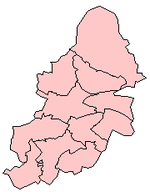
Sutton Trinity is one of the 40 electoral wards in Birmingham, England. [2] It is named after Holy Trinity Church, the town's parish church.

Contents

Sutton Trinity is one of four wards comprising the Parliamentary Constituency and formal district of Sutton Coldfield, Birmingham. It was created on 10 June 2004, following a Boundary Commission review of the city. It covers Sutton town centre and includes the neighbourhoods of Tudor Hill, Maney, New Hall Manor, Falcon Lodge, Whitehouse Common, Withy Hill, Little Sutton and Reddicap Heath.

Population

It covers an area of 4.60 square miles (11.9 km2). According to the 2001 Population Census, there were 23,394 people living in 9,887 households in Sutton Trinity and 5.1% (1,183) of the ward's population consists of ethnic minorities compared with 29.6% for Birmingham in general.

Local politics

Sutton Trinity, like all of Sutton Coldfield is dominated by the Conservative Party and is represented by three Conservative councillors: David Allan, David Pears and Keith Ward. Sutton Trinity has adopted a Ward Support Officer.

Infrastructure

Schools and colleges

Bishop Vesey's Grammar School for boys and Sutton Coldfield Grammar School for Girls are located within the ward. Sutton Coldfield College, located next to Bishop Vesey's Grammar School, is a college of further education. A separate building owned by Sutton College, located opposite Holy Trinity Church, is in use as the media centre. Sutton Coldfield Library is located in Sutton Town Centre in the Rose Centre.

Medical

Good Hope Hospital on the Rectory Road is the main hospital for the whole town.

Transport

Sutton Coldfield railway station on the Cross-City Line serves the town centre. There are a number of bus services operated by National Express West Midlands that stop at the Parade in Sutton town centre.

Sutton Town railway station on Midland Drive. Sutton Town railway station.jpg
Sutton Town railway station on Midland Drive.

From 1879 until 1924, Sutton Coldfield was served by the Sutton Town railway station, as well as the LNWR-owned Sutton Coldfield railway station. It was forced to shut as a result of low passenger figures. The buildings still remain but as office buildings. [3]

Sport

The town is served by the Wyndley Leisure Centre, which is the largest leisure centre in Birmingham. It is located on the edge of Sutton Park and is used by local football teams for training. [4]

Related Research Articles

Sutton Coldfield Town in West Midlands, England

Sutton Coldfield or the Royal Town of Sutton Coldfield, known locally as Sutton, is a large town and civil parish in Birmingham, England. The town lies around 7 miles northeast of Birmingham city centre, 9 miles south of Lichfield and 7 miles southwest of Tamworth. Sutton Coldfield and its surrounding suburbs are governed under Birmingham City Council for local government purposes but the town has its own town council which governs the town and its surrounding areas by running local services and electing a mayor to the council.

Sutton Park, West Midlands Park in Birmingham, England

Sutton Park is a large urban park located in Sutton Coldfield, Birmingham, West Midlands, England. Most of the park is a national nature reserve; large parts are also a scheduled monument. Sutton Park is one of the largest urban parks in the United Kingdom. The park covers more than 2,400 acres (970 ha) according to one source, or 2,200 acres (900 ha) according to another. It consists of a mix of heathland, wetlands and marshes, seven lakes, extensive ancient woodlands, several restaurants, a private 18-hole golf course on its western edge and a municipal golf course to the south, a donkey sanctuary, children's playgrounds and a visitors' centre. There is no entrance charge to the Park, however there is a parking charge for cars on Saturdays and Sundays during the summer. A wide range of leisure activities are undertaken in the park including dog walking, pony trekking, bike riding and kite flying and there are areas to fly model aeroplanes and helicopters. Additionally, a railway line runs through the park.

Erdington Suburb of Birmingham, England

Erdington is a suburb and ward of Birmingham that is historically part of Warwickshire. It is 5 miles (8 km) northeast of central Birmingham, England and borders Sutton Coldfield. It was also a council constituency, managed by its own district committee. The former council district consisted of the ward of Erdington, and Tyburn,, Stockland Green and Kingstanding, although all of Kingstanding and most of both Tyburn and Stockland Green wards lie outside the historical boundaries of Erdington. Stockland Green was formerly part of Aston, Kingstanding part of Perry Barr and Tyburn partially split between Aston and Hodge Hill. Erdington (ward) was part of the Sutton Coldfield constituency before 1974.

Wylde Green Human settlement in England

Wylde Green is a residential area within the town of Sutton Coldfield in Birmingham, England in the West Midlands. It was in the county of Warwickshire. The area is in the Sutton Vesey ward.

Boldmere Human settlement in England

Boldmere is a suburban village and residential area of Sutton Coldfield, near Birmingham, England. It is bordered by New Oscott, Sutton Park, Wylde Green and Erdington, and is in the ward of Sutton Vesey.

Walmley Human settlement in England

Walmley is a village in Sutton Coldfield, Birmingham, England. It is in south Sutton Coldfield, near to Erdington, Minworth, Wylde Green, Pype Hayes and south of Thimble End. It is approximately 6 miles (9.7 km) northeast of Birmingham City Centre. It is the main focus of the Sutton New Hall Birmingham City Council ward.

Sutton Coldfield (UK Parliament constituency) Parliamentary constituency in the United Kingdom, 1945 onwards

Sutton Coldfield is a constituency represented in the House of Commons of the UK Parliament since 2001 by Andrew Mitchell, a Conservative.

Sutton Vesey (ward) Ward in England

Sutton Vesey is one of the 69 electoral wards in Birmingham, England.

Sutton Four Oaks (ward) Ward in England

Sutton Four Oaks is one of the 40 electoral wards in Birmingham, England.

John Vesey

John Vesey or Veysey (c.1462–1554) was Bishop of Exeter in Devon, from 1519 until his death in 1554, having been briefly deposed 1551-3 by King Edward VI for his opposition to the Reformation.

Fordbridge Civil parish in West Midlands, England

Fordbridge is a civil parish in England between Kingshurst and Chelmsley Wood in the Metropolitan Borough of Solihull, which is in the West Midlands and also part of the West Midlands conurbation. It is 8 miles (13 km) east of Birmingham city centre. It has a town council. According to the 2001 census, the parish had a population of 8,749. Fordbridge lies within the historic county of Warwickshire.

Maney

Maney is an area of Sutton Coldfield, Birmingham, England. It is situated close to the town centre of Sutton Coldfield and is also near Wylde Green and Walmley. The main thoroughfare is Birmingham Road, which runs through Maney.

Bishop Veseys Grammar School Grammar school in Sutton Coldfield, West Midlands, England

Bishop Vesey's Grammar School (BVGS) is a selective state grammar school with academy status in Sutton Coldfield, West Midlands. Founded in 1527, it is one of the oldest schools in Britain and the third oldest school in the West Midlands, the first two being Bablake School and Wolverhampton Grammar School. The school had boarders until 1969 but is now a day school only.

Moor Hall

The Moor Hall is a 1905 house, built for Colonel Edward Ansell of Ansells Brewery, in Sutton Coldfield, Birmingham, England. It has been used as a hotel since 1930 and subsequently extended. It is on the site of a former 15th century building. It is also a suburb of the town, situated between the district of Roughley and Sutton town centre.

Hurley, Warwickshire Human settlement in England

Hurley is a village in the Kingsbury civil parish of North Warwickshire, England. Other nearby places include Wood End, Hurley Common, Coleshill, Water Orton, Curdworth, Atherstone and Tamworth.

Plants Brook is a stream in Erdington and Sutton Coldfield, Birmingham, England. It is a tributary of the River Tame, whose waters ultimately flow, via the Humber Estuary, into the North Sea.

This article is intended to show a timeline of events in the History of Birmingham, England, with a particular focus on the events, people or places that are covered in Wikipedia articles.

Roughley

Roughley is an electoral ward within the Royal Town of Sutton Coldfield, and is the most northerly part of the administrative area covered by the Royal Sutton Coldfield Town Council and the City of Birmingham. Over half of Roughley Ward is attractive Green Belt countryside, including arable and dairy farms, historic field boundaries survive with mature hedgerows and woodlands. Several public footpaths provide access to the countryside and the one linking Hillwood Road and Dale Farm provides distant views of Lichfield Cathedral and on a clear day the Pennine Hills.

Holy Trinity Church, Sutton Coldfield Church in Birmingham, England

Holy Trinity Parish Church is the parish church of Sutton Coldfield, Birmingham, England. It is Grade I listed and gives its name to the ward in which it stands, Sutton Trinity.

References

  1. "Birmingham Ward population 2011" . Retrieved 15 December 2015.
  2. "Wards and constituencies | Birmingham City Council".
  3. www.railaroundbirmingham.co.uk/
  4. Welcome to Wyndley Leisure Centre