Słonne Mountains Landscape Park

Last updated
Słonne Mountains Landscape Park
Park Krajobrazowy Gór Słonnych
IUCN category V (protected landscape/seascape)

San Liszan i Debna.jpg

Slonne Mountain Valley View near Sanok as seen from Dębna
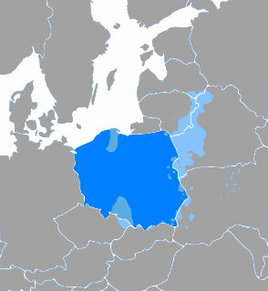
Location Subcarpathian Voivodeship
Area 513.92 km²
Established 1992

Słonne Mountains Landscape Park (Park Krajobrazowy Gór Słonnych) is a protected area (Landscape Park) in south-eastern Poland, established in 1992, covering an area of 513.92 square kilometres (198.43 sq mi). It lies in the Słonne Mountains (Polish : Góry Słonne, literally "salt (brine) mountains" [1] ) in the Eastern Carpathians (Carpathian Plateau).

Protected area location which receives protection because of its recognised natural, ecological or cultural landscape values

Protected areas or conservation areas are locations which receive protection because of their recognized natural, ecological or cultural values. There are several kinds of protected areas, which vary by level of protection depending on the enabling laws of each country or the regulations of the international organizations involved.

Poland republic in Central Europe

Poland, officially the Republic of Poland, is a country located in Central Europe. It is divided into 16 administrative subdivisions, covering an area of 312,696 square kilometres (120,733 sq mi), and has a largely temperate seasonal climate. With a population of approximately 38.5 million people, Poland is the sixth most populous member state of the European Union. Poland's capital and largest metropolis is Warsaw. Other major cities include Kraków, Łódź, Wrocław, Poznań, Gdańsk, and Szczecin.

Polish language West Slavic language spoken in Poland

Polish is a West Slavic language of the Lechitic group. It is spoken primarily in Poland and serves as the native language of the Poles. In addition to being an official language of Poland, it is also used by Polish minorities in other countries. There are over 50 million Polish language speakers around the world and it is one of the official languages of the European Union.

Administratively the Park is within Subcarpathian Voivodeship: in Bieszczady County (Gmina Ustrzyki Dolne), Lesko County (Gmina Lesko, Gmina Olszanica) and Sanok County (Gmina Sanok, Gmina Tyrawa Wołoska).

Bieszczady County County in Subcarpathian, Poland

Bieszczady County is a unit of territorial administration and local government (powiat) in Subcarpathian Voivodeship, in the extreme south-east of Poland, on the border with Ukraine. It takes its name from the Bieszczady mountain range. The county was created on January 1, 1999, as a result of the Polish local government reforms passed in 1998. In 2002 the western part of the county was split off to form Lesko County. The only town in Bieszczady County is now Ustrzyki Dolne, the county seat, which lies 80 kilometres (50 mi) south-east of the regional capital Rzeszów.

Gmina Ustrzyki Dolne is an urban-rural gmina in Bieszczady County, Subcarpathian Voivodeship, in south-eastern Poland. Its seat is the town of Ustrzyki Dolne, which lies approximately 80 kilometres (50 mi) south-east of the regional capital Rzeszów.

Lesko County County in Subcarpathian, Poland

Lesko County is a unit of territorial administration and local government (powiat) in Subcarpathian Voivodeship, south-eastern Poland, on the Slovak border. It was created in 2002 out of five gminas which previously made up the western part of Bieszczady County. Its administrative seat and only town is Lesko, which lies 67 kilometres (42 mi) south of the regional capital Rzeszów.

Within the Landscape Park are nine nature reserves. Coordinates: 49°37′N22°14′E / 49.617°N 22.233°E / 49.617; 22.233

Nature reserve protected area for flora, fauna or features of geological interest

A nature reserve is a protected area of importance for flora, fauna or features of geological or other special interest, which is reserved and managed for conservation and to provide special opportunities for study or research. Nature reserves may be designated by government institutions in some countries, or by private landowners, such as charities and research institutions, regardless of nationality. Nature reserves fall into different IUCN categories depending on the level of protection afforded by local laws. Normally it is more strictly protected than a nature park.

Geographic coordinate system Coordinate system

A geographic coordinate system is a coordinate system that enables every location on Earth to be specified by a set of numbers, letters or symbols. The coordinates are often chosen such that one of the numbers represents a vertical position and two or three of the numbers represent a horizontal position; alternatively, a geographic position may be expressed in a combined three-dimensional Cartesian vector. A common choice of coordinates is latitude, longitude and elevation. To specify a location on a plane requires a map projection.

Related Research Articles

Podkarpackie Voivodeship Voivodeship in Poland

Podkarpackie Voivodeship or Podkarpackie Province, also known as Subcarpathian Voivodeship or Subcarpathia Province, is a voivodeship, or province, in extreme-southeastern Poland. Its administrative capital and largest city is Rzeszów..

Czerteż Village in Subcarpathian Voivodship, Poland

Czerteż is a village in East Małopolska in the Lesser Beskid mountains, in the district called Gmina Sanok. It is situated below the main watershed at the foot of the Słonne Mountains, and has an elevation of 346 metres. Situated in the Subcarpathian Voivodship, previously in Krosno Voivodship (1975–1998) and Sanok district, Sanok subdistrict, parish Kostarowce. In Czerteż is The Agricultural Production Cooperative "Unity"

Gmina Lesko is an urban-rural gmina in Lesko County, Subcarpathian Voivodeship, in south-eastern Poland. Its seat is the town of Lesko, which lies approximately 67 kilometres (42 mi) south of the regional capital Rzeszów.

Gmina Olszanica is a rural gmina in Lesko County, Subcarpathian Voivodeship, in south-eastern Poland. Its seat is the village of Olszanica, which lies approximately 9 kilometres (6 mi) east of Lesko and 71 km (44 mi) south-east of the regional capital Rzeszów.

Gmina Sanok is a rural gmina in Sanok County, Subcarpathian Voivodeship, in south-eastern Poland. Its seat is the town of Sanok, although the town is not part of the territory of the gmina.

Gmina Tyrawa Wołoska is a rural gmina in Sanok County, Subcarpathian Voivodeship, in south-eastern Poland. Its seat is the village of Tyrawa Wołoska, which lies approximately 12 kilometres (7 mi) east of Sanok and 57 km (35 mi) south-east of the regional capital Rzeszów.

Gmina Zagórz is an urban-rural gmina in Sanok County, Subcarpathian Voivodeship, in south-eastern Poland. Its seat is the town of Zagórz, which lies approximately 6 kilometres (4 mi) south-east of Sanok and 61 km (38 mi) south of the regional capital Rzeszów.

Cisna-Wetlina Landscape Park is a protected area in south-eastern Poland, established in 1992, covering an area of 510.14 square kilometres (196.97 sq mi).

San Valley Landscape Park is a protected area in south-eastern Poland, established in 1992, covering an area of 342.70 square kilometres (132.32 sq mi).

Dziurdziów Village in Subcarpathian, Poland

Dziurdziów is a village in the administrative district of Gmina Lesko, within Lesko County, Subcarpathian Voivodeship, in south-eastern Poland. It lies approximately 6 kilometres (4 mi) south-west of Lesko and 70 km (43 mi) south of the regional capital Rzeszów. It is not necessarily a large village, but the people that live there live in a spread-out area of single houses.

Dębna Village in Subcarpathian, Poland

Dębna is a village in the administrative district of Gmina Sanok, within Sanok County, Subcarpathian Voivodeship, in south-eastern Poland. It lies approximately 8 kilometres (5 mi) north of Sanok and 50 km (31 mi) south of the regional capital Rzeszów.

Tyrawa Solna Village in Subcarpathian, Poland

Tyrawa Solna is a village in the administrative district of Gmina Sanok, within Sanok County, Subcarpathian Voivodeship, in south-eastern Poland. It lies approximately 9 kilometres (6 mi) north-east of Sanok and 51 km (32 mi) south-east of the regional capital Rzeszów.

Łukowe Village in Subcarpathian, Poland

Łukowe is a village in the administrative district of Gmina Zagórz, within Sanok County, Subcarpathian Voivodeship, in south-eastern Poland. It lies approximately 12 kilometres (7 mi) south of Zagórz, 15 km (9 mi) south of Sanok, and 71 km (44 mi) south of the regional capital Rzeszów.

Mokre, Sanok County Village in Subcarpathian, Poland

Mokre is a village in the administrative district of Gmina Zagórz, within Sanok County, Subcarpathian Voivodeship, in south-eastern Poland. It lies approximately 11 kilometres (7 mi) south-west of Zagórz, 12 km (7 mi) south of Sanok, and 66 km (41 mi) south of the regional capital Rzeszów.

Poraż Village in Subcarpathian, Poland

Poraż is a village in the administrative district of Gmina Zagórz, within Sanok County, Subcarpathian Voivodeship, in south-eastern Poland. It lies approximately 5 kilometres (3 mi) south-west of Zagórz, 8 km (5 mi) south of Sanok, and 64 km (40 mi) south of the regional capital Rzeszów.

Jaćmierz Village in Subcarpathian, Poland

Jaćmierz is a village in the administrative district of Gmina Zarszyn, within Sanok County, Subcarpathian Voivodeship, in south-eastern Poland. It lies approximately 4 kilometres (2 mi) north of Zarszyn, 17 km (11 mi) north-west of Sanok, and 47 km (29 mi) south of the regional capital Rzeszów.

Eastern Beskids and the Ukrainian Carpathians

The Eastern Beskids and the Ukrainian Carpathians are a geological group of mountain ranges of the Outer Eastern Carpathians, mostly in Ukraine. The region includes the mountainous far southeastern point of Poland and the far eastern point of Slovakia, then stretches southward through western Ukraine to the Romanian border.

Great Bieszczady Loop Road is a common name for an automobile and bicycle tourist route in the Polish part of the Carpathians and Sanocko-Turczańskie Mountains.

Sobień Castle castle

Sobień – Medieval castle in the San river valley, at the feet of Eastern Carpathian mountains, in the Manasterzec village in Lesko County, Subcarpathian Voivodeship.

References

  1. Saltus Carpathians [in:] Tacitus. De origine et situ Germanorum. Mapa.